From Dave Brigham:
I've written about aqueducts before, but they are such a part of the landscape in Boston's western suburbs (if you know where to look) that I can always find more to say (see November 11, 2011, "History Flows On, Part I").
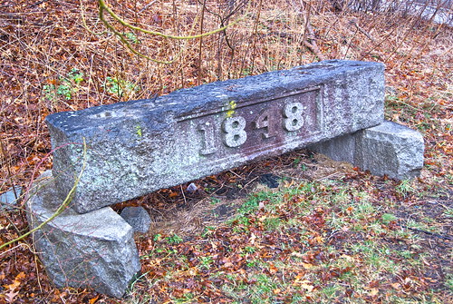
Over the years, I've driven past this stone marker in Wellesley numerous times, and wondered what it was.
One day in late winter I finally found the time to investigate, and boy was I pleasantly surprised.
Just past the marker there's a path that leads up a small hill, in between an office complex on the left and an apartment building on the right. The path then goes down a short, steep hill and opens up onto this.
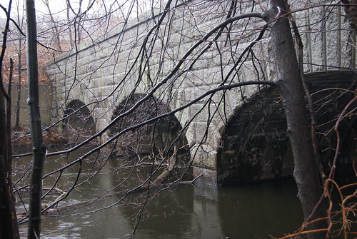
Actually, the path continues over this beautiful bridge and, if you so chose, you could then hop over a short fence onto Route 95/128, stick out your thumb and hitch a ride south to, oh, I don't know, Rhode Island. I've driven this section of the highway countless times in the last 20 years, and never had any idea the Charles River and this segment of the old Cochituate aqueduct were right there. Since discovering this scene, I drive by on the highway and spot it and just shake my head. It's been there since 1848!
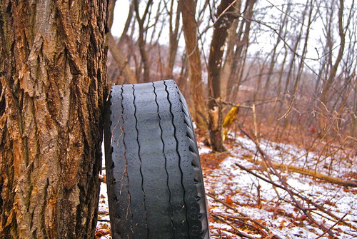
As if the scenic bridge wasn't enough, there's also a nice walking path along the river that cuts pretty close to the highway. There's quite a bit of trash on the embankment leading up to the highway, as well as this tire about 120 feet from the road.
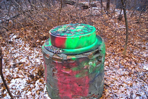
The little trail is the Charles River Path, part of the Wellesley Trails network, which itself is part of the Charles River Link, a 16-mile regional trail. On a gray, drizzly day, it was nice to see some color.
By the way, the marker is from the former aqueduct's gatehouse, which no longer stands.


No comments:
Post a Comment