Wednesday, December 28, 2011

Amusement Park Ghosts

From Dave Brigham:

From 1897 to 1963 Norumbega Park in Newton, MA, was one of the premier trolley parks in New England. As was the fashion of the day, the park was built by the Commonwealth Avenue Street Railway in an effort to increase ridership. The park featured canoeing, a picnic area, an outdoor theater, a penny arcade, a restaurant, a zoo and a carousel, and several rides among other attractions. In 1930, the Totem Pole Ballroom opened; it was considered the best and most elegant ballroom in the area, according to NorumbegaPark.com, a site offering a history of the park as well as sales of a documentary DVD of the park.

The park took its name from Norumbega Tower, a large stone structure across the Charles River in Weston that was built by a Harvard professor to honor the Viking explorers he believed had visited the area in 1000 A.D. (this tower is the subject of my next post).

I'd known about the park's legacy for many years, but only recently got around to visiting the former site. Much of the land formerly occupied by the park now houses a Marriott Hotel. The remainder is conservation land.

At the entrance to the park, there is an overgrown, sunken garden surrounded by stone walls. I have no idea if this is a remnant of the amusement park. What I do know, is that local kids use it as to bomb around on their BMX bikes, as evidenced by this ramp, one of three I spied.

Bike ramp #1

Just a little way down the path there are sections of stone wall that look like they were built before the amusement park.

Old wall

And not much further down the path I found this light stuck in a tree. Now this I can picture as part of the park.

Tree light

Behind the hotel there's a nice space that opens up to the Charles River. There's a gazebo there, as well as this old stairway leading up to some benches.

Goin' up

At the northern end of the park, where it meets with a nice residential neighborhood, I found this sagging barbed wire fence. Strange.

Keeping out or in?

Friday, December 23, 2011

Happy Holidays!

From Mick Melvin:

IMG_0002

My wife and I were in New Britain, CT, to see an exhibit at the New Britain Museum of Art and I stumbled upon this backside opportunity. Across the street from the museum was a large display of Christmas lawn ornaments. I walked over to take a look and was amazed by the variety of decorations. I then spied a sign on the front lawn with dates of an open house. I never did make it back for the open house, but I did take a few shots.

IMG_0013

As it turns out, the woman who lives at the house has been putting on the display since 1978. The admission fee for the open house is as little as a non-perishable food item. Rita Giancola, who is 87, opens up her house every year. This year it was open from December 18-22. Many schools and local folks come to view the Christmas extravaganza. The lawn is covered with many Christmas-themed items such as plastic Santa Claus, Toy Soldiers, Mickey Mouse, Winnie the Pooh and Snoopy to name a few. She also decorates the inside and the balcony of her home with a plethora of Christmas ornaments. It is said to be the largest lawn display in the area.

If viewing this display doesn't get you in the holiday spirit, you need to check your pulse. Happy Holidays to you all and best wishes for the new year!

IMG_0008

Tuesday, December 6, 2011

History Flows On, Part III

From Dave Brigham:

This is the final installment in a three-part series providing some history of Greater Boston water works. See November 11, 2011, "History Flows On, Part I," and November 20, 2011, "History Flows On, Part II."

In the second part of this series, I wrote about a long hike I took in Cutler Park. The photos below were taken in another section of the park, hard by the Charles River and close to major retailers and business parks in both Newton and Needham, Mass. Here is a pump house similar to the one I featured in part two of the series.

Pump house #4

Cutler Park was for a time used by the city of Newton, MA, as water storage before the Quabbin Reservoir in central Massachusetts was built in the 1930s. As such, pump houses like this one were surely more common sights in the Greater Boston area.

As I mentioned above, this area of Cutler Park is close to major thoroughfares. There is a bridge that carries abandoned train tracks across the Charles River from Newton into Needham. This is the underside of that bridge:

Damn kids

And here are the tracks, looking from Needham into Newton:

Leafy tracks

The tracks used to go all the way into the Needham Industrial Park (now known as the New England Business Center), a massive spread of buildings built in the 1950s. The tracks now end just behind a new housing complex on the fringe of the park:

End of the line

I'm not sure if a resident of that complex dumped this side table, or if a hobo passing through couldn't fit it on his wagon:

Hobo night table?

OK, so this post wasn't really about Greater Boston water works, but it shows how you can find abandoned bits of history just about anywhere you look. And in a hundred years, the pump house might be gone, and the railroad tracks might have been torn up, but there will always be something else for curious Backsiders to tromp around and see.

Saturday, November 26, 2011

Might We Recommend

From Dave Brigham:

There are several great sites referenced in the right-hand column of this blog -- Backside's Beloved Blogs. While many of them don't change much, if at all, they all offer really cool photos and commentary of the lesser-seen parts of this great country (except for the few music- and general-interest blogs listed there). As for the ones that do update on a regular basis, I have to admit that I don't check them out often enough.

I've had Shaun O'Boyle's Portraits of Place site linked for quite some time, and have enjoyed looking through his numerous excellent galleries. Just recently, though, I decided to check out his affiliated blog. And boy, what a trip!

The majority of the pictures (as of this writing) are black and white. Most of the gorgeous shots fit into the Backside aesthetic, but even the ones that don't, such as the Appalachian Trail and Saratoga race track pictures, have that oh-so-pleasing historical feel.

I hope you like them as much as I do.

Sunday, November 20, 2011

History Flows On, Part II

From Dave Brigham:

Recently, I posted about two old aqueducts in Newton, MA (see November 11, 2011, "History Flows On, Part I"). Now I present the second installment in a three-part series that gives a little insight into the history of Greater Boston's water works.


I knew little about Cutler Park before recently crashing through its woods in a light rain. I thought I'd spend about an hour there, see most of the park, including the tunnel under the commuter train tracks, then run a few errands and head home for a shower before picking up my daughter at preschool.

This place, it turns out, is massive and has quite a history.

Spanning the towns of Newton, Needham, Dedham and Brookline, and the West Roxbury neighborhood of Boston, Cutler Park is comprised of somewhere between 700 and 800 acres, and is the largest remaining fresh water marsh on the middle Charles River, according to the Newton Conservators web site.

The marshlands, according to the conservators, was created by flooding from the Newton Upper Falls Silk Dam, and were used for pasturelands for hundreds of years. In the late 1800s, the marshes were used as watershed well sites, which explains the remains of filtering ponds, ditches and waterworks.

As I've said in previous posts, I love stumbling upon this type of stuff in the woods, and realizing how much the landscape changes in a relatively short time. If I'd wandered these same acres perhaps half a century ago, I would've seen working pump houses and electrical wires strung along the ponds, and been able to do so without any of the noise that nearby Route 128 now provides.

A century ago, I would've seen train tracks that were used to transport soil taken from the west side of the pond to fill in the Back Bay section of Boston in the 19th century. According to Wikipedia, some of the old tracks are visible near the north entrance to the park, but I didn't notice them. I definitely plan on revisiting the park, so I'll look for the tracks.

Stay tuned for the third, and final, part in this series.


Cutler Park waterworks

Cutler Park #30

Cutler Park #4

Cutler Park #29

Cutler Park #14

Cutler Park #13

Friday, November 11, 2011

History Flows On, Part I

From Dave Brigham:

Honestly, I could keep this site going simply by posting about the out-of-the-way places I find in and around my adopted hometown of Newton, MA. But if I changed the blog's title to "The Backside of Newton," people might think I was consumed with Sir Isaac, or Juice or Fig.

So I'll keep things the way they are, but the content I post here is going to remain skewed toward Eastern Massachusetts, 'cause I don't get around much.

As with many things in Newton and surrounding towns that I've posted about before (see June 27, 2011, "War of the Worlds," and May 19, 2010, "Nuclear Dump Playground?"), the aqueducts that are the subject of today's piece are things I've driven past countless times and wondered about.

There are two of them: the Cochituate and the Sudbury. The Cochituate was built between 1846-48 and conveyed water from Natick's Lake Cochituate through several towns before reaching its final destination, Boston. The aqueduct was taken out of service in 1951, replaced by other systems.

The Sudbury was constructed between 1875-78 and brought water from Framingham to Boston. It, too, was taken out of service many years ago, replaced by three other delivery systems. However, in May 2010, the Sudbury was put into emergency use when the Weston Aqueduct suffered a major rupture. The Sudbury remains part of the Massachusetts Water Resources Authority's (MWRA) emergency backup service (thanks, Wikipedia!).

For that reason, I shouldn't have been surprised when two MWRA workers questioned why I was taking pictures of visible remnants of the aqueduct. I assured them I was only interested in the history of the water system. I told them I ran a web site featuring abandoned factories and old bridges, and that satisfied them enough to point out the Cochituate aqueduct, which at certain points in Newton runs adjacent to the Sudbury.

One of the things I love about living in and traveling around New England is that I'm surrounded by the past. Just off a main drag running north to south through Newton, you find this pleasant entrance to the Sudbury Aqueduct:

Sudbury Aqueduct #6

After disappearing underground for about half a mile, the aqueduct reappears in the spot where I encountered the MWRA workers. This picture was the one they seemed most concerned about.

Sudbury Aqueduct #1

Pop the lock off this old hatch and you'd be able to lower yourself into the aqueduct. Obviously, the MWRA is concerned about somebody accessing the water supply and poisoning it. I guess I have an honest face. Or perhaps they took down my license plate and are shadowing my every move.

As I said, they were nice enough to direct me across the street to the trail that follows the old Cochituate Aqueduct. I don't know for sure that the waterway was made from bricks, but I'm guessing it was based on this picture.

Cochituate Aqueduct #1

The trail continues on through some private property, and while I didn't go that far, I enjoyed this sign.

Jolly's Hollow #1

My final stop on the tour took me to an old gate house near the Mason-Rice Elementary School. The building is small but quite impressive, and you can hear the water rushing underneath.

Sudbury Aqueduct Gatehouse #2

A hop over a fence and a scramble down a small hill lands you at this grate, where you can actually see the water rushing by.

Sudbury Aqueduct Gatehouse #1

Stay tuned for the second and third parts in this series.

Saturday, November 5, 2011

Goodwill and Good Luck on the Wrong Side of the Tracks

From Joe Viger:

Goodwill and Good Luck Runs the Railroad

Duluth is a cool town. It sits on the shore of Lake Superior, the largest lake in the world. Gitche Gumee. This photo of Duluth screamed Backside to me. I’m not exactly sure why. So, even though I made the image several weeks ago, I still hadn’t posted anything to the blog.

I’m still not clear on why it’s an image from the Backside. I have my theories.

Maybe it’s a Backside image because train yards are rare today. We like days gone by. Maybe it’s because even before I hit town I had "The Wreck of The Edmund Fitzgerald" buzzing in my head. A melancholy song about Lake Superior that evokes images we like here on the Backside… wrecked tools of industry and the stories of people who are part of real working America.

Maybe it’s because bustling downtown Duluth -- the beautiful Canal Park, convention center and the arena where the National Champion University of Minnesota Duluth hockey team faces off -- is barely a quarter mile from where I made this image. The train yard seemed a world apart from the Duluth most visitors experience. The side of a place most folks don’t see is classic Backside subject matter.

Quite likely the two messages in the image are meaningful… Goodwill and "Is this your lucky day?" Many photographs and stories that have appeared here on the Backside speak to hopes, dreams and luck… good and bad.

What do you think? Give me your sense of this picture as the Backside of America.

Sunday, October 30, 2011

Monday, October 24, 2011

Love Barn

From Dave Brigham:

I've driven west many times on Route 20 past signs for Sudbury's Wayside Inn, but had never actually driven down the side road that leads to the oldest inn operating in the U.S.

I drove past slowly the landmark, admiring the historic buildings and beautiful surroundings.

I figured I'd hit the end of the side road and turn around to get back on Route 20 and start heading home. And then I saw the grist mill. Built in 1929, the mill produces roughly five tons of flour per year, according to the inn's web site. It was used by Pepperidge Farm as a production facility from 1952 to 1967, and is the basis for the company's logo (but you already know that if you clicked the previous link).

But as often happens when I stop to take pictures, what seems to be the most interesting feature turns out to just be a gateway drug to something more fascinating.

I wandered away from the mill, down a path, and found this old barn.

Wayside Inn barn #1

From a distance, it seemed like your standard old New England barn, except that it's boarded up.

Wayside Inn barn #2

Closer examination, however, revealed quite a few scratched-in sentiments.

Wayside Inn barn #6

Wayside Inn barn #3

Seems this old barn is quite the romantic hot spot.

Wayside Inn barn #5

Wayside Inn barn #4

Thursday, October 20, 2011

UPDATE: Facing Death

From Dave Brigham:

As much as I love ruins, I am equally as excited when such sites get scrubbed clean and turned into useful properties again. Especially a place like the old Faces nightclub on Route 2 in Cambridge, MA (see November 24, 2010, "Facing Death").

As I reported 11 months ago, the site is no longer zoned for entertainment, but rather for office space, R&D and housing. The owners began cleaning the area up roughly two years ago, but not much of note happened until this week.

Quite a few folks, including Cambridge Mayor David Maher, turned out for the ceremonial toppling of the Faces sign, which for 20 years served as an ugly welcome to Cambridge for those arriving from the west. Not only did the heavy machinery tear the sign down, but it also chewed it up, as you can see in these pictures from Boston.com.

According to Boston.com, the property's new owner plans to demolish the nightclub in the next few weeks, and then begin construction of a 228-unit apartment building.

Stay tuned....

Wednesday, October 12, 2011

Troubled Bridges Over Water

From Dave Brigham:

The single greatest achievement in my adopted hometown of Newton, MA, in the eight years I've lived here is the creation of a bike path along the Charles River. The section closest to my house was completed in 2004 and marked with the installation of a 140-foot suspension bridge named for the blue herons that live along the river. The path was built by the Department of Conservation and Recreation, based on a master plan developed in the early '90s.

Thanks to the hard work and determination of the DCR, it is now possible to walk, bike or run from Newton's Auburndale section, which abuts Route 128, to Boston's Museum of Science, a distance of nearly 20 miles. The DCR plans to extend the pathway south from Auburndale into neighboring Needham, Dedham and the West Roxbury neighborhood of Boston.

As you can imagine, abutters fought the project over the years, arguing that creation of the path would enable drug addicts and criminals easier access to homes and businesses (see this blog post and discussion).Many abutters thought they owned the land, because it had been unused or unclaimed by the state for so long.In most instances, however, the state owned the land close to the river. Reclaiming the land, clearing it out and providing access to the river was a major undertaking.

To make a long story short, the path is fantastic and people love it. I jog on it a few times a week and see a lot of fellow runners, along with walkers, cyclists, bird watchers, and people commuting to work on foot. And I see blue herons, geese, ducks and other small wildlife.

Yet, despite all the good generated by these paths -- great places to exercise free from car traffic, beautiful places to fish and observe nature, nice areas for dog walking -- there are people opposed to their expansion.

In one case in Newton, neighbors fought against the state when it announced plans to create a walking path over the Charles in the Lower Falls area of the city. The path, which is currently nearing completion, was built over a 100-year-old rail bridge that the DCR has owned since 1975. The path is a short one right now, connecting Washington Street in Wellesley to Concord Road in Newton, but the DCR is considering extending the path to the Riverside MBTA station, where trolleys and buses operate.

Here's what the bridge and path look like:

Newton Lower Falls Bridge #4

(Looking from the Newton side to a new development in Wellesley)

Newton Lower Falls Bridge #1

(Looking toward the Newton Lower Falls neighborhood)

Newton Lower Falls Bridge #3

(Looking toward the Newton Lower Falls neighborhood)

Newton Lower Falls Bridge #2

(The original train bridge abutment)

The path provides a nice connection from Concord Road to a commercial section of Wellesley where there are numerous restaurants and shops. It's a scenic little jaunt and one that I'm sure neighbors will enjoy making once the path is completed. Will there still be grumbling? Sure, but it's all gonna go into the wind.

Not too far away from the new Lower Falls path is the Riverside Park Pedestrian Bridge, which connects Newton's Auburndale section with the town of Weston. The bridge spans the Charles River, and has been closed for quite some time due to instability. There are plans in the works by the state Department of Transportation to rehabilitate the bridge and open it for foot traffic.

Riverside Park Bridge #1

Riverside Park Bridge #2

Riverside Park Bridge #3

Once again, neighbors are taking part in public forums to express their reservations about reopening the bridge and opening up their neighborhood to unknown elements. Like the Lower Falls bridge, this one, too, will surely be completed and enjoyed thoroughly by people who just want to share in the river's beauty.

About a quarter of mile down river from the Riverside bridge I found this old crossing.

Auburndale Bridge

Located next to the Lasell College boat house, this bridge dead-ends near a site that I believe is a staging area for the state's Department of Transportation construction projects on nearby Route 128. I have no idea whether this bridge will be opened at the other end at some point, but as far as I'm concerned, in case it wasn't obvious enough already, I believe that the more ways to access a river, the better.

(For more on Charles River crossings, see May 12, 2010, "Dead-End Tracks, Part I.")

Sunday, October 2, 2011

Parking Lot Limbo

From Dave Brigham:

Life is full of so many little mysteries, many of which can be solved with a little Internet searching. Some head-scratchers, however, I prefer not to reason out. It's more fun to speculate.

For many months, or perhaps as long as a year, I've jogged and driven past this car.

Two-tone Caddy #1

It's a Cadillac; I believe it's a Fleetwood. Late '80s/early '90s.

It's located in the parking lot of Queen Screw & Manufacturing, a small factory situated in a small but relatively busy industrial area just over the Newton line in Waltham, MA. For quite some time, I figured some joker had splashed paint on the car and that whoever owned the Caddy didn't have enough money to get it repainted. Maybe they'd grown to like the distinctive mark the paint made.

But on a few early morning jogs, I saw the car alone in the lot, long before anyone was working in the factory. And I stopped long enough to realize that the paint that had been splashed on the car had dripped to the ground and the car had evidently never been moved since that time.

Two-tone Caddy #3

So I figured perhaps the car's owner had died, and the Caddy had been left there in honor of him (or her). But who splashed it with paint, and why? And when? Was the car sitting there for a long time before someone doused it? Or did the owner abandon it once the paint hit the door (and some of the hood, which I didn't realize until I finally busted out my camera)?

Why is this car taking up valuable space in the company's small parking lot? Why hasn't it been defaced more than it is? That white canvas seems to be just calling out for graffiti, doesn't it?

Two-tone Caddy #2

The car has no plates on it, so evidently it's unregistered. I suspect one day I'll go by this lot and the car will be gone. Taken out of limbo by mysterious hands.

Monday, September 26, 2011

Carnival of Sorts (Box Cars)

From Mick Melvin:

Step right up

I arrived at work in Hartford early one morning to find a Ringling Bros. and Barnum & Bailey circus train parked on the tracks across the street from my job. I'm used to seeing freight trains, commuter trains and even Amtrak service pick-up trucks occupying the tracks. It was a delight to see the circus train stretched along the tracks. My eye was drawn to the American flag flying and the satellite disk attached to one of the cars. It made me wonder about the train and its passengers.

Ringling Bros.


Ringling Bros. has two circus trains, the Blue Tour and the Red Tour. They alternate touring major U.S. cities on a two-year rotation. Each unit performs a different edition of the show. Both trains are one-mile long, with 55 cars for the Red Tour and 56 for the Blue Tour. There are four animal stock cars, two container flats for concession storage and 17 piggyback flats for equipment, props and vehicles.

Thirty-three cars are used by the staff, maintenance crew, performers and their families. Approximately 325 people ride the train on the tour.

These passengers must see some beautiful sights while traveling the railways of America. The only view they had while parked in Hartford was the front of my office building, a few auto repair shops and the back of a factory. I am glad it was parked there because I got to see one of the trains that brings joy to so many people in our country.

Circus Train

(I stole the title for this post from an R.E.M. song. In light of the band's announcement last week that it has broken up, I figured I'd bend the format here a little bit and toss in a tribute to a band that I loved completely during the '80s -- ed.)

Tuesday, September 20, 2011

In Search of President Little

From Dave Brigham:

This post means more to me than anything else I've written here. But with a bit of effort, I'll be posting at least one update, and perhaps turning this story into something more substantive for another outlet.

In my inaugural post for this blog, I talked about how a canoe trip down the Farmington River in my hometown, Simsbury, CT, with my dad when I was a kid inspired my fascination with the backside of America (see March 1, 2010, "Take Me To the River."). But that wasn't the only event from my childhood that sparked my curiosity about what goes on behind the calm facades of Main Street, and in the cracks of society where people don't often look.

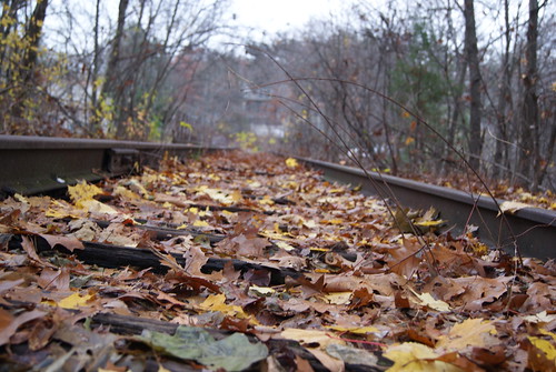
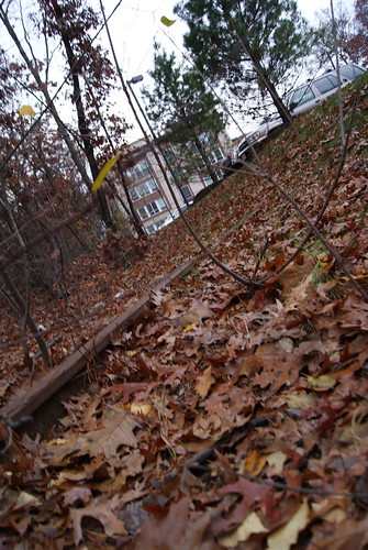
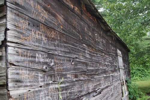
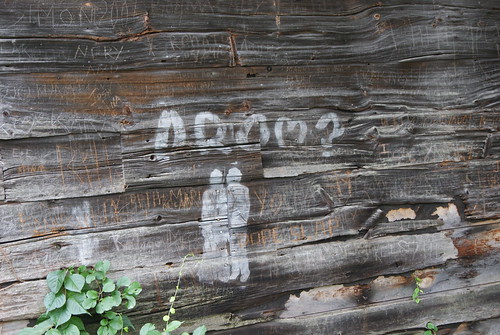
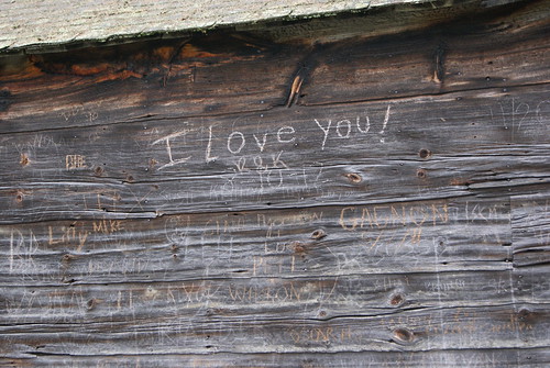
When we were teens, my friend Pat and I walked from his house about half a mile down the road, along a set of railroad tracks, down a slope, into a small, wooded section of our hometown and into the back yard of an abandoned house. Two neighborhood kids had told us about the house, so we checked it out. We walked through the open front door and into a house filled with all the stuff of life: cans of food, pots and pans, dishes, bottles and cans, framed photos, clothing, books and magazines, furniture and, most oddly of all, a mannequin.

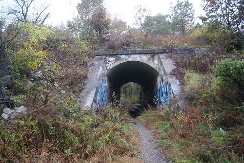
We walked around for a while, marveling at the fact that somebody had left all of their stuff behind. I suppose we visited the house one or two more times, but honestly, I can't recall. I don't remember paying much attention to the house afterward, even though we used to walk down the railroad tracks to Louie's Market to buy soda and Slim Jims, and to the Country Store to buy penny candy. We also used to pick up beer bottles from the slopes lining the tracks, and line them up on the tracks and smash them with rocks, and scamper through a tunnel under the tracks that connected Boot Pond (where we played hockey in the winter) with the swamp on the other side.

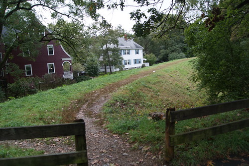
While I certainly found it odd that somebody had left behind all their belongings, and that nobody appeared to want them, I didn't think too deeply about the situation until after college. By then, the house was long gone, having been torn down to make way for a road into a new housing development.

From time to time, I thought about the abandoned house. I tried to work the mystery into a short story on at least one occasion. Last year I posted on a Facebook group dedicated to my hometown, wondering whether anybody remembered the abandoned house and if anybody knew anything about the situation. Nobody did.

Then, last month, a new Facebook page popped up that was more informal than the first one to which I'd posted. I asked the question again, and this time, two people responded that they not only remembered the house, but that they'd spent some time as teens hanging out with the man who lived there.

They told me that the man, President Little, said he was the son of slaves, and that he had no family to leave anything to when he died. This was why, one of the responders told me, the house was full of stuff when President passed away.

Through a quick bit of research online, I found some genealogical information about President. Turns out he wasn't the son of slaves, but it's quite possible that he was the grandson of slaves. He was born in Americus, GA, in 1904, to parents who were born in the 1880's. He also had five children, four of whom were evidently alive when President died in 1981. So perhaps he was estranged from his family, and that's why when he died, all of his stuff stayed in the house.

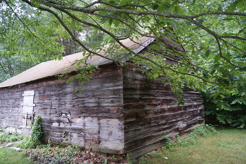
As it turns out, shortly after I learned who President Little was, I had a trip scheduled to Simsbury to play in a golf tournament. I decided to make a side trip to see if there was any evidence of President's house on the spot where it once stood.

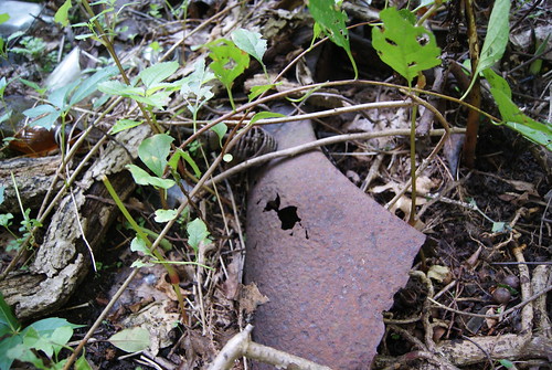
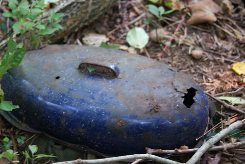
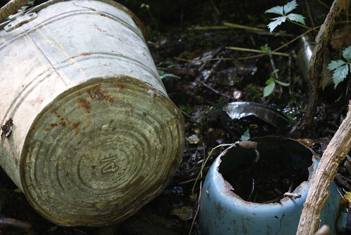
I found much more than I could ever have hoped for.

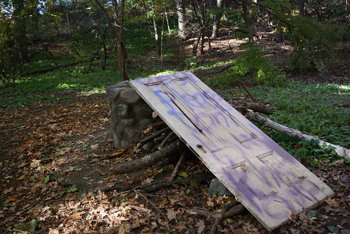
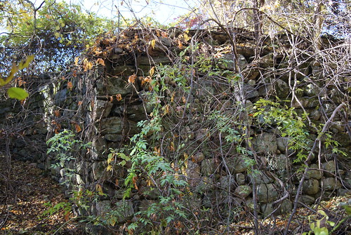
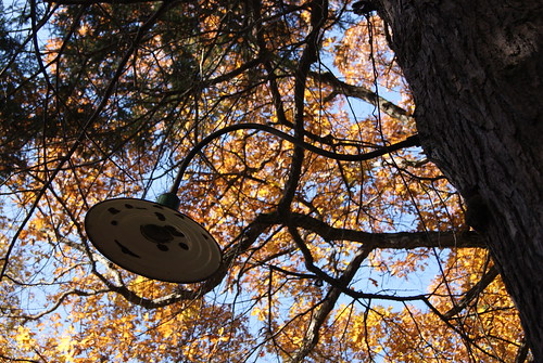
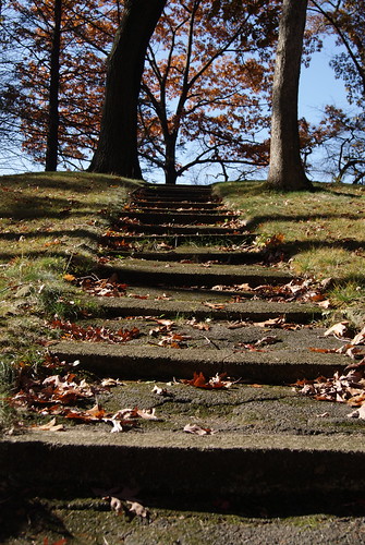
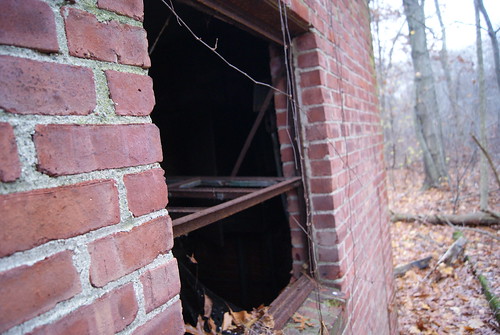
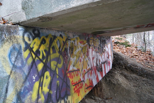
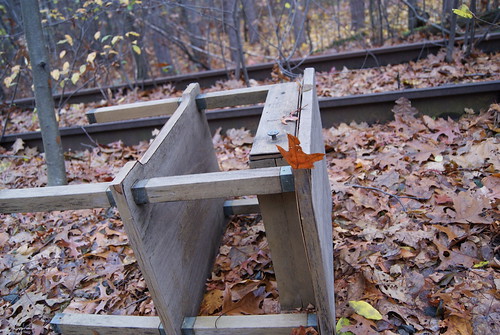
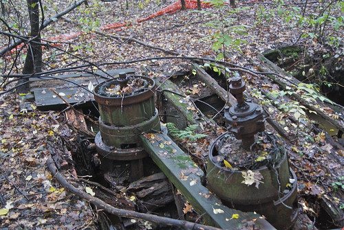
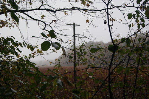
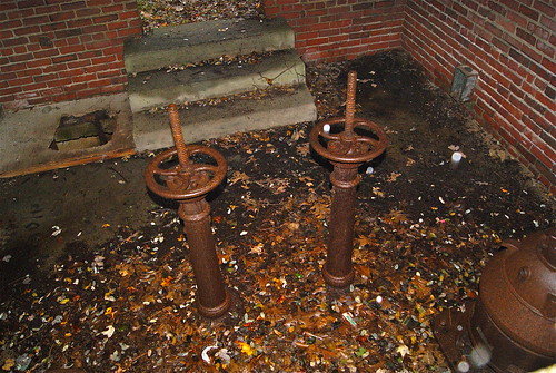
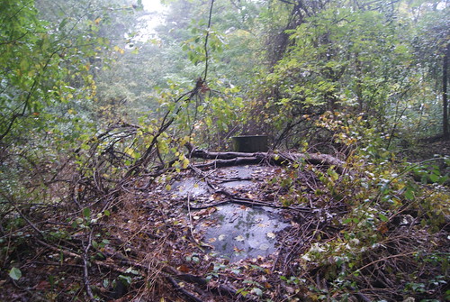
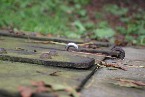
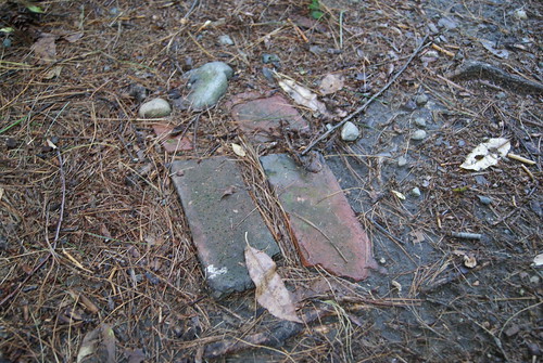
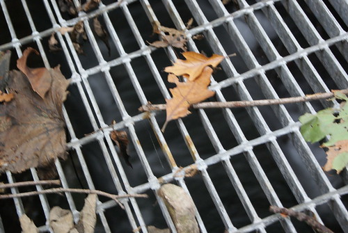
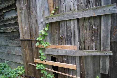
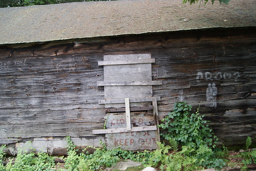
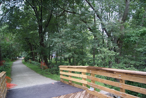
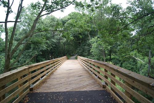
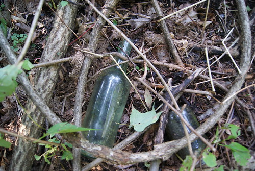
I doubt many people venture into the little patch of woods that's left between the driveway to the housing development to the south, the bike path to the west (where the railroad tracks once stood) and the main road, Route 10, to the east. I couldn't find an easy path into the woods, so I created my own, and within five minutes, had found what I was looking for.

Archeological dig

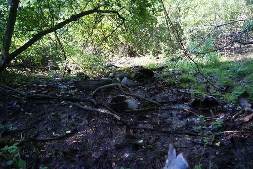
I was beside myself with excitement. The house had been torn down years ago; I had no reason to expect that anything would be on the site. I'm not a spiritual guy whatsoever, but I feel like something drew me here to discover the remnants of a forgotten place.

Rust

Blue pot

Tub & pot

Old bottles

I've sent emails to both the Simsbury Historical Society and the person from whose web site I gleaned the genealogical information, to see if they can provide more information about President Little, his family, his life, his work, etc. If I can put together enough of a picture, I hope to publish an article in a history, genealogy, archeology or some other type of magazine.

For the record, much of this information (and some different photos) first appeared last month on my blog, DaveTronik 2000. See August 24, 2011, "My Nascent Archeology Career."

Cape Cod Lobster Joint Can't Claw Its Way Back to Life

From Dave Brigham: Lobster shacks and Cape Cod go together like Cape Cod and lobster shacks. But the unimaginatively named American Lobs...