Showing posts with label charles river. Show all posts

Saturday, November 8, 2025

Grid Luck Crossing the Charles

From Dave Brigham:

Whenever I discover something quirky in service of this blog, I act as if people have been purposely keeping it a secret from me.

The old buildings that make up Brighton's Charles River Speedway, a favorite drinking and hangout destination of mine, were once part of a horse racing facility? Why didn't anyone ever tell me?!

There's a Colonial-era highway behind a hotel just a few miles from where I grew up in Connecticut? That's something I should have been told about as a kid!

Today, I focus my apoplexy on the folks who hid from me the existence of the Gridley Locks near Boston's TD Garden.

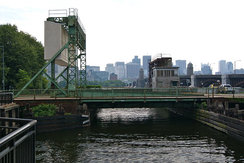
I stumbled across the locks, which are part of the Charles River Dam that was built in 1978, when looking on Google Maps for a good place to make photos of the Zakim Bunker Hill Bridge. "What the hell are the Gridley Locks?" I asked myself. "Who's responsible for keeping this Backside knowledge from me?"

Accessible via Lovejoy Wharf to the south and Paul Revere Park to the north, the locks are not at all hidden, but since they sit parallel to the North Washington Street bridge connecting the North End to Charlestown, they are certainly a less popular way of connecting those urban dots.

I love lesser-used pathways and alleys and tunnels and the like, so within a few days of learning about the locks, I had to check them out. There is nothing particularly photogenic about the locks, although there is the added attraction of the Charlestown Bells, an interactive music sculpture created by artist Paul Matisse. The bells are located, as you may have guessed by the name, near the Charlestown side of the dam.

I passed several people in my walk across the locks. I'm sure a few were wondering why the hell I was making photos of something as pedestrian as the walkway across a narrow part of the Charles River. The emotion I felt as I walked along was, I will admit, glee mixed with boredom. I'm always happy to find an out-of-the-way method of getting from one place to another.

So, what's the story with the locks, and who are they named after?

"Built and operational in 1978, the three locks can be crossed by pedestrians," per Wikipedia. "It is part of the popular Boston Harborwalk. The dam contains three individual locks, with one wider than the other two to accommodate the occasional passing of a larger vessel."

They were named for Col. Richard Gridley, who was George Washington’s chief engineer in the Continental Army. "Col. Gridley engineered the fortifications at the Battle of Bunker Hill in 1775, and at Dorchester Heights, where General Howe and his army were forced to evacuate Boston in March of 1776," according to the always thorough and enjoyable The Next Phase Blog.

Several years ago I explored near the locks, as my son and I checked out the North Bank Pedestrian Bridge that connects the southeastern tip of Cambridge to Charlestown.

Monday, November 5, 2012

Where's the Gondolier?

From Dave Brigham:

This is another one that falls into the category of Places That I've Passed Countless Times But Never Really Noticed.

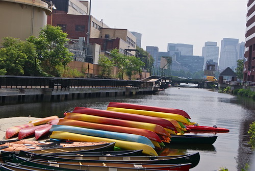
Broad Canal in Cambridge, Mass., is a shadow of its former self. Once part of an extensive system of waterways, the canal now extends just a short distance from the Charles River near Kendall Square.

Toward Boston

From Wikipedia:

The canal began in 1806 when Henry Hill, Rufus Davenport, and others laid out a canal system in the land and tidal flats along the Charles River. Broad Canal was dug before 1810, and 80 feet (24 m) wide from the low-water mark to Portland Street. In 1874 the lower part of the canal, between First and Third Streets, was 100 feet (30 m) wide. Connecting canals ran through much of today's East Cambridge.

No visible trace remains of that system, and extensive landfills have removed all remnants of Cambridge's seaport docks and wharves. Broad Canal's truncated remnants can now be found just north of Broadway, entering the Charles River immediately north of Longfellow Bridge.

I found out about the canal while doing a Google search, scanning the map for a waterfront location in the Boston area to do some Backside work.

I spied the words "Broad Canal Walkway" on the map and realized it was a spot I'd driven by numerous times on the way to and from various points, including the Museum of Science, the CambridgeSide Galleria and baseball games in Charlestown.

The walkway is hard by the massive Kendall Cogeneration Station. I saw two small boats tied up along the stone wall that defines the border between the canal and the power plant.

Jammed up

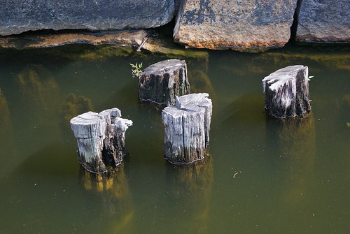
These wharf pilings are silently elegant in their quest to defy the modern world.

Pilings

But the modern world, alas, presses in from the end of the canal.

Broad Canal, Cambridge Mass.

Monday, August 20, 2012

Beer Tent

From Dave Brigham:

Beer tent #1

When I saw this lean-to along the Charles River near my house, my first thought was, "This could be a homeless camp." I remembered that a few years back some neighbors told me there was somebody living on the river bank.

But after exploring this very basic shelter, I concluded that it was more likely a teen drinking spot.

Empties

In recent weeks, however, I've come back around to my original thinking. There are definitely some homeless guys around who collect cans and bottles out of the neighborhood trash, and who fish in the river.

Obviously they're hard up, but I didn't realize to what degree until I walked past a wooden platform next to the Charles River bike path and saw some couch cushions and trash bags -- what looked very much like an effort to bring the comforts of home into the woods.

Friday, May 18, 2012

Aqueduct, My Friend

From Dave Brigham:

I've written about aqueducts before, but they are such a part of the landscape in Boston's western suburbs (if you know where to look) that I can always find more to say (see November 11, 2011, "History Flows On, Part I").

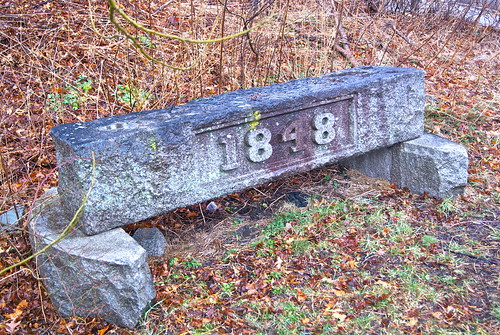
Over the years, I've driven past this stone marker in Wellesley numerous times, and wondered what it was.

1848

One day in late winter I finally found the time to investigate, and boy was I pleasantly surprised.

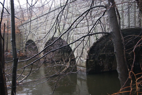
Just past the marker there's a path that leads up a small hill, in between an office complex on the left and an apartment building on the right. The path then goes down a short, steep hill and opens up onto this.

1848 bridge

Actually, the path continues over this beautiful bridge and, if you so chose, you could then hop over a short fence onto Route 95/128, stick out your thumb and hitch a ride south to, oh, I don't know, Rhode Island. I've driven this section of the highway countless times in the last 20 years, and never had any idea the Charles River and this segment of the old Cochituate aqueduct were right there. Since discovering this scene, I drive by on the highway and spot it and just shake my head. It's been there since 1848!

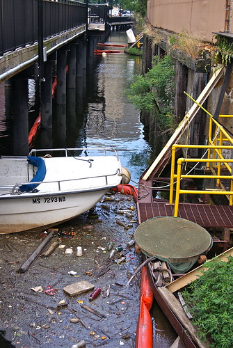
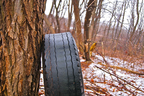
As if the scenic bridge wasn't enough, there's also a nice walking path along the river that cuts pretty close to the highway. There's quite a bit of trash on the embankment leading up to the highway, as well as this tire about 120 feet from the road.

Tire

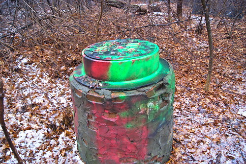
The little trail is the Charles River Path, part of the Wellesley Trails network, which itself is part of the Charles River Link, a 16-mile regional trail. On a gray, drizzly day, it was nice to see some color.

Psychedelic well

By the way, the marker is from the former aqueduct's gatehouse, which no longer stands.

Saturday, April 21, 2012

Beached

From Dave Brigham:

On a recent walkabout on the border of Newton and Waltham, I shouldn't have been surprised to find a large piece of trash just a stone's throw from the dump in my town, but I was.

I was tromping through Flowed Meadow, a conservation area that extends out from the Auburndale Playground. I'd walked around this area a few times before, and remembered that there was an abandoned house not too far from where I'd parked my car.

I followed the path that runs between two houses, which, honestly, are a surprise to see in the conservation area. The path is actually called Wabasso Road. At one point, years ago, there were obviously houses along here, and I was hoping to explore and take pictures of the one I remembered from the last time I'd been in the area.

Unfortunately, the house is no longer there. I walked the lot, looking for anything photo-worthy, but found only felled trees and remnants of a stone wall.

So I walked on, past the old fire hydrant that at one time was useful to the neighborhood, but which is now surrounded by trees, and looks like part of an absurdist landscape.

I looked up the slope to my right, and saw where all the lawn bags and yard waste in my town go to die: the dump. My journalism background compels me to tell you that the place is actually called the Rumford Avenue Resource Recovery Center.

I looked to my left, and spied a large, white mass of some sort, hunkered in the weeds. A whale? No. What the hell is that? Is that a boat? No, that can't be a boat.

It's a frickin' boat.


Beached

I'm not sure if the boat slid down the hill from the dump and landed here. Or if somebody at the nearby apartment building was storing it there in anticipation of taking it out on the nearby Charles River.

Obviously, nobody's been out on this rig in quite some time. And won't be ever again.


No fishing

But if you get just the right angle, you feel a big wave coming in.


Ridin' the wave

Friday, January 27, 2012

Smoke On the Water

From Dave Brigham:

Old pilings #2

The story about these old pilings in the Charles River in Waltham, MA, turns out to be much better than I'd imagined. I figured they were remnants of an old dock, something simple where people could walk out and dangle their feet in the water and watch the boats and the ducks float by, while taking a break from the nearby watch factory. As time progressed, went my thinking, the dock rotted and fell apart and floated away, leaving behind these ghostly markers.

Well, this spot had much more going on during its heyday. I had to do quite a bit of searching to discover that a canoe manufacturer named C.P. Nutting built a boathouse here in 1914. According to an article I found at eHow.com, "This was also a boat house that was used for roller skating, boxing, dancing and concerts. This ballroom was famous, as it was one of the few ballrooms in Massachusetts, outside of Boston, where the famous big bands of the time played."

Here is a picture of the dance hall. And here is a card advertising some performances at the hall from 1936.

As for Nutting's company, according to a posting on a forum for the Wooden Canoe Heritage Association (I told you I had to dig deep!), "it was established in 1884, but did not start building boats and canoes until 1890. By 1905, between 6 and 10 canoe builders were employed at Nutting’s, and it was reported that on average, Nutting built 150 canoes per year. In contrast, the fledgling Old Town Canoe Company was producing about 10 times that many by 1906. Nutting’s specialty was canvas canoes, and they had a reputation of being finely constructed."

Nutting-on-the-Charles was not too far down the river from the Totem Pole Ballroom, which was part of Norumbega Park in nearby Newton, which I wrote about recently (see December 28, 2011, "Amusement Park Ghosts").

Norumbega, which was a "trolley park," closed down in 1963. Nuttings had a much more dramatic ending two years earlier, when it burned to the water line. All that's left are the pilings.


Old pilings #1

Wednesday, October 12, 2011

Troubled Bridges Over Water

From Dave Brigham:

The single greatest achievement in my adopted hometown of Newton, MA, in the eight years I've lived here is the creation of a bike path along the Charles River. The section closest to my house was completed in 2004 and marked with the installation of a 140-foot suspension bridge named for the blue herons that live along the river. The path was built by the Department of Conservation and Recreation, based on a master plan developed in the early '90s.

Thanks to the hard work and determination of the DCR, it is now possible to walk, bike or run from Newton's Auburndale section, which abuts Route 128, to Boston's Museum of Science, a distance of nearly 20 miles. The DCR plans to extend the pathway south from Auburndale into neighboring Needham, Dedham and the West Roxbury neighborhood of Boston.

As you can imagine, abutters fought the project over the years, arguing that creation of the path would enable drug addicts and criminals easier access to homes and businesses (see this blog post and discussion).Many abutters thought they owned the land, because it had been unused or unclaimed by the state for so long.In most instances, however, the state owned the land close to the river. Reclaiming the land, clearing it out and providing access to the river was a major undertaking.

To make a long story short, the path is fantastic and people love it. I jog on it a few times a week and see a lot of fellow runners, along with walkers, cyclists, bird watchers, and people commuting to work on foot. And I see blue herons, geese, ducks and other small wildlife.

Yet, despite all the good generated by these paths -- great places to exercise free from car traffic, beautiful places to fish and observe nature, nice areas for dog walking -- there are people opposed to their expansion.

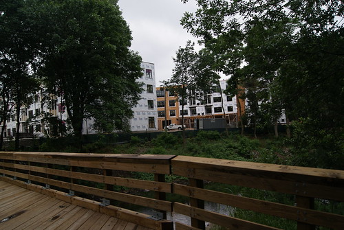
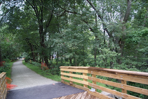
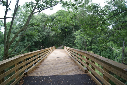
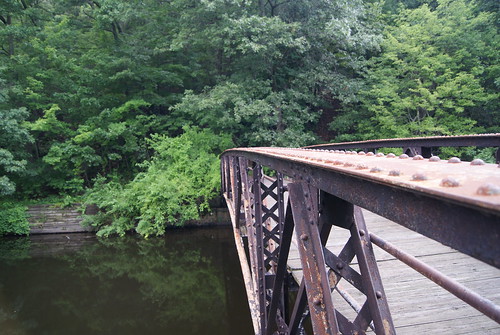
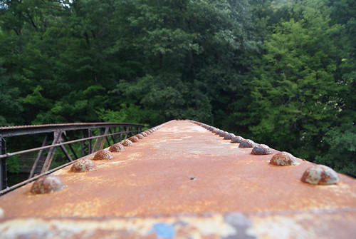
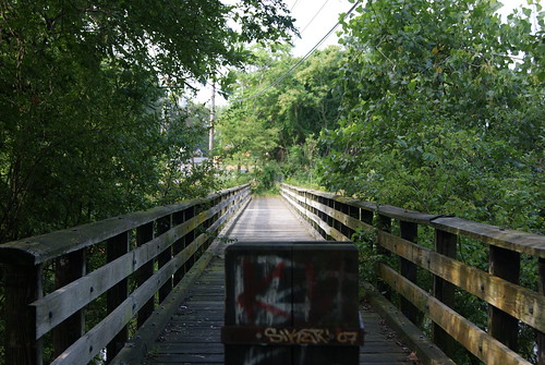
In one case in Newton, neighbors fought against the state when it announced plans to create a walking path over the Charles in the Lower Falls area of the city. The path, which is currently nearing completion, was built over a 100-year-old rail bridge that the DCR has owned since 1975. The path is a short one right now, connecting Washington Street in Wellesley to Concord Road in Newton, but the DCR is considering extending the path to the Riverside MBTA station, where trolleys and buses operate.

Here's what the bridge and path look like:

Newton Lower Falls Bridge #4

(Looking from the Newton side to a new development in Wellesley)

Newton Lower Falls Bridge #1

(Looking toward the Newton Lower Falls neighborhood)

Newton Lower Falls Bridge #3

(Looking toward the Newton Lower Falls neighborhood)

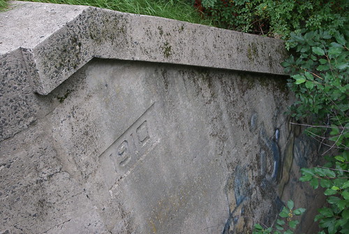
Newton Lower Falls Bridge #2

(The original train bridge abutment)

The path provides a nice connection from Concord Road to a commercial section of Wellesley where there are numerous restaurants and shops. It's a scenic little jaunt and one that I'm sure neighbors will enjoy making once the path is completed. Will there still be grumbling? Sure, but it's all gonna go into the wind.

Not too far away from the new Lower Falls path is the Riverside Park Pedestrian Bridge, which connects Newton's Auburndale section with the town of Weston. The bridge spans the Charles River, and has been closed for quite some time due to instability. There are plans in the works by the state Department of Transportation to rehabilitate the bridge and open it for foot traffic.

Riverside Park Bridge #1

Riverside Park Bridge #2

Riverside Park Bridge #3

Once again, neighbors are taking part in public forums to express their reservations about reopening the bridge and opening up their neighborhood to unknown elements. Like the Lower Falls bridge, this one, too, will surely be completed and enjoyed thoroughly by people who just want to share in the river's beauty.

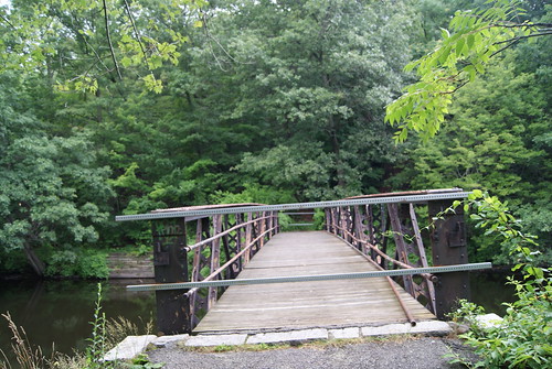
About a quarter of mile down river from the Riverside bridge I found this old crossing.

Auburndale Bridge

Located next to the Lasell College boat house, this bridge dead-ends near a site that I believe is a staging area for the state's Department of Transportation construction projects on nearby Route 128. I have no idea whether this bridge will be opened at the other end at some point, but as far as I'm concerned, in case it wasn't obvious enough already, I believe that the more ways to access a river, the better.

(For more on Charles River crossings, see May 12, 2010, "Dead-End Tracks, Part I.")

Thursday, January 13, 2011

Water Under the Bridge

From Dave Brigham:

l took these pictures in Weston, MA, at a water main crossing for the Massachusetts Water Resources Authority. The site is directly across the Charles River from the Newton Marriott Hotel and very close to a canoe and kayak rental place located in a one-time Metropolitan District Commission police building.

The water main crossing site is also popular for feeding ducks, and for gay cruising, according to my wife, who's a Newton native. For me, it's just a cool place to wonder and wander.


MWRA Water Main Crossing, Weston, MA #1

Graffiti Crown

Small old bldg., Weston, Mass.

Monday, March 1, 2010

Take Me to the River


From D. Brigham:

The picture above shows a staircase running from the back of a house on Farwell Street in Waltham, Mass., down to the Charles River. Most likely it used to connect to a boat dock. It's made of concrete or stone, rather than wood, like most dock stairways are. As a result, it looks more like an ancient ruin than a recently abandoned walkway that once led to a pleasure craft filled with some cold Bud Light. Curiously, this part of the Charles isn't conducive to boats bigger than kayaks or canoes, as it is very shallow and less than a mile from the Watertown Dam, so I'm not sure what purpose a dock would have served (photo by Dave Brigham).

I decided to post this photo as the inaugural picture here not because it's an especially great shot, but because it reflects the method by which I discovered the backside of America. When I was about 12, I went on my first canoe ride with my dad, putting the old green boat into the Farmington River at the Route 185 bridge in Simsbury, Conn., hard by the renowned Pinchot Sycamore, the largest tree in the Nutmeg State. While I enjoyed the sights along the banks of the river -- trees, birds, frolicking fish, garbage snagged on rocks -- what really caught my eye was the rear of various residential and commercial properties at or close to the water's edge.

I'd grown up in Simsbury, and was familiar with all of the houses along Hopmeadow Street, the town's main drag, as well as the wide array of businesses, from Mitchell Pontiac and the Weatogue Barber Shop, to the Ensign-Bickford munitions factory and Fitgerald's grocery store. But I'd never been on the river, and so had no idea how the town looked from the water.

It sounds obvious to say, but I saw the town from a whole new angle. Nothing was familiar, and nothing was as attractive from the back as it was from the front. Today I am lucky to live very close to the Charles River in Newton, Mass. There is a walking path next to the river that my family and I use for runs, bike rides and leisurely strolls. I took the above photo by straying from that path into the woods next to the river. While the trees and wildlife along the river are beautiful and fun to watch, and the path offers a quick route to grocery shopping, I am more interested in the old railroad trestle in Waltham, the lot where linemen for the local electric company practice climbing utility poles, and other places hidden from the street.


UPDATE: Guido's Court

From Dave Brigham: Longtime readers of this blog might recall that every once in a while I check in on a quaint campo di bocce in Brighto...