From Dave Brigham:
Welcome to the second (and final) installment of my Watertown Square miniseries. I ended part one talking about restaurants, a liquor store and a fraternal organization (see February 13, 2021, "Making Things Right in Watertown Square, Part I"). To start this section, I'm going to pivot from eating and drinking and socializing to saving souls.

First Parish of Watertown Unitarian Universalist is one of the oldest congregations in the United States, dating to 1630, per its web site. The First Parish has worshipped in eight different meetinghouses since its founding, according to its web site: one near present day Mt. Auburn Hospital in Cambridge; others on sites at the corner of Arlington and Mt. Auburn Street, on Hillside St., at the top of Common Street; one at the bottom of Common Street on Mt. Auburn Street. "This structure became the meeting place for the Provincial Congress during the American Revolution, when Watertown was the capital while Boston was occupied by the British. The four corners of this meetinghouse are marked with stone posts in the Common Street Cemetery (for more on this burial ground, see January 15, 2021, "A Revolutionary Cemetery in Watertown").

"The sixth, seventh, and eighth buildings have all been located near the corner of Church and Summer Streets. The sixth, built in 1836, burned and was replaced by the seventh in 1842. The current building, designed by Charles Brigham, was erected in 1889 as a parish hall. It became the sanctuary when the 1842-era church was torn down after the parish had witnessed declining numbers, per the web site.
On Mount Auburn Street stands Grace Vision United Methodist Church, the front door of which is pictured below.

Built in 1894, the building is known historically as St. John Methodist Episcopal Church, a congregation that was founded in 1836. I'm not sure whether the St. John congregation still exists. It may have joined another parish.
Along Main Street is the imposing Church of St. Patrick.

The Roman Catholic church dates to 1901; it replaced a structure that the parish had acquired from a Methodist congregation. Construction of this church by Irish Catholics was a big deal in Watertown, which had since its founding been, like most Colonial towns and cities, a Protestant stronghold. Per MACRIS: "Located on one of the busiest and most established streets in town, the church, with its dramatic and dramatically different architecture, symbolized the prominence which its congregation had achieved in only two generations. Originally, the Irish were unwelcome in the Yankee Protestant town. They worked the mills and farms and were restricted to living in a few districts. But the town which had a single homogeneous congregation for its first two hundred years, could not suppress the ambition and numbers of the ethnic community, which congregated there in the mid-19th Century."
In more recent decades, another immigrant group has taken hold in Watertown and its neighbor, Belmont: Armenians. In 1985, the Armenian Museum of America opened in Belmont, in the basement of the First Armenian Church. Three years later, the museum's founders purchased a former bank building on Main Street in Watertown, renovated it, and opened the museum there, per its web site.

Armenian emigration to Boston was spurred largely by the 1915 genocide by the Ottoman Empire upon Armenians. As of five years ago, Massachusetts claimed 25,000 people of Armenian ancestry, the second-most among states, according to the 2013 American Community Survey. Just over 12,000 of those live in Middlesex County, concentrated in Watertown, per this Boston.com article.
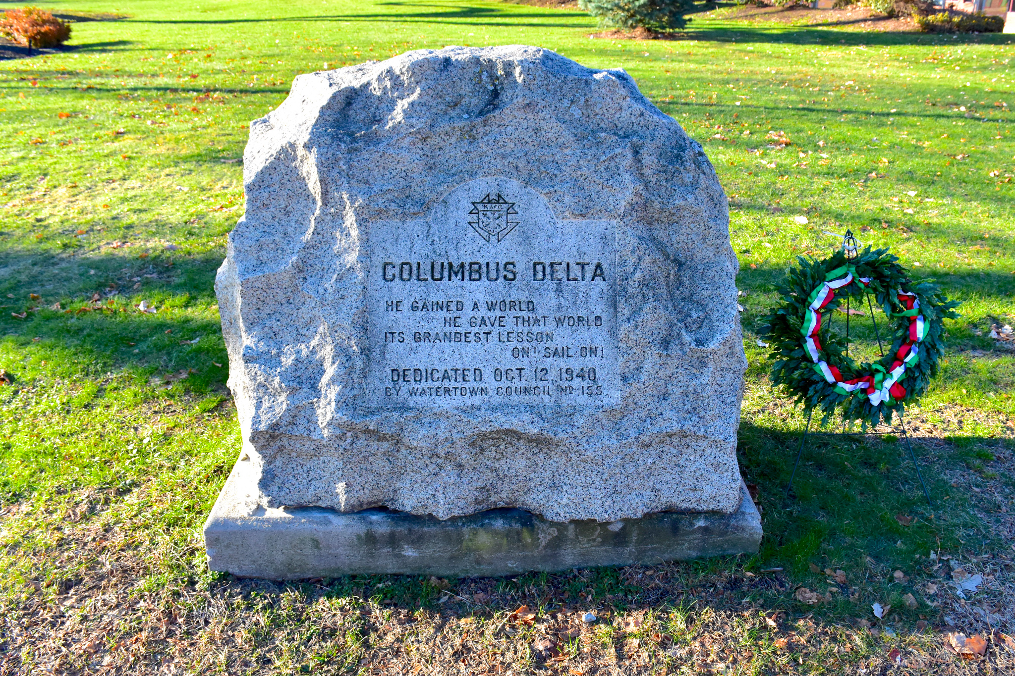
I want say at this point that I certainly haven't shot photos of and researched every important aspect of Watertown Square. In a few cases, I have already covered some of this territory; I want to point readers to a post from late 2013 that includes a few named buildings in Watertown Square (see December 26, 2013, "What's In a Named Building (Part 1)").
Ok, let's move along.

The Inn on Arsenal, which sits along Irving Street in between Arsenal and North Beacon streets, is the latest hotel to occupy this site over the years. According to the web site, the inn has been serving the area since 1985. Prior to its current name, I believe this place was a Super 8 Motel. I seem to recall other names over the years.
On Main Street, not far from the Armenian Museum, sits a building that was an inn back in the 19th century.

This building is pre-1850 (hard to track down an exact date) and was once a hotel called the Shamrock House. A plaque on the building gives a date of 1785 and the name Wm. Leathe, Blacksmith. I'm assuming Mr. Leathe's shop pre-dated this structure, which is known as the Winnick Building and houses offices.
Next to the Grace Vision United Methodist Church mentioned above is a really neat apartment complex (I know, that seems impossible, but it's true!).

Known alternately as Old English Terrace and the George Frederick Robinson Apartment building, this set of connected apartments dates to 1902. Designed by William E. Putnam, Jr. in the Tudor Revival style, the complex runs along Mt. Auburn and Palfrey streets. The building was erected for George Frederick Robinson, a prominent local author and man-about-town, per MACRIS.
As for Putnam, his firm Putnam & Cox designed many buildings in Amherst, Boston and Brookline, among other towns and cities. One of his Boston buildings is the Edward Kirstein Memorial Library, which I included in a December 2019 post about a ramble I took through the city (see December 21, 2019, "Just a Typical Day Wandering in Boston").
OK, let's return to architect mentioned above, one with a strong Watertown pedigree and, ahem, a very important name: Charles Brigham.

As the plaque on Watertown Savings Bank says, Brigham (likely a very distant relative of mine) was a Watertown resident and one of Boston's leading 20th century architects. The bank, which he designed, rose in 1892 in the heart of the square. "[B]orn, raised, and educated in Watertown, Massachusetts schools...[he] graduated at age 15 in 1856 in the first class of Watertown High School. He had no formal education in architecture," per Wikipedia.
In addition to the Unitarian-Universalist Church and bank mentioned in this post, Brigham also designed the Albert Burrage House in Boston's Back Bay (see March 2, 2020, "Tom Brady Slept Here") and the annex to the Massachusetts State House (mentioned in part two of my Beacon Hill series), among many others in the city and the Greater Boston area.
Brigham designed the building in the middle of the photo below. The additions were added in the 1920s.

Below is a detail from the newer part of the bank.

Below is the front of the former night deposit box.

I would be remiss if I didn't include a few true "backside" images in this post.

Located at 164 Main Street, this long-shuttered retail spot is one of the few blights on Watertown Square. I believe the last business to be located here was a 7-Eleven convenience store. Unfortunately, the likelihood is high of other stores and restaurants closing due to the ongoing pandemic.
Along Arsenal Street, not far from the Inn on Arsenal, sits Escort Limousine, below.

Founded in 1984, Escort provides limo and bus services, including trips to the Foxwoods Casino in Connecticut, per the ad in the window. I don't know if the business is still active; if it is, someone should tell them to spruce things up a bit.
Speaking of sprucing things up....

This small park and community garden site sits across Irving Street from the relatively new Elan Union Market apartment complex. As part of Watertown's approval of the development, the developers agreed to clean up this site and install a park. The garden looks pretty nice, but the rest of the park, while it is clean and pleasant, doesn't offer much. The developers indicated that the rear of the building in the background (an electric substation) could be used as a community movie screen.
There is another electric substation on Spring Street, below, directly across from the Molana and Ixtapa restaurants mentioned in the first post about Watertown Square.

I believe Eversource owns this one; if you look closely, you can see EDISON over the door. The Boston Edison Company was founded in 1886 as the Edison Electric Illuminating Company, per Wikipedia. "In 1999 it was merged with Cambridge Electric Light Company, Commonwealth Electric Company, and NSTAR Gas Company to form NSTAR. After subsequent mergers, what remains of the Boston Edison Company is now part of Eversource Energy." For more about Boston Edison, see this post about Boston's Kenmore Square from August 2019.
Over on North Beacon Street is a former service station that most recently was home to Aquatic Treasures.

I'm not sure if this place is still in business. Prior to the aquarium store, this site was home to Watertown Towing, I believe. I can't find out the age of this building, but I'm guessing it dates to the 1930s or 1940s.
I've got a few more things -- including a large former mill complex that, although I've been aware of it for years, I've managed to mostly ignore -- from the main part of the square. After that, I'll cross the Charles River and expound on several places on the south side of the river, heading closer to Newton.

Located at the nexus of Pleasant, Galen and Main streets, the former Lewando Cleaning and Dyeing plant dates to 1906. The multi-building complex is hard by the Charles River and is currently known as Riverbend. Companies located here include Greenough, which calls itself a brand storytelling company (I think that means marketing); Insight, which is an information resources company (I don't know what that means); and Steward Medical Group, which I think is pretty self-explanatory.

Now for some history, thanks to my old pal, MACRIS.
"Lewando's occupies the site of the earliest grist mill in Watertown...built by Thomas Mayhew (name-checked in the first installment) in 1634. In the early 1800s, part of the property on Pleasant St. was owned by James McGarvey who ran a small dyehouse there. He was bought out by Adolphos Lewando, whose cleansing and dyeing business became the largest in the country, with branch offices in New York City, Baltimore, Providence, Lynn and Cambridge.
"Originally, dyed items were set out to dry in the open air by the river. Before the advent of drycleaning chemicals, garments were taken apart and steam scoured. With new equipment supplied by Watertown's own Empire Laundry Machinery Co. in the 1870's, the quantity of laundry and cleaning which the company could handle was dramtically increased. Garments were cleaned intact, large washers and dryers handled the laundry and special machines were devised to add starch and polish to collars and cuffs. During the 1930's, business continued to thrive. Rug cleaning and fur storage replaced the dye business. By the 1950's there were 55 Lewando's stores. Traffic and parking problems in Watertown Square forced the [closure] of this plant in 1965, ending 150 years of Lewando's presence in Watertown."

For a time, the building was occupied by Instrumentation Laboratory, Inc., per MACRIS.
Just west of the Riverbend complex is another former mill complex.

The former Hollingsworth & Whitney Mill buildings date to 1867, and were erected on the site of William May's paper mill, according to the 2015 Watertown Comprehensive Plan. "One of May's employees was Leonard Whitney, Sr. who subsequently bought out the company and went into business with his son," per MACRIS. "Eventually,the company became Whitney & Priest, noted for its invention of the brown paper bag, which revolutionized grocery and store packaging. When Priest retired in 1862, the firm became Hollingswoth & Whitney, and greatly expanded its operations."
In later years, the site was home to the Union Bag and Paper Company.

The complex is now home to companies including print and graphics company AIR Graphics and architecture/interior design/landscape architecture/civil engineering firm Sasaki Associates, which I'm guessing redesigned the space that the company occupies. Notice the nice contrast of building styles below.


A fantastic bike path runs behind these old mill buildings, hard by the Charles River, and on past a cool Art Deco swimming pool complex.

The Clarence W. Dealtry Memorial Swimming and Wading Pool dates to at least 1950, and was named for a well-known attorney who lived in Watertown in the first half of last century, according to this Digital Commonwealth photo of the pool in its early days.

A relatively new footbridge takes you from behind the pool, over the Charles and to the southern tip of Watertown.

This bridge replaced a narrower, more steeply pitched one that was named the Corporal Joseph U. Thompson Footbridge, after a soldier killed in World War I. I didn't notice whether the new bridge also commemorates Thompson's service.
On your way across this bridge, if you look east, you'll see the Watertown Dam.

(View of Watertown Dam, looking south.)
The current dam dates to 1900 and is 180 feet long. According to Wikipedia, there have been dams here since at least 1632 when members of the Pequossette tribe constructed a fish weir. "The dam is located where the Charles River tidal estuary historically ended," sez Wikipedia. The Charles River Watershed Association has floated the idea of removing the dam, in order to "restore the free flow of water and sediment, allow fish and other wildlife to travel between portions of the river, help migratory fish populations rebound, and eliminate expensive dam maintenance costs, among many other benefits," per the organization's web site.
In front of the brilliantly named Watertown Square Apartments, near the end of California Street, is an unsatisfying memorial that I suspect few people realize exists, even though it relates to one of the most recognizable figures in American history. I sure as hell didn't know about this slab of concrete until I randomly stumbled across mention of it online.

"SITE OF THE PAUL REVERE HOUSE," is all that's etched into this monument. Anybody who pays attention to Paul Revere, and those historically minded folks who have visited Boston, will tell you that this American hero lived in what is now Boston's North End. And that's true. But, what this marker doesn't tell you is that the great patriot moved his family here after getting into hot water with the British. "Paul Revere, wanted by the British after the Battle of Lexington and Concord, had his family slip out of Boston to live in Watertown, at what is now the intersection of Watertown and California Streets, for a year," according to the official Watertown web site. Why didn't they carve that information into stone?
A short trot away is another historic marker, and this one provides actual useful information.

Located at the corner of Galen Street and Nonantum Road, in front of the MBTA bus terminal (about which more in a second), the plaque for the Coolidge Tavern lets passersby know that "many leaders of the patriot cause, including George Washington, John and Samuel Adams found lodging and refreshment" at this site during the American Revolution. In fact, the "Great and General Court met here briefly in the winter of 1175-1776."
That's what I like to call the good kind of plaque.
Directly behind this plaque is the former Watertown Carman's Lobby, which dates to 1934. It was built by the Boston Elevated Railway Co. to replace a previous structure.
The little brick building sits at the front corner of Watertown Yard, a commuter bus terminal and maintenance facility with a history as a trolley barn and end/starting point of the long-gone A line of the MBTA's Green line service.

From Wikipedia: "The A branch or Watertown Line was a streetcar line...operating as a branch of the Massachusetts Bay Transportation Authority Green Line. The line ran from Watertown through Newton Corner, Brighton, and Allston to Kenmore Square, then used the Boylston Street subway and Tremont Street subway to reach Park Street station.
"Portions of the route were built as horsecar lines between 1858 and 1880. The segment between Union Square and Oak Square was electrified in 1889 as part of the Beacon Street line. By 1896, electric routes ran from Newton Corner to downtown Boston via Brighton and via Watertown. Brighton service was extended to Watertown in 1912. The line was operated until 1969, when it was replaced by MBTA bus route 57, though it remained in service for non-revenue moves to Watertown Yard until 1994."
Hence, the old train tracks you see in the photo above.
On the Newton-Watertown line along Galen Street sits Newton Corner House of Pizza, which I believe has been around forever.

On Water Street, opposite Watertown Yard, is the Norman-Kent Building.

So, who were Norman and Kent, and why did they hyphenate their names and erect a building? I have no clue, and neither does the Internet.
Across Galen Street, near Watertown Street, and within spitting distance of Newton (well, if you're a champion lougie-hocker), sits 101-103 Morse Street.

You can just tell this used to be something, right? I'd seen this place a few years ago when my daughter played softball at a field across the street. I drove by here as the final stop on my Watertown treks, and I'm really happy I remembered it.
This is the former Dalby Knitting Factory. The main building rose in 1865; additional buildings followed over the ensuing decades. "Thomas Dalby,who built the factory, was a weaver from the English Midlands," per MACRIS. "He worked in the knitting mill near Bemis Mills [in Newton]. Dalby started a business in fine underwear using 150 knitting machines. The work was done on an upper floor, from which the great rolls dropped to bleaching department, then were cut in patterns, stiched, steam pressed, & marketed on the company's newly devised mill-to-store plan."


The property is currently being redeveloped into 45 apartments that will accommodate between 60 and 80 residents, according to this document at the official Watertown web site.
I want to wrap this mini-series up with a look at some empty lots.
Beautiful, no?
Not long ago, these unrelated properties were populated by a car dealership, a quick oil-change business, a small house and a gas station. As soon as I saw this vast ugliness, I knew there was something cooking in the development realm.
And sure enough....
"Boston Development Group...has recently proposed a major life sciences development at 66 Galen Street in Watertown. The proposed life science campus, comprised of two phases totaling nearly 450,000sf of class A office/ R&D LAB, addresses the goals outlined in The Watertown comprehensive plan, and builds upon the burgeoning life science cluster that has evolved and accelerated over the last several years," according to an October press release the real estate development firm issued.
"The city’s planning initiatives envisioned the South Square/Galen Street corridor as a major gateway into the downtown and an ideal place for a mix of uses including office/R&D, lab and other higher density, transit-oriented development that would serve to transform its character and identity," the press release continues.
As lab and R&D space fills up in Cambridge's Kendall Square (see June 8, 2019, "UPDATE: Strolling Among the L7's in Kendall Square") and Boston's Seaport District, Watertown has become a more affordable option for biotech companies. I find it amazing how much the town has changed in the last decade or so, with apartment complexes, shopping develoments, hotels, life science companies and more sprouting all over the place.
So there you have it, a fairly comprehensive, two-part look at Watertown Square. Next up in my Watertown series will be the Bemis neighborhood, which is defined by Main Street to the north, the Charles River to the south, and the City of Waltham to the west.