From Dave Brigham:
I've been thinking for years about doing some Backside field trips with friends, family and any other interested parties. In the early years of the blog, when I had a handful of regular contributors, we would discuss meeting somewhere to make photos together, but I never made that happen. For the most part when it comes to Backside treks, I am, like Lenny Kosnowski on "Laverne & Shirley," a Lone Wolf.
There have been a few occasions when I shot photos for this blog while hanging out with other people: on my 2016 visit to a long-abandoned church in East Granby, Connecticut, I was accompanied by my mother; during a 2019 family vacation in Seattle, I annoyed my wife and kids by lagging behind while shooting photos in Pioneer Square; and in the summer of 2019, I strolled Boston's Fort Point neighborhood with a reporter and photographer from the Boston Globe for an article they published about ghost signs.
Recently, I began working to make my vision for field trips a reality. In the short term, I am planning on a few excursions to locations I've visited previously, inviting along anybody who's interested. Depending on how I do with this concept, I may look to make it more of an official venture, offering guided tours with history of the sites, and perks for those who join.
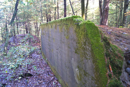
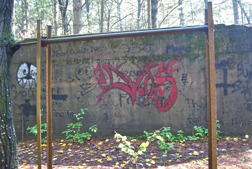
As you may have figured out by the video at the top of this post, I recently conducted my first "field test." I put out the call for any and all who wanted to check out the Old Rifle Range in Concord, Mass., which I first trekked through 10 years ago (see December 4, 2012, "Concord, Part I: Old Rifle Range").
I'd made a list of prospective sites to revisit, and figured the World War I-era range was a good place to start, as it's an easy hike, good for humans and dogs alike, and features the type of remnants one doesn't usually come across in the woods of New England.


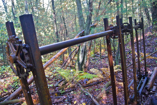
When I wrote about the range in 2012, I wasn't sure exactly how the set-up worked. A commenter on the post cleared it up for me: "The metal frames/gears were protected by the concrete, which also protected the soldiers manning the targets. They lifted the targets above the concrete."
I was joined on this hike by my friends Jay and Amy, their son, Henry, and their dog, Bernice. I also had my dog, Trudy.

It was great having them along for the obvious reason of friendship, but also to discuss things about this area that hadn't occurred to me on my first visit. Jay pointed out a few spots, large impressions in the side of the hill on the south side of the site, that may indicate where small buildings once stood. We speculated that there may be more range-related stuff in the heart of this conservation area than meets the eye.
We also learned from a fellow hiker that there is quite likely a coyote den here, as this woman has both seen and heard the canis latrans at the Old Rifle Range.
I hope to fit in one more Backside Adventure before the snow flies (although I certainly explore in winter, weather depending), so keep your eyes peeled to my Facebook page and to this space for updates on that.