Showing posts with label abandoned house. Show all posts

Saturday, January 23, 2021

Collapsing Old Buildings to Make Way for Shiny Apartments

From Dave Brigham:

This post is all about playing the long game.

For more than five years I'd driven past the dilapidated house above, which is in Sudbury, Mass., just over the Concord line on Route 117. No, the windows weren't missing until recently, but this place definitely had that creepy-old-house-from-"Scooby-Doo" vibe going.

At first, the house seemed to be in OK shape, but the barn I spied up the hill through the woods was definitely in a major state of disrepair, although still partway vertical.

Over time, however, I noticed that the house and the trees and garage and yard looked worse and worse, like a rotting corpse. I saw an old pickup truck in the driveway, so I figured somebody lived there. Eventually, the barn collapsed completely. I wanted to shoot this place so badly, even though I don't normally care much for such places.

In late December or early January, I realized I hadn't seen the pickup in quite a while. And then, one day, contractors erected a fence around the house and marked the house with a red "X." I knew my time to check out this property was short, as both of those things meant demolition was imminent.

So, with my dog waiting in the car, I pulled off Route 117 and walked around, shooting quickly, all the while concerned that I would be busted for trespassing. I'm such a chicken when it comes to that. I was surprised at the condition of the barn.

But what really shocked me was the back of the house, where somebody had been living perhaps a year ago.

The house is listed online as dating to 1955; I'm guessing the barn was older. The property was sold in April 2020 for $845,000. In many towns outside of Boston, when a place like this gets demolished, one of two things happens: a McMansion goes up, or the developer crams as many townhouses onto the site as is allowed by law.

Because this property abuts a former quarry that was once owned by the Town of Sudbury, the plan here is larger. Much larger.

Let's start from the beginning. I'll try to keep this brief.

In February 2016, developer Chris Claussen submitted to the Town of Sudbury a Chapter 40B proposal to build a massive apartment complex in the center of town. Chapter 40B is a state statute that enables local Zoning Boards of Appeals to approve affordable housing developments under flexible rules if at least 20-25% of the units have long-term affordability restrictions, according to the Mass. Housing and Community Development web site. The goal of the statute is to allow developers to override local zoning bylaws in order to increase the stock of affordable housing in municipalities where less than 10% of the housing stock is defined as affordable, per this web site.

"The project proposes 13 buildings, some as tall as 50 feet and four stories high, 250 residential units, and 500 parking spaces," according to the Oppose Sudbury Station web site. Sudbury is a town with a deep Colonial history and a largely white, fairly well-to-do population. As you might imagine, people were up in arms over this housing proposal, right in the center of the historic town.

There was a lawsuit and, I imagine, protests and angry letters to the editor. Folks were surely in high dudgeon.

Fast forward to late 2018. The Board of Selectmen voted to do a switcheroo, giving Claussen and his development team the former town-owned quarry along Route 117, in exchange for the nearly 40 acres of land where Sudbury Station would have risen in all its metropolitan menace.

Earlier in 2018, the Town had "put out a request for proposals to develop the Melone property," aka the quarry site, per this Metrowest Daily News article. In addition to Claussen and his Quarry North group, San Diego-based EDF Renewables submitted a proposal for a solar farm and Sudbury-based Cavicchio Greenhouses Inc. put forward plans for an agricultural project.

Quarry North secured the former town property in late 2018. I'm not sure how things shook down for Claussen to buy the old house and barn. Judging by how run-down the property was, perhaps the owner died and the sale was made quite easily with his or her estate. It's conceivable that the owner of the house was holding out and once Claussen received the quarry property from the town, he or she got what they wanted and moved out.

Either way, it's all done now. The new development -- which will be known as Cold Brook Crossing, and which will also include property in abutting Concord -- will include 274 units, a small retail component, recreational facilities and more. The developer applied last year to install a private wastewater treatment plant on the site, as there are wetlands on the property.

This will be quite a change for this area, which still contains quite a bit of farmland, but not unprecedented. A quarter-mile from the proposed Cold Brook Crossing is an office complex (where my son's school is), as well as a few condo developments, all built on a former farm.

For more posts about Sudbury, check out: February 20, 2019, "Finding Some Cool, Mostly True, Memorials in Sudbury"; August 30, 2016, "The Tavern of Death"; and February 17, 2016, "Bunker Buster."

Tuesday, January 14, 2020

Of Pests, Pestilence & Death

From Dave Brigham:

Concord, Mass., is a town connected intimately with Colonial American history. Incorporated in 1635 as the first inland settlement in the Massachusetts Bay Colony, per the Concord Museum, Concord is "perhaps best known as the site of the first organized armed resistance to the British rule." On April 19, 1775, "British soldiers marched out to Concord to destroy the arms, ammunition and other provisions which the colonials had stored here. At the North Bridge in Concord, the command was given to return fire: with the 'shot heard round the world,' the American Revolution had begun."

As you might expect, or possibly already know, the town of about 15,500 people located about 20 miles west-northwest of Boston, is filled with beautiful old homes, historic battle sites, old graveyards, great conservation areas and other funky backside areas (see Parts I, II, III and IV of my series about this fair town from 2012).

What one doesn't see a lot of are abandoned houses and two-stone cemeteries with connections to America's pestilent past.

Located on the corner of Fairhaven Road and the Concord Turnpike (Route 2), this old farmhouse has obviously been vacant for quite some time. A stone's throw from famous Walden Pond and a mile from downtown Concord, 188 Fairhaven Road includes nearly two acres of land, most of it now woods and swamp that abut the Farm at Walden Woods.

As so often happens with older buildings, I haven't been able to definitively put a date on this house. I found online a list of properties subject to Concord's demolition review bylaw that lists the build date as 1876. I also found a much more useful file from the Massachusetts Cultural Resource Information System (MACRIS) that says the place went up in 1907. I'm tempted to believe the former date, but because the latter file has a lot more research behind it, and presents much more information about prior owners and connections to surrounding properties, I'll assume it's correct.

From MACRIS: ""At the turn of the century its lot was part of the property at #154 Fairhaven Road....an early-eighteenth-century Potter family farm which was then owned by Elisha S. Develley (Dwelley,) who operated it as a hen farm until about 1907. It was then acquired by farmer George F. Wheeler....who rented the old Potter farmhouse out to tenants. It was he who had #188 built, probably as a rental house for workers on his large Hubbardville farm."

Full confession: I left something out of that MACRIS report -- the words "Pest House" in parentheses after 154 Fairhaven Road. What is a Pest House? you ask. Man, are you behind the times! The kids today are all about the pest houses. "Oh, man, let's go vape in the pest house," they'll say as they ride motorized scooters while uploading TikTok videos. "Yes, pest house vaping is certainly the best."

OK, boomer.

Unlike many of you, I knew about pest houses before I read this paragraph. I learned about them in the course of trying to pin down facts about 188 Fairhaven Road, which took a bit of time online. A pest house, per Wikipedia, is "a name used in the 18th century to describe a building in which to quarantine those afflicted with communicable diseases such as tuberculosis, cholera, or smallpox." So 154 Fairhaven, which is located across Route 2 from the decrepit house in the photo above, was for a time a place where, presumably, nurses and doctors tended to the sick while keeping them away from the general population so as not to induce an epidemic.

But the house we're interested in wasn't the pest house, it was simply on that property. Still, fascinating.

Even more interesting is this bit from Wikipedia about 154 Fairhaven Road (which still stands): "John Fitzgerald, the current owner of this old property, describes that it is his 'dream...to keep it standing.' He lives happily with his wife Maria and two children Erin and Brendan. The Fitzgeralds regularly perform period reenactments where they turn their home back into a functioning smallpox hospital and perform surgeries on young school children from surrounding Concord."

!!!!!!

What?! I want to party with these people....

This rundown pile of memories also has a garage.

I wonder if there's a cool old car or tractor in there.

Maybe there are some unpaid delousing bills in there.

As mentioned above in the MACRIS report, a family named Potter is associated with both this property and the Pest House. From the Wikipedia write-up about the Pest House: "In 1752, Ephraim Potter married Sarah Taylor, which probably dates this house. Ephraim was one of the men who stored provincial supplies in his house prior to the Revolution - tents, tow cloth, canteens, etc."

I love reading stuff like this! Learning about everyday Colonial citizens and the roles they played in the American Revolution never gets old for me.

Anyway, it's Ephraim Potter's wife who we're here to learn more about. As often happens when I'm out backsiding (I really want to make t-shirts that say, "Gone Backsidin'". Would you buy one?), I stumbled across another intriguing site. Driving past the house, I looked up the small hill across the street from 188 Fairhaven and saw something else I had to explore.

This is the smallest graveyard I've ever seen. Even smaller than one I stumbled upon while exploring a chapel on the grounds of St. Elizabeth's Episcopal Church in Sudbury, Mass. (see August 20, 2019, "A Perfect Sanctuary").

The large stone indicates that Mrs. Sarah Potter, wife of Ephraim Potter, died of small pox, "taken the natural way", Nov. 29, 1792, 60 years old. "Taken the natural way" indicates, I believe, that the brave former Sarah Taylor refused treatment for her disease, whose initial symptoms include fever and vomiting, per Wikipedia, followed by "formation of sores in the mouth and a skin rash. Over a number of days the skin rash turned into characteristic fluid-filled bumps with a dent in the center." I'm assuming she was ensconced in the Pest House when she passed on to her great reward.

While the large stone is engraved with Sarah's information, the smaller one says absolutely nothing. I'm not sure the purpose of that stone. At first, I thought it marked a child's grave. But since Mrs. Potter was 60 years old, her children would have been grown. Somewhere online I saw speculation that there are other, unmarked graves here.

As for the abandoned house, I'm not sure when it was last occupied, or what may become of this property. Since the house was on a list of properties to be reviewed for demolition, surely it will be knocked down eventually.

Stay tuned, you little pest.

Monday, December 5, 2016

I Seek Newton, Part VI: Chestnut Hill

From Dave Brigham:

(Bench in Houghton Garden, Chestnut Hill.)

Chestnut Hill is arguably the chicest of Newton's villages. Waban has loads of beautiful homes on large, wooded lots. In West Newton Hill, gorgeous Victorians abound. But Chestnut Hill -- which is comprised of parts of Brookline and Boston as well as Newton -- has enormous estates and old-money history, as well as a fairly good-sized backside.

When I think of Chestnut Hill, I think of captains of industry (New England Patriots owner Robert Kraft), old-money WASPs (at least one Saltonstall), professional athletes (Tom Brady) and other highfalutin types living behind high walls or gates. In my mind, they drive from their well-appointed homes in brand new BMW's or Teslas, directly into Boston for sumptuous meals at private clubs, or to a well-guarded helipad for a weekend on Nantucket. Their kids go to private school, and are named Teddy and Hampton and Tessa and Stella. They are mostly white, these people in my mind, as you can tell.

While I'm sure that Chestnut Hill is more diverse than I realize -- watching "Keeping Up with the Kardashians," shopping at Star Market and worrying about bullying and teen drug addiction and Donald Trump, like the rest of us -- there is definitely still an element of the "Essex Colony" that moved into the area back in the 1850's.

"In 1822, Joseph Lee came from Beverly and bought one hundred and sixty acres of the old Hammond Farm," according to Newton's 19th Century Architecture: Newton Centre, Oak Hill, Chestnut Hill, Commonwealth Avenue, issued by the Newton Historical Commission and the City Department of Planning and Development in 1985. When he died in the mid-1840's the land passed to his six nieces and nephews, who initially did little with the property. In the 1850's, however, "when Beacon Street and the railroad improved communication between Boston and Newton, several family members decided to settle there."

The family laid out roads and built houses, dubbing the new neighborhood Chestnut Hill. Among the families to settle in the newly constructed enclave were the Lees, the Saltonstalls, the Cabots and the Lowells, blue bloods through-and-through from Boston's North Shore (the name Essex Colony comes from Essex County in Massachusetts), according to the NHC/DPD booklet.

"The original Lee properties shown on the 1856 plan of 'Chestnut Hill' lay roughly between Beacon Street, Reservoir Avenue, Hammond Street and the railroad tracks," according to the booklet. "Some of the acreage lapped over into Brookline, accounting for that area of Brookline also called Chestnut Hill. As succeeding generations married, they were provided with house lots in Chestnut Hill and many of these houses remain, still lived in by descendants of the original families."

This document is 30 years old, but I'm sure there are still descendants of those families, and other original Chestnut Hillers, living there.

Despite a collective effort to maintain manicured lawns, employ a constant stream of renovation contractors and obtain privacy, Chestnut Hill has hidden elements that aren't really that hard to find.

Welcome to the sixth part of my series on the villages of my adopted hometown of Newton, Mass. For links to the previous five installments, and a tease about the next in the series, see the bottom of this post.

Chestnut Hill could just as easily have been named Hammondville. The family of Thomas Hammond Jr. were among the first white settlers in the area, in 1655. The village features Hammond Pond, Hammond Woods, Hammond Street and Hammond Pond Parkway. As stated above, the old Hammond Farm was carved up to become the heart of the early residential area of Chestnut Hill.

(Hammond House, the oldest in Newton.)

Known as the Hammond House, the property at 9 Old Orchard Road was built in 1714 by Thomas Hammond Jr., according to the National Register of Historic Places nomination, and is considered the oldest house in Newton. The house is currently on the market for just under $3 million; Coldwell Banker lists the house as being built "c.1645." I'm not sure what the correct date is, but I recommend clicking on the listing link to check out photos of this cool residence.

Just around the corner from the Hammond House is the Mary Baker Eddy Home.

(The backside of the Mary Baker Eddy Home.)

Founder of the Church of Christ, Scientist, Eddy lived in this house from 1907 until hear death at age 89 in 1910. She extensively remodeled the home, which was built in 1880, according to the Longyear Museum, which owns the home.

South of the Eddy home is the Webster Conservation Area, part of which was opened to the public in 1916 when the owner, Edwin Webster, gave 38 acres to the Commonwealth of Massachusetts, according to the Newton Conservators web site. In the ensuing decades Webster gave additional acreage, and the State took other portions of the land, as well as some Hammond land, by eminent domain for conservation, according to the Conservators.

This building was in the section of the conservation area known as the Deer Park. According to the Conservators web site, "Mrs. Webster brought a couple of dozen deer into the area many years ago." Many times over the last 15 years or so I spied deer on this property as I sped by on the busy Hammond Pond Parkway. I found it very cool to see wildlife frolicking in such a busy area. Alas, there are no more deer on the property, according to the Conservators. This building, which may have been part of a chicken farm at one point, was torn down recently.

Just steps away from where the shed/coop/barn once stood is Houghton Garden.

"From 1906 through 1940 Mr. and Mrs. Clement Houghton created a garden adjacent to their home at 152 Suffolk Road in Chestnut Hill," according to the web site for the Chestnut Hill Garden Club. "Mrs. Houghton served as the president of the American Rock Garden Society and her love of rock gardens resulted in one of the first of its kind. Their alpine rock garden is situated on a ledge overlooking Houghton Pond. It contains many dwarf conifers originally imported from the Orient by the Houghtons." The garden was listed on the National Register of Historic Places in 1999.

I've walked through this garden several times over the years. It's very peaceful despite the fact that it sits mere feet from the busy trolley tracks. Because of this proximity to the trains, my son loves going to this area.

I made my guess about the chicken farm because along the trolley tracks that separate the Deer Park from Hammond Pond conservation area, there is an official sign that says "Chicken Farm Truck Pad," where vehicles from the Massachusetts Bay Transit Authority (MBTA) can drive up to the tracks. There is also a pedestrian crossing here from the gardens to the pond.

(A rusty old rail cart sits next to the pedestrian crossing.)

The Hammond Pond area has some cool paths and rock walls where I've seen climbers testing their skills. On the other side of the Hammond Pond Parkway stands another section of the Webster Conservation area.

Signs urging the city to "Save Webster Woods" have sprung up since Boston College announced its purchase of Congregation Mishkan Tefila earlier this year. The college plans to use the former synagogue site for "parking and administrative uses," according to this Newton Tab article. But it is the 20+ acres of undeveloped land (i.e., Webster Woods) and B.C.'s potential use for that property that has many folks, including me, concerned.

(Half-submerged rock in small pond in Webster Woods.)

Worth saving, don't you think? Stay tuned...

Just a short distance away is a shopping area known as The Street.

(The Street outdoor shopping mall.)

The site along very busy Route 9 has been a retail destination since 1950, according to the official timeline on The Street's web site.

Above is the faded facade of the former AMC Theater, which opened in 1975 as a General Cinema. In the last few years, a new theater, Showcase Superlux, opened at the site.

Long before the retail development of this area, very different types of activities took place here. On an old map at the City of Newton web site, I spied something that said "Posse-Nissen School." It didn't take long to find out a bit more information online. The Posse-Nissen School of Physical Education specialized in Swedish Gymnastics, a system of calisthenics and exercises developed by Hartvig Nissen, a Swede who was director of the massage department at Boston City Hospital, and Nils Posse, a Swedish royal who moved to Boston in the late 19th century, according to Wikipedia and The Journal of Physical Education, Recreation and Dance.

At the eastern edge of the retail complex, just past the Star Market grocery store, sits an abandoned property hidden behind fences.

(A staircase that was once part of a home near the Star Market.)

Owned by the Chestnut Hill Shopping Center LLC, the land was sold to the developer by Eleanor Baldwin, according to documents I found online. In a cursory search online I found evidence that Ms. Baldwin was a Chestnut Hill resident for many years. I'd love to know what her old house on this property looked like.

Then there's the house that stands just a short distance away from The Street that has confused me for quite some time.

Listed on the Newton Assessors Database (one of my favorite online tools for research) as "developable land" owned by a trust, the property consists of this old shingled house and a small shed on just under 6.5 acres. I found nothing online for quite some time, but a few months ago I stumbled across information about architect William Ralph Emerson and houses he built in Chestnut Hill.

"The prominent architect William Ralph Emerson is known to have designed at least two houses in Chestnut Hill. Reusing an old barn, Emerson developed a striking Shingle style house for John Lowell which still stands at 517 Hammond Street." -- from a document published in 1985 by the Newton Historical Commission and the city's Department of Planning and Development.

But then I realized that 517 Hammond Street is next door to this property. Perhaps he also designed the long-abandoned house in the above photo. I need to visit Newton City Hall to find out more information.

The neighborhood just to the north of this neglected house, over the MBTA trolley tracks, is filled with stately mansions and beautiful churches. The lawns are green and constantly filled with contractors and landscapers running to and fro. Along Suffolk Road sits this reminder of times gone by.

(An old gate post, perhaps original to the neighborhood, stands on Suffolk Road.)

Back on Route 9, just a short distance west, once stood the Atrium Mall. Opened in 1989, the mall catered to the well-to-do of Chestnut Hill and surrounding areas. I used to like to take my kids there when they were young, because the mall had a playroom. But the high-end Atrium couldn't compete with downtown Boston shopping and the larger Natick Mall, located less than 10 miles away.

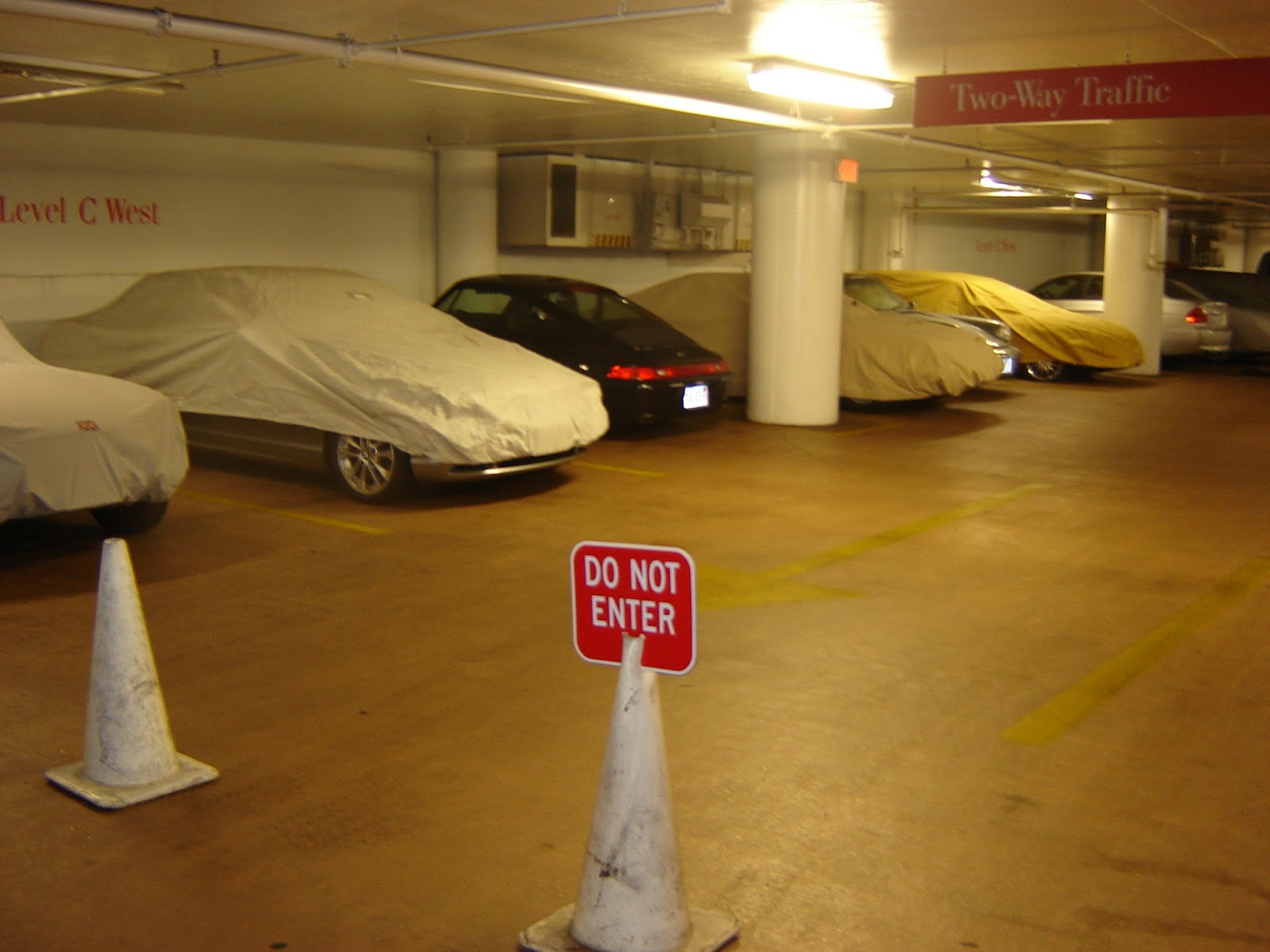
The parking garage under the mall was a cool place to spot sports cars and vintage vehicles under wraps.

Perhaps the cars' owners lived in some of the nearby high-rise apartment buildings that didn't have a lot of parking.

I took that photo a number of years ago. The mall closed four years ago and has been converted to an athletic center and medical offices

Just a short hop away from the old Atrium Mall, and across the street from the Mall at Chestnut Hill (and not far from The Street -- yes, Chestnut Hillers love to shop!) once stood an ugly strip mall/office complex/grocery store.

(The backside of the former Omni Foods grocery store, which was torn down a few years back to make room for the Chestnut Hill Square shopping area.)

A short jog down Route 9 and you're at Kennard Park on Dudley Road, the western edge of Chestnut Hill.

The City of Newton acquired the land in 1978 from Dr. Harrison Kennard, according to the Newton Conservators web site. This is a very pleasant, nicely wooded park, with old stone walls, lean-tos, remnants of an orchard, the old Kennard house, which serves as headquarters for the town parks and recreation department, and well-kept paths that eventually lead to a small pond over the town line in Brookline.

At the far eastern end of Chestnut Hill stands Boston College, which spills over into Boston's Brighton neighborhood. Across Beacon Street from the college's dorms, in a small patch of woods next to a dirt parking lot, stands this lovely statue.

The street abutting the statue is a dead end now, but used to go through.

Amidst the beautiful homes dotting the south side of Beacon Street as you wind eastward toward Boston sits this impressive pile.

The old gate house for the Chestnut Hill Reservoir across Beacon Street, this Romanesque building was erected in the late 1870's and controlled the flow of water from both the Cochituate and Sudbury aqueducts, according to Wikipedia.

Not far from the Chestnut Hill Reservoir sits the Waban Hill Reservoir.

(Waban Hill Reservoir and gate house.)

The City of Newton began construction on this reservoir in 1875, as part of its effort to supply all of its 13 villages with water. The water was drawn from the Charles River, near the Needham line, and pumped by coal-fired steam engines through the mains and across the city, according to Historic Newton's "Waban Hill Reservoir History."

I've explored the area near the location of the former pumping station on Needham Street (see November 20, 2011, "History Flows On, Part II," and December 6, 2011, "History Flows On, Part III").

Newton sold the reservoir to the Boston Metropolitan Water Board in 1900, according to the Newton Conservators web site. In 1891, the City of Newton completed construction of the reservoir's replacement, a covered, 10-million gallon structure just up the hill.

Across Commonwealth Avenue from the old reservoir sits this funky building with a cool roof.

Currently home to a fitness studio and a custom fabric and design shop, this place was built in 1920 and was used from 1925-1972 as a pharmacy and grocery store, according to property documents on file with the City of Newton. In ensuing years the building served as a real estate office and an insurance agency.

And thus completes my survey of Newton's Chestnut Hill village. As with all of the installments in this series, I could have dug more into Chestnut Hill. I plan to do so in the future, in the hopes of writing a book covering all of Newton's 13 villages.

Here are links to the previous five installments, ordered from most recent:

September 26, 2016, "I Seek Newton, Part V: Oak Hill"

June 3, 2016, "I Seek Newton, Part IV: Waban"

March 23, 2016, "I Seek Newton, Part III: Highlands"

September 20, 2015, "I Seek Newton, Part II: Auburndale"

May 21, 2015, "I Seek Newton, Part I: Lower Falls"

I'm not sure which village will be next. There are seven more, some more involved than others. Most likely I'll report on Thompsonville, the smallest and least commercialized village.

Monday, January 19, 2015

Maryland Mansion

From Dave Brigham:

It's always nice to add a new name to the roster of contributors here at the Backside of America. My brother, Steve, recently sent along a few pictures and a quick story of a hike he took with his kids near their home in Bowie, Maryland.

"When school got canceled last Monday, we hiked out our back yard, through a long open, overgrown field (on an old horse farm) to find a good sledding hill. We came across an old abandoned farm and mansion that didn't look like it had been lived in for many years. Not much good sleddding (only 2 inches), but quite an adventure!"

Because I'm a research geek, I had to find out more about this place. And, as often happens, I spent way more time than I thought I would, and found some information that I don't trust. Still, I love how often persistence pays off when doing research online.

One real estate web site lists the house as being built in 1956, but as you can see, it looks more modern than that. I'm guessing the place was totally overhauled, or that some part of the place was built that long ago. I also found conflicting reports about the size of the place, with one site indicating 4,470 square feet, and another 7,200. Either way, it's a big place.

The place sold for $1.45 million in 1999, and has an estimated value of $1.57 million, because the estate comprises more than 83 acres, and backs up to a small nature preserve. There is an in-ground pool and a few other buildings on the property, including an old barn.

My brother indicates that the land had been rezoned for an active adult community before the 2008 recession. At some point a church bought the land and rented the land for horse owners, but that church evidently filed for bankruptcy. So now the property is listed for sale under the name The Enclave at Beechfield, with a special permit allowing 400 units (250 condo, 150 townhouses) for a retirement community." I'm assuming The Enclave at Beechfield is the name of the entity formed to originally develop the land. I'll check in with my brother for any updates.

Tuesday, September 20, 2011

In Search of President Little

From Dave Brigham:

This post means more to me than anything else I've written here. But with a bit of effort, I'll be posting at least one update, and perhaps turning this story into something more substantive for another outlet.

In my inaugural post for this blog, I talked about how a canoe trip down the Farmington River in my hometown, Simsbury, CT, with my dad when I was a kid inspired my fascination with the backside of America (see March 1, 2010, "Take Me To the River."). But that wasn't the only event from my childhood that sparked my curiosity about what goes on behind the calm facades of Main Street, and in the cracks of society where people don't often look.

When we were teens, my friend Pat and I walked from his house about half a mile down the road, along a set of railroad tracks, down a slope, into a small, wooded section of our hometown and into the back yard of an abandoned house. Two neighborhood kids had told us about the house, so we checked it out. We walked through the open front door and into a house filled with all the stuff of life: cans of food, pots and pans, dishes, bottles and cans, framed photos, clothing, books and magazines, furniture and, most oddly of all, a mannequin.

We walked around for a while, marveling at the fact that somebody had left all of their stuff behind. I suppose we visited the house one or two more times, but honestly, I can't recall. I don't remember paying much attention to the house afterward, even though we used to walk down the railroad tracks to Louie's Market to buy soda and Slim Jims, and to the Country Store to buy penny candy. We also used to pick up beer bottles from the slopes lining the tracks, and line them up on the tracks and smash them with rocks, and scamper through a tunnel under the tracks that connected Boot Pond (where we played hockey in the winter) with the swamp on the other side.

While I certainly found it odd that somebody had left behind all their belongings, and that nobody appeared to want them, I didn't think too deeply about the situation until after college. By then, the house was long gone, having been torn down to make way for a road into a new housing development.

From time to time, I thought about the abandoned house. I tried to work the mystery into a short story on at least one occasion. Last year I posted on a Facebook group dedicated to my hometown, wondering whether anybody remembered the abandoned house and if anybody knew anything about the situation. Nobody did.

Then, last month, a new Facebook page popped up that was more informal than the first one to which I'd posted. I asked the question again, and this time, two people responded that they not only remembered the house, but that they'd spent some time as teens hanging out with the man who lived there.

They told me that the man, President Little, said he was the son of slaves, and that he had no family to leave anything to when he died. This was why, one of the responders told me, the house was full of stuff when President passed away.

Through a quick bit of research online, I found some genealogical information about President. Turns out he wasn't the son of slaves, but it's quite possible that he was the grandson of slaves. He was born in Americus, GA, in 1904, to parents who were born in the 1880's. He also had five children, four of whom were evidently alive when President died in 1981. So perhaps he was estranged from his family, and that's why when he died, all of his stuff stayed in the house.

As it turns out, shortly after I learned who President Little was, I had a trip scheduled to Simsbury to play in a golf tournament. I decided to make a side trip to see if there was any evidence of President's house on the spot where it once stood.

I found much more than I could ever have hoped for.

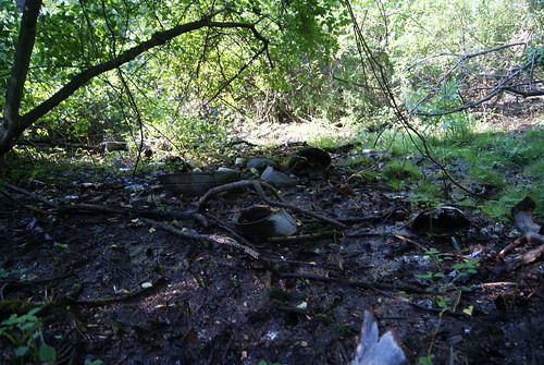
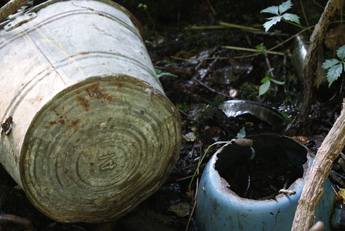
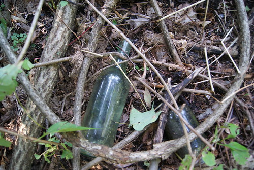
I doubt many people venture into the little patch of woods that's left between the driveway to the housing development to the south, the bike path to the west (where the railroad tracks once stood) and the main road, Route 10, to the east. I couldn't find an easy path into the woods, so I created my own, and within five minutes, had found what I was looking for.

Archeological dig

I was beside myself with excitement. The house had been torn down years ago; I had no reason to expect that anything would be on the site. I'm not a spiritual guy whatsoever, but I feel like something drew me here to discover the remnants of a forgotten place.

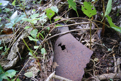
Rust

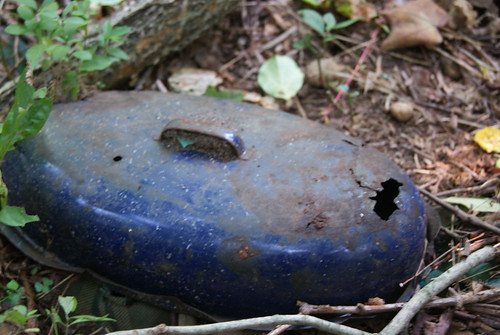
Blue pot

Tub & pot

Old bottles

I've sent emails to both the Simsbury Historical Society and the person from whose web site I gleaned the genealogical information, to see if they can provide more information about President Little, his family, his life, his work, etc. If I can put together enough of a picture, I hope to publish an article in a history, genealogy, archeology or some other type of magazine.

For the record, much of this information (and some different photos) first appeared last month on my blog, DaveTronik 2000. See August 24, 2011, "My Nascent Archeology Career."

Checking Out Dudley Street in Roxbury...and a Historic, Pre-Civil War House

From Dave Brigham: As part of a series of quick-hit jaunts through Boston this spring, I checked out the outer reaches of Nubian Square, m...