The single greatest achievement in my adopted hometown of Newton, MA, in the eight years I've lived here is the creation of a bike path along the Charles River. The section closest to my house was completed in 2004 and marked with the installation of a 140-foot suspension bridge named for the blue herons that live along the river. The path was built by the Department of Conservation and Recreation, based on a master plan developed in the early '90s.
Thanks to the hard work and determination of the DCR, it is now possible to walk, bike or run from Newton's Auburndale section, which abuts Route 128, to Boston's Museum of Science, a distance of nearly 20 miles. The DCR plans to extend the pathway south from Auburndale into neighboring Needham, Dedham and the West Roxbury neighborhood of Boston.
As you can imagine, abutters fought the project over the years, arguing that creation of the path would enable drug addicts and criminals easier access to homes and businesses (see this blog post and discussion).Many abutters thought they owned the land, because it had been unused or unclaimed by the state for so long.In most instances, however, the state owned the land close to the river. Reclaiming the land, clearing it out and providing access to the river was a major undertaking.
To make a long story short, the path is fantastic and people love it. I jog on it a few times a week and see a lot of fellow runners, along with walkers, cyclists, bird watchers, and people commuting to work on foot. And I see blue herons, geese, ducks and other small wildlife.
Yet, despite all the good generated by these paths -- great places to exercise free from car traffic, beautiful places to fish and observe nature, nice areas for dog walking -- there are people opposed to their expansion.
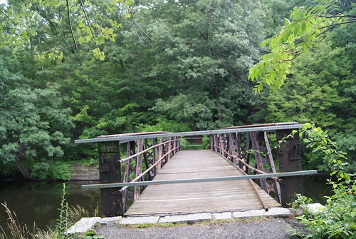
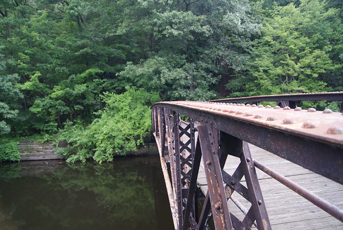
In one case in Newton, neighbors fought against the state when it announced plans to create a walking path over the Charles in the Lower Falls area of the city. The path, which is currently nearing completion, was built over a 100-year-old rail bridge that the DCR has owned since 1975. The path is a short one right now, connecting Washington Street in Wellesley to Concord Road in Newton, but the DCR is considering extending the path to the Riverside MBTA station, where trolleys and buses operate.
Here's what the bridge and path look like:
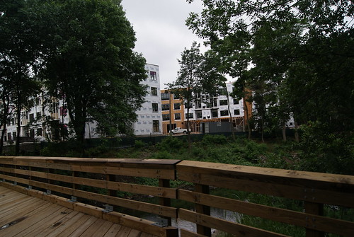
(Looking from the Newton side to a new development in Wellesley)
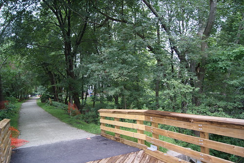
(Looking toward the Newton Lower Falls neighborhood)
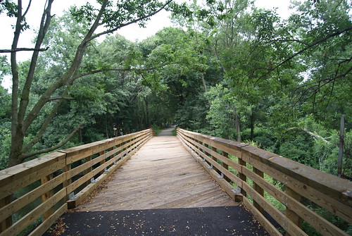
(Looking toward the Newton Lower Falls neighborhood)
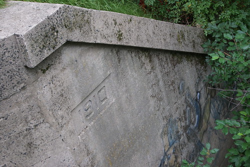
(The original train bridge abutment)
The path provides a nice connection from Concord Road to a commercial section of Wellesley where there are numerous restaurants and shops. It's a scenic little jaunt and one that I'm sure neighbors will enjoy making once the path is completed. Will there still be grumbling? Sure, but it's all gonna go into the wind.
Not too far away from the new Lower Falls path is the Riverside Park Pedestrian Bridge, which connects Newton's Auburndale section with the town of Weston. The bridge spans the Charles River, and has been closed for quite some time due to instability. There are plans in the works by the state Department of Transportation to rehabilitate the bridge and open it for foot traffic.

Once again, neighbors are taking part in public forums to express their reservations about reopening the bridge and opening up their neighborhood to unknown elements. Like the Lower Falls bridge, this one, too, will surely be completed and enjoyed thoroughly by people who just want to share in the river's beauty.
About a quarter of mile down river from the Riverside bridge I found this old crossing.
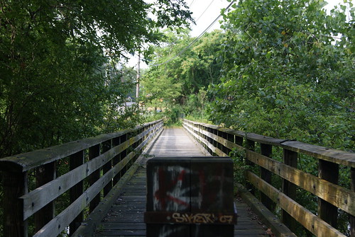
Located next to the Lasell College boat house, this bridge dead-ends near a site that I believe is a staging area for the state's Department of Transportation construction projects on nearby Route 128. I have no idea whether this bridge will be opened at the other end at some point, but as far as I'm concerned, in case it wasn't obvious enough already, I believe that the more ways to access a river, the better.
(For more on Charles River crossings, see May 12, 2010, "Dead-End Tracks, Part I.")


Nice blog, which I just stumbled across. I live near this old Charles Street bridge, which long ago carried car traffic but has been just a footbridge for the 30 years I've lived here. It was closed when the MRWA built its new water delivery channel, and has been deteriorating since then. This is the site of a major water main break a few years back. It's a shame it's been closed because it was a nice shortcut to the remains of the old Riverside park, another bit of green space in the shadow of route 128.
ReplyDeleteI should add my comments are specifically about the bridge next to the Lasell boathouse. And I should also add my favorite story about the bridge. About 10 years ago, the city rebuilt Auburn Street, where I live, and one day tried to close down the street. I watched a police office diverting traffic down Charles Street, which comes to a dead end at the bridge. He obviously thought the road went somewhere, and for 5 or 10 minutes drivers headed down the street and looked for the exit in vain, then came back befuddled to ask the officer how they were supposed to get anywhere. He must have thought the bridge still went through, and it may have showed up on some old maps.
ReplyDeleteFunny story! Thanks for your comments, Jeff. Glad you enjoy the blog. I've written quite a bit about Newton, so look around...
ReplyDelete