Friday, March 18, 2011

Anatomy of a Teardown

From Dave Brigham:


I live in Newton, Mass., a well-to-do community that's gone teardown crazy in recent years. See a '50s-style ranch house that's a little worse for wear? Don't blink; it'll soon be gone.

This house used to be in the Oak Hill section of my fair city, on Dudley Road, one of my favorite "big ol' house" thoroughfares.

Date w/ the wrecking ball

The older section of the road is close to Route 9, and filled with enormous houses, both new and old, set on wooded lots and away from the road. The teardown house was located on the newer section of the road, amid average-sized houses. It went on the market in March of 2010, and was scooped up by a developer, who soon leveled it.

Teardown complete, #1

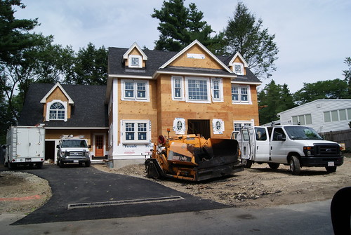
By July, the new house looked like this:

Chestnut Hill Teardown/New house

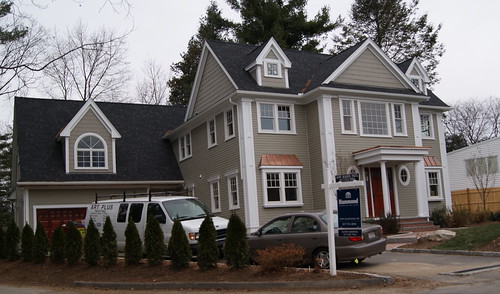
Now it's on the market for a cool $1.525 million.

Teardown Reborn #2

I'm not gonna argue that the original house was anything worth saving, and I understand the economics of development means that you have to build something that you can put a big price tag on. But doesn't anybody remodel anymore?

Monday, March 14, 2011

Lost Bomber

From Kristen Smith:

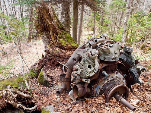
B18 bomber engine

In January 1942, just weeks after the Pearl Harbor attack, a B18 bomber crew were on anti-submarine patrol over the north Atlantic. Flying out of Chicopee, Mass., they planned to be as far north as Newfoundland, where enemy submarines were suspected to lurk. The weather was not on their side and quickly turned nasty when a storm came up the coast. Blown inland, the inexperienced crew (they were B24 experts, a different beast altogether) were soon hopelessly lost. Some say the men, who had never worked together before, had trouble calculating their drift. Visibility was nil. Whatever the problem, it became apparent only when the plane brushed treetops that they were anywhere near a mountain. By that time it was too late and the pilot’s evasive maneuvers failed. They crashed spectacularly into Mt. Waternomee, waking up the towns below.

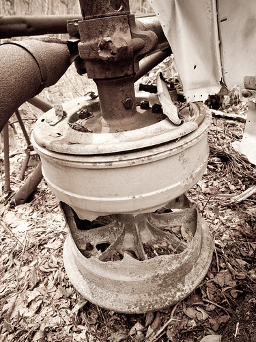
The hub

A rescue team was rounded up and within an hour they were headed up the steep, deeply snowed-in mountain in North Woodstock, NH. I can only imagine the intense stress they were under, not only from the trepidation about what they would find, but because of the utter chaos of the forest after the hurricane of 1938. Trees down everywhere, the trail obscured, deep snow drifts, camouflaged chasms just waiting for someone to fall in. No GPS or cell phones. No Gore-Tex or fleece either. Amazingly, they found five of the seven-man crew alive.

After more than 60 years, the site is and isn’t what you’d expect. You’d expect there to be almost nothing visible, but there is, due to the fact that volunteers annually clear debris from the extant wreckage. You’d also expect there to be more wreckage than there is. What with the Army carting off the cockpit and ordinance and others carting off the fuselage and tail section for a museum, there isn’t a lot of recognizable stuff on the ground. What’s left is almost unrecognizable. Most of the site looks like this:

Wrecked

Fifty years after the crash, in 1992, a memorial plaque was erected and an American flag flies from a nearby sapling. It’s pretty startling to come across this on the trail. On the whole it’s a very steep and rocky climb and then the next time you raise your head, there it is. Mangled hunks and twisted metal spread over a couple of acres. I can’t believe anyone lived, but they did.

Photographs from the day of the crash can be seen here, and a more detailed account of the crash, the crew and the rescue is here.

I have more photos here.

Monday, March 7, 2011

Graffiti Highway

From Mick Melvin:

My niece and nephew told me about an abandoned highway near Route 84 going through West Hartford, CT. Of course, I thought of the photo opportunities right away.

abandoned ramp

The “highway” is actually a series of never-used on and off ramps near Route 84. They told me how to get to it and I made the trek on my mountain bike, with camera backpack in tow. I rode along the ramps and the overpasses for many hours on a beautiful spring day. (We ran a short piece with one photo about these ramps in June 2010, called "Ghost Highway" -- ed.)

There are six ramps that run underneath the overpasses and over the highway. Four of the ramps lead to the overpasses that go above Route 84 near Exit 39A leading to and from Route 9. The other two ramps were to be off ramps on the northern side of the highway.

I enjoyed the quiet while pedaling along the abandoned ramps. It's really quiet until you are practically over the highway; then you can hear the roar of the traffic below. It was really eerie being there all alone, but it was a good ride for an old fella like me.

side by side

Besides the overgrown vegetation on my journey, there was graffiti of all sorts to see along the way. I spent a good amount of time viewing the various writings and artwork on the walls, railings, and mostly the pavement.

Upper ramp across I-84

I also enjoyed the view of Route 84 while on the empty overpasses. While standing and enjoying the view, I couldn't help but think that the location could be a great park or fitness trail. Hopefully someday the abandoned highway will be utilized and be removed from backside status.

two ramp view

Tuesday, March 1, 2011

Happy First Birthday to Backside!

From Dave Brigham:

I had no idea what to expect when I launched The Backside of America a year ago (see March 1, 2010, "Take Me to the River."). I'd long had an interest in what goes on behind the neat and polite curtain of society, whether it be the crumbling walls hidden behind the solid abandoned factory facade, or the neat-as-a-pin back lawns of Newport, RI, as seen from the Cliff Walk.

I had a backlog of my own photos to get things rolling, but I had a sometimes sketchy point-and-shoot digital camera and no knowledge of exposure, composition, lighting, shutter speed and editing. So I reached out to a handful of friends whose photos I admired. Luckily, most of them agreed to join the ranks here. And they have done recruiting of their own, so this blog continues to flourish (and we're always looking for more people; America's a BIG place.).

I've been overwhelmed by the great pictures and fascinating stories that have come across the digital transom, such as Joe Viger's stark black-and-white frozen Alaskan tundra (see March 8, 2010 "Backside at the Topside of the Continent"); Mick Melvin's tale of the rise and fall of turn-of-the-20th-century African American community, Deerfield, Colorado (see July 9, 2010, "Dearly Departed Deerfield"); and David Burke's June 8, 2010, B & E adventure, "Meet Me at the Station (We'll Find a Way In)."

Over the last 12 months, we've covered many of my favorite topics:

Diners -- see March 18, 2010, "Eat, Dance & Be Happy" from David Burke and my own July 28, 2010, ode to Lazarus-like diner owner Barbara Lind "Two Hearts Beat As One".

Drive-in Movie Theaters -- see April 12, 2010, "Cars, Flicks & Weiners" from David Burke.

Old vehicles -- see Michelle Loya's May 24, 2010, "This Old Truck" piece, and Mick Melvin's January 1, 2011, post, "Patriotic Caddie."

Old Factories -- see my July 5, 2010, post "Rebuilding the Lost City."

There are plenty of great things in the hopper: fantastic shots and a history lesson about a downed B-18 bomber from our newest contributor, Kristen Smith; my chronicle of, and diatribe against, the tear-down culture; and a post that brings new meaning to The Backside of America.

Still, with all the great stuff we've run in the past 12 months, there are some pictures that either haven't fit in anywhere, or have been cut from posts due to space considerations. Below, you'll find some of those pictures.


From Mick Melvin:
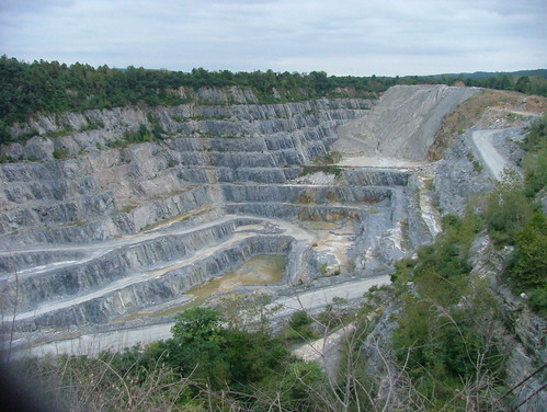
downingtown quarry

(Hansen Agregates- Distribution Quarry, Downingtown, PA, taken through a chain linked fence.)

From David Burke:

Torrington, CT

(Old quarry, Torrington, CT)

From Michelle Loya:

Wagon wheel

(Wagon wheel, Woodstock, Vermont)

From David Burke:
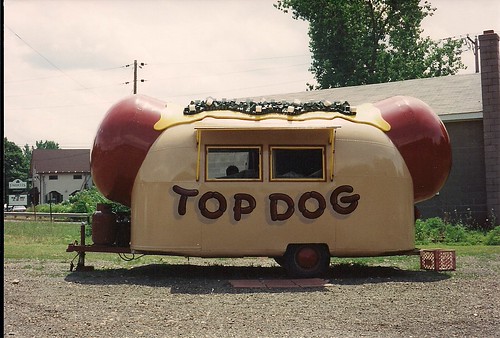
Top Dog

(Taken in Portland, CT, in the late '90s)


From Dave Brigham:

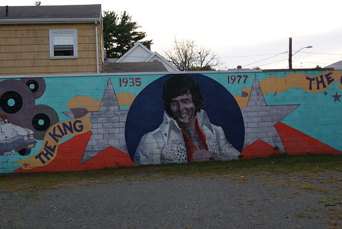
Elvis Mural, Newton MA

(The King, Newton, MA)

From Kristen Smith:

A signal from the shelter

(Bedford Golfland, Bedford, NH)

From Joe Viger:

Wide Treads & Cheater Slicks

(Taken in Asheville, NC)

From David Burke:

Torrington, CT

(Taken in Torrington, CT)

From Dave Brigham:

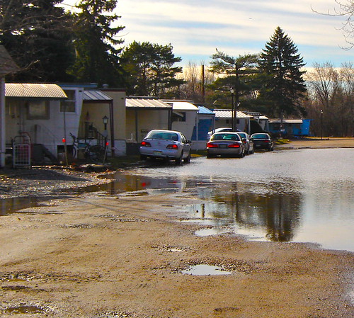
Boston Trailer Park

(Taken at the Boston Trailer Park on March 16, 2010, after three days of heavy rain.)


From Joe Viger:

Backside Mosaic

(Oakland, CA)

From Joe's Flickr page: The Talking Heads album cover for "More Songs About Buildings and Food" features this great photomosiac done by David Byrne. He made a portrait of the band using hundreds of polaroids. It's amazing... they have it at the Rock and Roll Hall of Fame. This view reminded me of that, despite being much less interesting than Talking Heads.

From Mick Melvin:

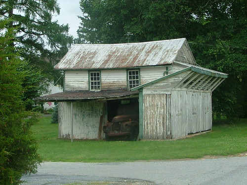
avondale garage

(Old broken down truck in an old garage in Avondale, PA.)

I'm happy to report that I have a new camera, and have been taking an adult ed class to learn how to use it more effectively. Here's to the next 12 months of beautiful pictures and fascinating posts!

Sunday, February 27, 2011

UPDATE: What a Dump

From Dave Brigham:

I love the immediacy of the Internet. Not long after I originally posted this, one of our loyal followers pointed me toward this web page because she suspected this building is the old O'Hara Waltham Dial Company. One look at the picture there, and I knew she was right. A big Backside thanks to Shuko, proprietress of the wonderful Creepy-chusetts, Strange-chusetts photo blog!

Built in 1897, the building was added to the National Register of Historic Places in 1989. I'm glad to know that one of my original guesses about this building -- that it was either automotive- or watchmaking-related -- turned out to be correct.


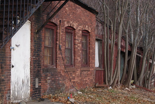
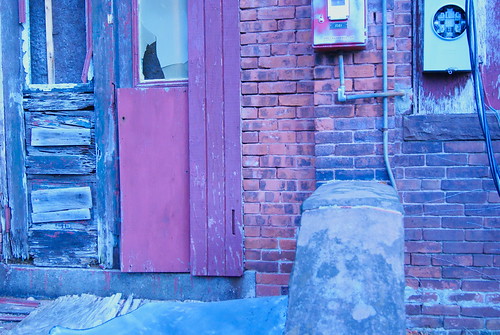
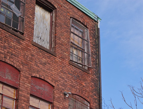
Rumford Ave., Waltham #3

Rumford Ave., Waltham #2

I know a guy who lives nearby and he said a developer bought the place a few years back with plans to build condos. I'm not sure if the developer was going to save the building. It's on Rumford Avenue, within sniffing distance of the Newton town dump, so I get the feeling nothing will happen until the housing market catches a big fire.


Rumford Ave., #4

Rumford Ave., Waltham #1

Thursday, February 24, 2011

Shuttered Island: Update

Last August, Dave Hill posted about a trip he took to Peddocks Island (see August 27, 2010, "Shuttered Island."). Home to the abandoned Fort Andrews, which was constructed in the late 1800's and active until the end of World War II, the island comprises dozens of rundown buildings that seem to just beg for rehabilitation. Part of the Boston Harbor Islands park system, Peddocks is where Martin Scorsese's "Shutter Island" was filmed in part.

Well, as part of a new agreement announced last week, roughly half of the island's 30 buildings are going to be rehabbed or at least shored up so they can be restored at a later date. Others will be sacrificed as the Mass. Department of Conservation and Recreation, in tandem with the island alliance organization, take on a project to turn Peddocks into a public campground and, possibly in the future, a location for corporate retreats, a bed and breakfast, and festivals.

Check out this video and article for more about the island's history and its future.

Sunday, February 20, 2011

Lose, Place or Show

From David Burke:

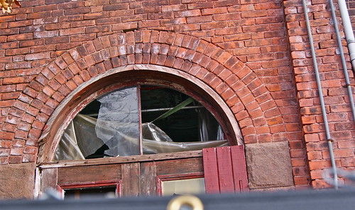
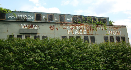
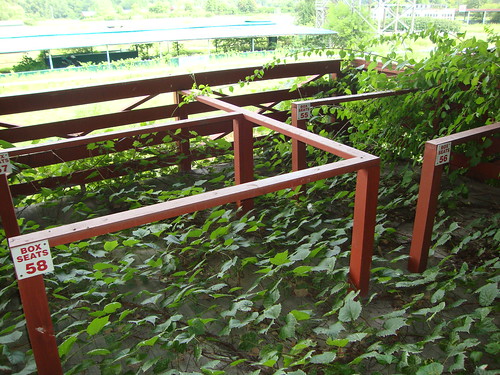
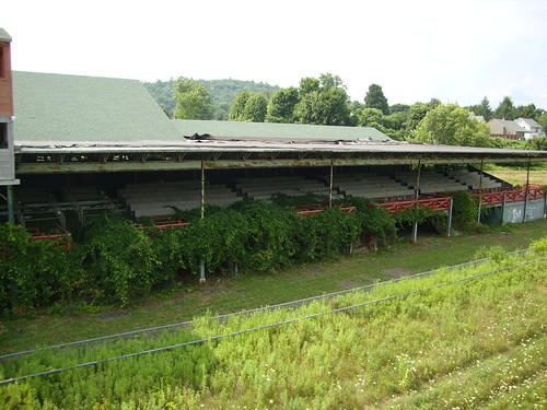
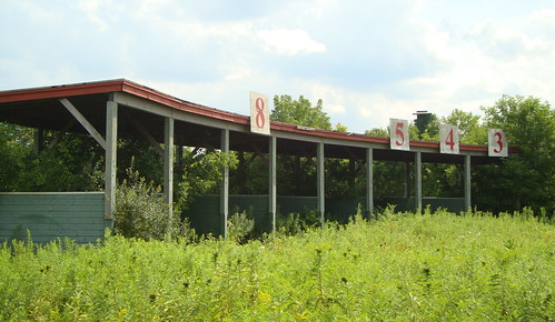
(These great shots of the former Great Barrington Fairgrounds in Great Barrington, MA, were taken in August 2010 -- Ed.)

Racetrack

Box Seats

View of the Grandstand.

Starting Gate

Tuesday, February 15, 2011

Abandoned for Your Amusement

From Dave Brigham:

My amusement park experiences are limited; I spent more time as a kid and teenager at the Simsbury (CT) Volunteer Fire Department's summer carnival than I did walking theme park midways admiring beautiful wooden roller coasters and freak shows. Still, my appreciation for old-time entertainment is real.

I love riding roller coasters and ferris wheels (although the older I get, the less tolerance I have for the spinning rides); eating fried dough; going through haunted houses with my son; watching motocross at county fairs. And when I read about another 100-year-old amusement park being shut down or torn down, I feel sad. Why? I lament the loss of the personal touch that smaller parks offer, the simpler pleasures, the idea that rides don't have to be 10 stories tall and travel at 150 mph to be fun.

I'm a Luddite at heart, one who should have been born in the late '30s or early '40s so I could've enjoyed driving a '57 Chevy to the malt shoppe with my best girl, sneaking friends into the drive-in movies and riding rickety roller coasters and watching the roustabouts sing, fight and ride motorcycles around the Globe of Death.

Anyway, I'm rambling. Check out some great photos and videos of abandoned amusement parks that the folks at trip planner Nile Guide posted.

Thursday, February 10, 2011

Up From the Basement?

From Dave Brigham:

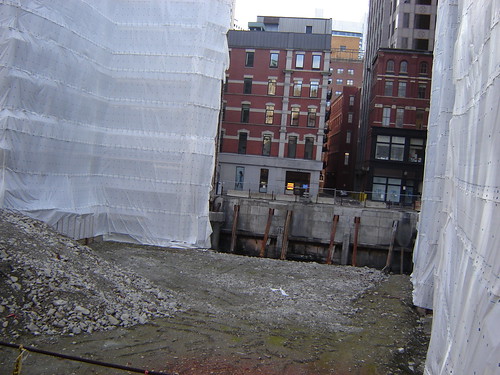
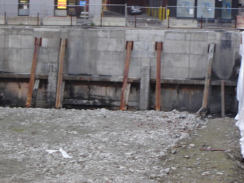
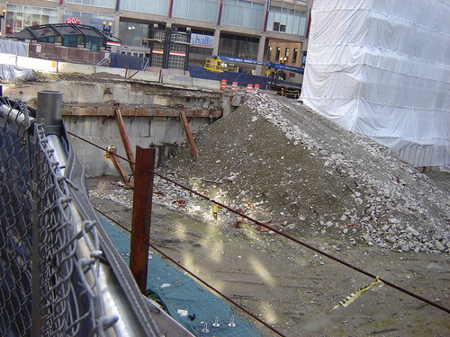
Some day the ugly pit formerly known as Filene's in Boston's Downtown Crossing neighborhood will be filled with something other than gravel, hyperbole and lost dreams.


Construction pit, Boston's Downtown Crossing

Filene's Basement Pit #1

Filene's Basement Pit #2

Anybody else thinking of Mike Mulligan and his steam shovel?

Friday, February 4, 2011

The Zen of Finding a Barn and a School Bus

From Joe Viger:


Early on the first Saturday of the New Year I struck out with a friend for a day of making pictures. Our stated plan was to shoot Glen Ellis Falls and then see what else we could find of interest in Pinkham Notch. Nothing seemed all that inspiring. After all, in winter, waterfalls are frozen and currently there isn't even the drama of ice because of snow cover. My partner and I were of like minds to wander and see what might happen. We hatched a plan to head to the backside of the Presidential Range and get pictures of Mt. Washington from Bretton Woods.

This is home turf to me. I grew up on the northern slopes of the Presidential Range. The marquee side is south... North Conway, outlet shopping, Mt. Washington views and ski areas. But north, it's Berlin, shut-down paper mills, two prisons, French Canadians, people who work for a living and open space. And a better view of the Presidential Range in my humble opinion (for more on Berlin, see Joe's 6-20-10 post, "The Truth Behind Beautiful Ruins.").

We drove on to Gorham, but didn't stop, turning left on Route 2 to insanely beautiful Randolph. We made images of a couple of interesting summer homes and waited for the clouds to break. We were hoping for a view of Mounts Madison and Adams and the unique perspective of King Ravine you can only get from Randolph Hill, but it never materialized. Snow swirled all the while.

Back in the car, we headed west on Route 2. Mount Jefferson was interesting that day, but too shouded and gray to be worth a shot. I veered left on Valley Road in Jefferson, where my Boy Scout troop used to camp. Valley Road opened to Route 115 and the logical thing would have been to turn left again onto the trade route for retreating southbound tourists. I went straight across 115 almost instinctually on a road I had never driven called Israel River Road. We hit a wonderful open plain called Jefferson Meadows and there it was. In the shadow of finely pointed Cherry Mountain we found what we didn't even know we were looking for.

Cherry Mountain Farm

Schood Bus Recycled - Plant Hanger

Schood Bus Recycled - Hay Loft


Chaos Barn

Sunday, January 30, 2011

Demolition -- Par for the Course

We here at the Backside are pleased to welcome Kristen Smith to our ranks. Check out more of her terrific photos at Wicked Dark Photography .

From Kristen Smith:

Land of Pleasant Living

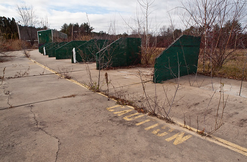
I can’t claim any nostalgia over Bedford Golfland other than in general. I only went there once in high school even though it existed all through my childhood and only became defunct a few years ago (I think the year on the day planner in the office was 2006). Even though I wasn’t a customer, I was used to seeing the place, if you know what I mean. It was the kind of thing you’d use to give someone directions –- go through the light at the mini golf place.

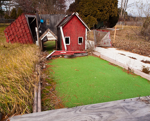
The site is due for a date with the bulldozer in the spring. Like the world needs another supermarket, right? As you can see, vandals have gotten a head start on the destruction. I seem to recall this trap was a little New England scene with a barn or a water wheel mill or something. Cutesy, but typical of the old-style mini golf set up.

Like a hurricane

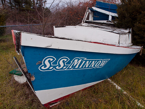
For some reason we also had a tribute to Gilligan’s Island.

A Three-hour tour

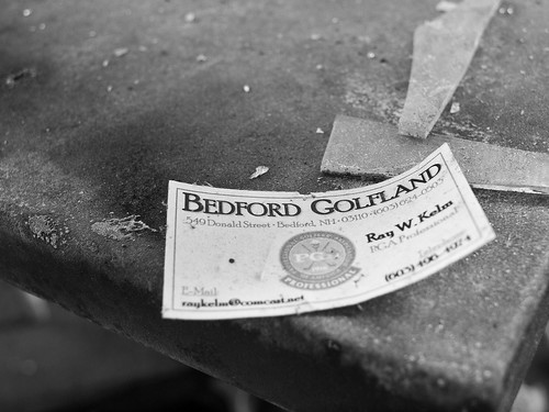
No one bothered me while I shot although I’m sure folks in the passing cars wondered what the hell I was doing out in the wind and cold. Eventually I made my way over to the former office. Had to wait until some hunters played through though. After I heard a couple of very close rifle shots, I looked over my shoulder a few minutes later and noticed a hunter standing in the walkway between the driving range and the office. It was a little weird, but he didn’t say anything and I didn’t see him again. The destruction inside the office was near total. Only more sturdy structures like walls, the counter and the ice cream treat freezer remain intact. It made for some interesting still lifes.

Forced retirement

I like this photo because the card was found as it is, but not where it was. I moved it to a better location and shot. The light was pretty damn great and having the camera on a tripod helped. All of these were shot with a tripod, something I don’t do often enough, but felt that I should since it wasn’t like I would be walking miles. The additional range of options it gave me really helped. I wasn’t cornered into using a high ISO or wide-open apertures.

Although the light isn’t the best in the outdoor shots, I like enough of what I got to feel satisfied with the shoot and what I was able to document.

It makes me a little sad that a supermarket is going in there. People complain that families and friends don’t do anything together anymore. That we’ve become a society of passive watchers only, instead of active doers. As long as we keep tearing down miniature golf parks to put up supermarkets, is there any wonder why?

New Balance Draws a Red Line with Diner

From Dave Brigham: I can't be expected to know everything about the backside of America, nor of Massachusetts or even of Boston. But I...