Saturday, December 30, 2017

Rail Trail Mix

From Watson T. Fuzzlebanker:

I don't recall when I began my foray into the wilds of Needham, Wellesley and Dover, Mass., the results of which you will read in this post and two subsequent installations. I set out what seems like 17 years ago but was probably more like 18 months ago to explore and find any remnants of the fabled Baker Estate, a private amusement park/folly/zoo/entertainment complex built in the late 19th century in what were then the wilds of Needham and Wellesley, two of Boston's western suburbs. I'd read about what had been -- for too short a time -- an amazing Utopia in a Boston Globe article several years ago. In more recent years I'd searched online for more information, all of which you'll read about in the third post.

During the course of exploring the southwestern section of Needham, both online and on foot, I naturally stumbled across other places of interest. One of these was an old Nike missile site, which I'll write about in the second post in this series.

In this post I'll cover an old rail line that's been turned into a (partial) rail trail, as well as a nearby dam just over the border in Dover with a few nice surprises in the abutting woods.

In May 2016, the Town of Needham celebrated the opening of a 1.7-mile stretch of the Bay Colony Rail Trail. The biking and walking path stretches from High Rock Street through Needham Town Forest, runs parallel to South Street, crosses Charles River and Fisher streets and ends short of the Charles River trestle that takes the old tracks into Dover (pronounced "Dovah" with a locked jaw). The abandoned tracks are owned by the Massachusetts Bay Transportation Authority (which operates commuter trains, subways and buses) and were most recently used by the Bay Colony Railroad, which in 1977 took over freight service in this area from Conrail.

(Rail trail crossing at Fisher Street.)

(An old utility pole along the rail trail.)

Some residents of Dover, spearheaded by the Friends of the Dover Greenway, hope to establish a section of the Bay Colony trail. These folks have been working for several years, but in chichi Dover -- the most affluent town in the Bay State -- things seem to move slowly, especially when it comes to the idea of letting their fellow citizens run, ride or roll through the exclusive enclave. The latest Friends proposal calls for the rail trail to extend from Springdale Avenue to Hunt Drive. The section of old rail right-of-way that crosses the river is not currently under discussion. According to this Boston Globe article, the trestle over the Charles River would need to be replaced before trail organizers could realize their goal of connecting Needham to Dover. The original plan for the trail calls for it to eventually extend south to Medfield.

(Looking from the tracks in Needham (which may be gone now; this photo dates to May 2016) toward the Charles River crossing, and on into Dover.)

A group called Be True to Dover opposes the idea of any rail trail in town. Perhaps they fear the "wrong element" will disrupt their croquet matches, cocktail parties and backyard tennis matches. Or maybe they've got stills and marijuana plots out there in the woods.

This sort of argument always erupts when rail trails are proposed. On one side you have normal people who enjoy exercise and seeing, ahem, the backside of their town or a neighboring burg. On the other you have snobs who don't want other people to have nice things. Of course, we all know their real fears:

Anyway, this makes a nice transition to the second part of this post, which deals exclusively with Dover, which is of course a very nice town, albeit one with a few too many busybody toffs.

Just a short equestrian jump from the old trestle discussed and pictured above, in the Charles River, is the Cochrane Dam in Dover. The river may have been dammed here as early as 1675, according to a Waymarking post I found online. In the ensuing centuries, there were grist, paper, saw and textile mills, as well as facilities making nails and automobile tires, according to various sources online. For a little more history about the mills and those who built them, read this post at the Shadowed Hills blog.

(Remnant of something alongside the Cochrane Dam.)

(Cool old fire hydrant near the dam.)

The old cement slab and fire hydrant are cool, but the most excellent things I stumbled across at the site were like monoliths from Stonehenge.

"These are remains from the mill that once stood at the site. The last use of the mill was the J E Cochran (sic) rubber factory hence the name of the dam as the Cochran (sic) dam," according to a guy named Rick Hardy on the Charles River Village page on Facebook, in response to my query.

In addition to mills and factories, this area was once home to the Charles River Power Company, according to a 1909 map of Needham I found online. I find it amazing that all that activity over a few hundred years at this site hasn't left more remnants behind. I'm sure if you started digging in the woods, you'd find some pretty cool old stuff.

Here are other posts I've written about Needham and Dover:

DOVER:

March 12, 2012, "Fire On the Mountain?", the first of three posts about Snow Hill. This one is about hiking to a fire tower.

March 17, 2012, "Scouting a Location," the second post about Snow Hill. This one is about a Boy Scout camp.

March 22, 2012, "Fresh-Air Salvation," the third post about Snow Hill. This one is about an outdoor worship area.

April 9, 2012, "Beyond the Mill," about the partially reconstructed Dover Union Iron Mill and the beautiful woodlands surrounding the site.

NEEDHAM:

November 20, 2011, "History Flows On, Part II," about my adventure in Cutler Park.

January 30, 2013, "Whimsical Woodlands," about the marvelous Martini Junction hidden in Needham Town Forest.

July 13, 2016, "Sad Gobble," about the loss of the iconic Owen Poultry Farm.

Monday, December 18, 2017

Signing Off

From Frank N. Stein:

I'm not sure whether the Ramones ever made it onto a playlist at WNTN, a low-power AM radio station that until earlier this year broadcast from my adopted hometown of Newton, Mass. But you can't ever go wrong kicking off a blog post with some classic American punk rock.

Full disclosure: I have never listened to WNTN, and only became aware of its existence last month when the Newton-centric Village 14 blog posted the news that the station had sold its cozy studio hard by the town dump, er, recycling depot.

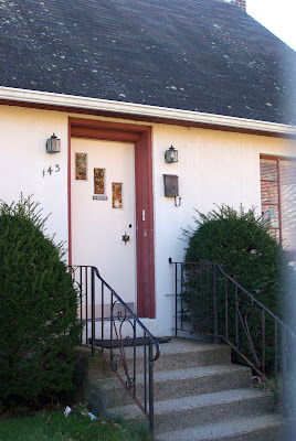
I took this photo shortly after learning that the building would be torn down. It is likely gone by now.

I'm happy to report that WNTN hasn't signed off, despite my wicked clever headline. The station moved to neighboring Needham and still broadcasts shows including Grecian Echoes, Reel Talk, Arabic Baptist Church and Benchwarmers, among others. The station came on the air in 1968 featuring "progressive rock music" until 1975, according to its web site. Over the years WNTN has showcased local news, "middle-of-the-road popular music," disco and, more recently, various ethnic programs.

Do yourself a favor and read the comments under that Village 14 story to get a flavor for the station. According to one commenter, "Most of what was in that building moved to [a new space]. The control boards, microphones, phones, tape and CD decks, etc were brought over to the new building."

The studio building was erected in 1950. I'm not sure whether this place was a private residence prior to WNTN taking it over in 1968, but it sure looks like it, doesn't it?

What's going to take its place? you ask. Dunno. Stay tuned....

Oh, and I would be remiss if I didn't mention that the station has an extremely famous alumni. "With the [radio] license, Stern landed his first professional radio job at WNTN in Newton, Massachusetts from August to December 1975 doing air shifts, news casting, and production work," according to Wikipedia.

To read about another abandoned radio station building, this one in Connecticut, check out Mick Melvin's October 27, 2010, post, "Off the Air."

Saturday, December 9, 2017

Artist Thinks: "I HAF to Fix That Smokestack"

From Dave Brigham:

It took me 11 months, but I finally got my beer-lovin' behind to the Boston Beer Co. in Boston's Jamaica Plain neighborhood. "How was the beer?" you're asking. While I drink the company's Sam Adams beer all the time, I wasn't at the brewery to tip my elbow. You know that. I was there to check out their refurbished smokestack.

Boston Beer is one of the most well-known independent brewers in the U.S.. The building complex the company occupies was once home to the Haffenreffer brewery. When I was in high school, Haffenreffer -- known for rebus puzzles on the inside of its bottle caps -- was known as Green Death, due to its high alcohol content. You see, the stuff inside those big avocado-shaded bottles was malt liquor ("works quicker") and had an alcohol content of 5.9%. The swill we usually drank -- Old Milwaukee, Meister Brau, etc. -- rated 4.5 or 4.6%.

I could tell you the story of the time one of my friends drank a few Haffen-wreckers (another great nickname) and yakked all over the inside of my buddy Andy's Toyota Corolla station wagon, resulting in the quickest evacuation you've ever seen. But I won't.

Rather, I'll tell you about how the smokestack from the circa-1870 brewery was restored to something akin to its former glory.

After Haffenreffer left Boston for Rhode Island in the 1960s, the complex sat empty for quite some time. In 1983, the Jamaica Plain Neighborhood Development Corporation bought the buildings. In addition to Boston Beer, tenants include a restaurant, food companies, a design company, a woodworking shop and much more.

In 1986, the development corporation had the top 30 feet of the original smokestack removed due to its state of disrepair, according to the Boston Globe. This resulted in the monolith touting "FENREFFER BREWERS." In more recent years, more letters had to be removed in order for the smokestack -- which no longer functions -- to be repaired and restored, per the Globe.

A neighbor who's an artist, Bob Maloney, finally decided to rectify the situation after many years of looking at the shortened brewery name, according to this Globe article. He manufactured a properly scaled stainless steel structure with the letters "HAF" and had it installed on the top of the stack in December 2016.

(The restyled Haffenreffer smokestack rising over the Boston Beer Company brewing complex.)

For more about Boston's beer brewing past, check out:

Curbed.com's "Mapping 21 of Boston's Lost Breweries and Their Second Acts".

The Jamaica Plain Historical Society's "Boston's Lost Breweries".

Keep your eyes peeled for a follow-up post about some cool things I stumbled across in the neighborhood around the brewery complex.

Thursday, November 30, 2017

Stone Cold Monuments

From Dave Brigham:

I've had my eye on this place since I was knee-high to a grasshopper. OK, maybe not that long. Perhaps it's only been about 17 years or so, since I lived in Boston's West Roxbury neighborhood.

July 2021 UPDATE: This place has unfortunately been torn down, replaced by a residence.

In business since starting in Quincy, Mass., in 1896, W.C. Canniff & Sons is a family-owned and operated memorial stone company, and has made memorials through the years for legendary Thoroughbred racehorse Seabiscuit as well as the Suffolk Downs horse track, according to The Historic Shops and Restaurants of Boston by Phyllis Meras (2007, New York Review of Books). In addition to its Quincy location and this memorial showroom in West Roxbury, the company operates one in Boston's Roslindale neighborhood, as well as Cambridge.

I love everything about this old building, from the plywood sheets on the small porch, to the hints of red paint, the "BRANCH OFFICE" sign over the door to the old-school phone number, "PARKWAY 3690," near the top of the facade. The building is situated directly across LaGrange Street from rival memorial dealer Thomas Carigg & Son, which opened in 1890. The Holyhood and St. Joseph Cemeteries are located just up the street.

The company's showroom in Cambridge is located in a former comfort station and waiting room for Mount Auburn Cemetery, for visitors who took the trolley, according to Meras's book. The trolley was replaced by trackless trolleys (aka electrified buses) a long time ago.

(W.C. Canniff & Sons Cambridge showroom.)

While I love both of the above buildings, I've saved my favorite for last.

(Canniff's showroom in Roslindale.)

Built in 1935, this memorial showroom and office located in a very urban setting looks like it shares an architect with The Alamo. The place is in somewhat rough shape on the outside, and I'm guessing the inside ain't so great either, but all of that mange is saved by the presence of this in the front yard.

The American Tank and Pump Company manufactured and sold pumps from 1909 until 1949, when the company was sold, according to a posting at OldGas.com. This is the kind of relic that the guys on "American Pickers" love to stumble across.

For more cemetery-related posts, see below:

July 18, 2013, "Cool Stones."

March 5, 2016, "Shakin' All Over."

December 17, 2015, "Bring Out Your Dead."

January 13, 2012, "Peaceful Rest."

Tuesday, November 21, 2017

Punk Farm?

From Dave Brigham:

The most obvious ulterior motive in my life manifests itself on this blog. I've taken my wife, my kids and even my mother along on explorations in service of the backside of America. A few Thanksgivings ago, I managed to roust a fair number of my extended family to trek along an old stagecoach route in my hometown (see February 4, 2016, "Stealing Back Into the Past of My Hometown"). On occasion I drive the long way to get places in order to snap photos of a piece of hidden history.

Sometimes, though, I head out for a hike just for hiking's sake. And yet my quest for the forgotten world wins out anyway.

Such was the case on a recent outing with my son, Owen.

After searching Google maps for a nearby conservation area, I decided on Rock Meadow in Belmont, Mass. I've hiked near this spot over the years, but had forgotten until Owen and I arrived at Rock Meadow that this was the entry point I'd used two decades ago when mountain biking with my wife and a friend to get to the abandoned Metropolitan State Hospital (see March 20, 2017, "Brigham in Waltham, Part III").

Owen and I saw numerous mountain bikers during the course of our short walk. The paths are well-worn and easy to traverse. We chatted about how things were going in school, said "Hi" to several dogs and their owners and enjoyed the cool autumn temperatures.

Returning to the small dirt parking lot, I saw through the woods something that I'd missed upon our arrival.

Originally part of the McLean Hospital farming operation, the building dates to around 1918 and was used as a dairy barn. Located across the street, McLean sold the land now known as Rock Meadow to the town of Belmont after the hospital's farming efforts petered out. The building is solid despite its appearance. There have been efforts by preservationists to resurrect the brick edifice, but to date nothing is planned.

The barn is quite stately, and I'm sure that with a lot of elbow grease and an even greater amount of money, it could be turned into a fabulous place for meetings, concerts (all-ages punk shows!) and other events. I hope this happens and will of course keep readers updated.

I understand, of course, why this building has been saved. But I'm not sure why the low outbuilding next to it hasn't been fully torn down and removed.

For more about barns and Belmont, read "Crouching Barn, Hidden Mill," a post I wrote in November 2012.

Monday, November 13, 2017

UPDATE: St. Philip Neri Church

From Dave Brigham:

You know a city has reached the acme of teardown fever when churches start getting razed.

This is the former St. Philip Neri Church, which was built in 1930 in the Waban section of Newton, Mass. Closed by the Archdiocese of Boston in 2007, it was used by a Korean congregation until 2014 (see June 3, 2016, "I Seek Newton, Part IV: Waban").

A developer put forth a few redevelopment plans for the church property before finally coming to an agreement with the city and neighbors. See this article for the plan.

And this is what the lot looked like as of mid-October.

What was once a peaceful, shady corner of Waban with a quaint, brick house of worship is being turned into yet another cookie-cutter assortment of houses that neighbors will for the most part disdain. I prefer when churches and synagogues are turned into housing, as has been the case in other parts of Newton.

The beautiful former First Church of Christ, Scientist on Walnut Street in Newtonville was converted to condos in 2004.

The condominiums below are in the circa-1910 former Newton Methodist Congregation Church on Centre Street in Newton Corner. The building was converted to homes in 2001.

Saturday, November 4, 2017

UPDATE: Your Standard Empty Plant

From: Who Else?

Nobody tells me nuthin'!

Just three months after I wrote about the empty Standard-Thomson factory in -- where else? -- Waltham, Mass., a Chicago real estate developer announced plans to transform the site (see November 21, 2015, "Your Standard Empty Plant").

According to this Boston Business Journal article, Hilco Redevelopment Partners purchased the 8.2-acre property in July 2015. The company plans to spend about $30 million to turn the former site of the automotive thermostat manufacturer into "three separate office and R&D facilities spanning a total of 130,000 square feet," per the article. The facility will be known as The Gauge, in a nod to Standard-Thomson's history.

Standard-Thomson closed the plant in 2009.

I recently noticed some site work going on, and hustled over to shoot some photos.

I'm so happy that this site is being redeveloped, using the existing buildings, rather than being torn down.

Friday, October 27, 2017

Set Yourself Free on Prison Point

From Dave Brigham:

When I'm walking along, minding my own business, and spy a building that says "Prison Point Pumping Station" on it, you know I don't have a choice but to take a boring picture of it and commit myself to finding out the story.

On one of my regular trips along Boston's subway system with my son, I requested of him that we check out the Lynch Family Skatepark. Located under an Interstate 93 offramp in the easternmost section of Cambridge, the skatepark opened last November after years in planning and development, and has become quite popular.

Check out the Creating Skate Space video from Leslie Tuttle to learn how the park came to be, hear from the people who sculpted it out of a former wasteland, and listen and watch as the young'uns who use it describe what it means to them.

After watching the skaters for a few minutes, we turned to walk toward Lechmere MBTA station to continue our journey. Just a few steps from the skate park we saw the Massachusetts Water Resources Authority pumping station, pictured above, behind a chain-link fence. It's not much to look at, but that name.

Why is this area called Prison Point?

Let's take a quick look at the larger area where Cambridge meets Boston down by the river Charles, shall we? Many of you are likely familiar with Boston's Museum of Science. Directly across the busy four-lane road from the museum sits the Lechmere viaduct, on which MBTA Green line trolleys run. Under the viaduct the Charles River is squeezed through a lock before opening up a bit on its way toward Boston's Charlestown neighborhood and on to Boston Harbor. If you were drifting by on a boat and looked to your left, you'd see North Point Park, a lush area popular with sun worshippers, dog walkers and the baby stroller crowd. The park in its former life was an industrial dumping ground and staging area for the construction of the massive Big Dig highway project. Moving a bit more northeast, you find yourself at Boston Sand & Gravel, which, like the above-mentioned skate park, sits under highway ramps. Finally, another quick jaunt to the northeast, under Interstate 93, and you're at Bunker Hill Community College, situated on the former site of -- wait for it -- Charlestown State Prison.

Opened in 1805, the prison was in operation for a century and a half. This area of Charlestown/Cambridge was filled in long ago, but when the prison was built the Charles River flowed right on by. Eventually railroad tracks, industry and housing were sighted nearby. The prison closed in 1955 and inmates were moved to a new big house in Walpole. By 1973 the imposing brick institution had been razed, replaced by the community college.

Check out this blog post from And This Is Good Old Boston for prints, maps, photos and history of the hoosegow.

I plan to return to the skate park, as it's fun watching people perform stunts I could never dream of doing. I also want to walk across the North Bank pedestrian bridge that connects North Point Park to Paul Revere Park in Charlestown.

I've enjoyed watching the evolution of this whole area of Greater Boston. In the coming years, plans call for the development of what is called NorthPoint, a 45-acre site that could eventually feature 5.2 million square feet of commercial, residential, hotel and mixed-use development. Some buildings have already been completed. I will surely keep an eye on this.

Friday, October 20, 2017

Dead Reckoning

From Dave Brigham:

Ah, the dead! They let us walk over their heads and stumble on their crumbling architecture. They tolerate us rubbing their headstones and pondering their out-of-fashion names. They know that we only come out during the day; the night belongs to them.

To get myself ready for Halloween, I recently bothered the good folks at the Old & New North Cemetery in Sudbury, Mass. Here's what I found.

The first fellow I ran into was Abel Hunt.

I love the Biblical names you find in old New England boneyards. Abel, of course, was the good son of Adam and Eve. Slain by his brother, Cain, Abel nonetheless has won out in the end, as his name (which means "breath" in Hebrew) was the 137th most popular on some random baby name list I found online, as opposed to Cain (meaning: "possessed"), which ranked 750th. Take that, evil brother!

Abel's relative, Asahel, got a much cooler tombstone, but, man, that name had to be tough to live with. Yes, it's pronounced just the way you think it is. Don't stifle your chuckle. Just let it out. Anyway, Asahel is another name from Biblical times. And, alas, like Abel, Asahel was slain. His death dealer was Abner. No, not this guy. This guy.

The name Mehitable is brought to you by the Old Testament. A girl's name, it means "God rejoices," according to the Bible of online information, Wikipedia.

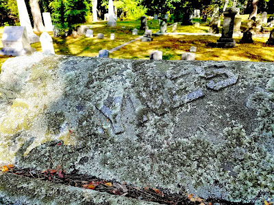
Haynes Road intersects with the road that the Old & New North Cemetery sits on. You'd think, therefore, that the family might have some pull and get the lichen cleared from the family tombstone. Actually, there are those who argue that lichen doesn't harm the stone, but rather gives older cemeteries a nice patina. I agree.

How cool is it that a family of pelagic seabirds is buried in this graveyard! Oh wait, what? Not puffins? Oh, Puffer. Anyway, they've got a nice spot.

Aren't Rebecca and Mary just the best? You can tell that Rebecca takes care of Mary. "Just lean on me," she sings. And Mary really appreciates that.

Adelaide Whelpley was the name that John Lennon and Paul McCartney planned on using for their song about "all the lonely people." But then through various lyrical twists and turns, the name changed a few times, before becoming a little something called "Eleanor Rigby."

Louisa means "renowned warrior," according to the Internet. I'm guessing not only is she safe in Jesus' fold, but that she provides more than a little protection for her fellow foldees.

Hoo boy. No goofy comments here. Can you imagine anything sadder than this tombstone?

These aren't the parents of the infant in the photo above. This headstone is powerful. Despite being cracked, this relationship is eternal.

The cemetery dates to 1843, but for the most part it holds up well. There are some signs of aging, however.

The most impressive memorial in the graveyard belongs to the Maynard family. I assume these folks are related to those for whom the neighboring town of Maynard is named for.

Below is a detail from the Maynard statue.

There are numerous graves of war veterans, as you'd expect. Still, I found the markers for these guys very cool.

(Spanish War veteran.)

(Grand Army of the Republic veteran, meaning he served in the Union Army, Navy or Marines during the Civil War.)

(Veteran of the War of 1812.)

Seeing these three veterans' graves made me realize just how little I know about the military history of this country. Ain't that odd....

(Speaking of odd, here's a guy who was a member of the Independent Order of Odd Fellows.)

And here's a video of an R.E.M. song:

So there are just some of the folks from your friendly neighborhood graveyard. Sit down and have a chat with them this Halloween.

Walking in Witch City

From Dave Brigham: In most towns, if you walk around looking for signs of Halloween nearly seven weeks ahead of time, you may find a half-...