Showing posts with label aqueduct. Show all posts

Saturday, July 9, 2022

Wellesley, Wild + Weird

From Dave Brigham:

I enjoyed exploring both Wellesley Hills (see April 23, 2022, "A Wonderful Walk in Wellesley Hills") and Wellesley Square ((see July 2, 2022, "Wandering in Wellesley Square") in recent months, after largely ignoring this well-to-do Boston suburb (a local blog is called The Swellesley Report for good reason) over the years. During those adventures, I also checked out some funky, one-off destinations, which I present here today.

First up is a place I've driven past many times over the years, on my way to the old Baker Estate grounds (see January 20, 2018, "The Fabulous Baker Estate"), the Elm Bank Reservation, Lookout Farm or the Broadmoor Wildlife Sanctuary.

Located on the grounds of Wellesley College, this quaint stone cottage is known as East Lodge. Built in 1869, this Second Empire house (thanks, MACRIS) was designed by Hammatt Billings, whose works include the National Monument to the Forefathers in Plymouth, Mass.; the Civil War monument in Concord, Mass.; and the original illustrations for Uncle Tom's Cabin, according to Wikipedia. He was also the architect for Wellesley College's College Hall, which burned down in 1914.

Located at a Washington Street entrance to the campus, just outside Wellesley Square, East Lodge "is important for its representation of the earliest documented building constructed specifically for the College campus," MACRIS indicates. I assume the little lodge was used as a residence at some point. I'm not sure whether it is currently occupied. At first, I guessed that this building was a gardener's cottage, much like the nearby Hunnewell Estate Lower Lodge.

I didn't make a photo of that lodge, which was built in 1866 as a gardener's lodge and gatehouse for the Hunnewell mansion known as "Wellesley," per MACRIS.

In Wellesley Lower Falls, which abuts Newton Lower Falls, I enjoyed checking out a historic mill and its attendant dam and bridge, as well as a few other places.

The Eaton Moulton Mill at 35 Walnut Street dates to 1853, per MACRIS. It replaced two prior structures that had burned down. All of these buildings were used for constructing and repairing machinery for the Ware Paper Mill, which was located across the Charles River in Newton Lower Falls. The Ware mill buildings are still standing, as well.

Currently in use as an office building, the old stone mill building was "for many years one of the leading builders of paper machinery in the country," MACRIS indicates, citing as a source a book by Clarence Wiswall called 100 Years of Paper Making: A History of the Industry on the Charles River at Newton Lower Falls, Massachusetts.

A footbridge connects Wellesley to Newton, spanning the Charles River and the Cordingly Dam.

The Newton Conservators indicates that this is a rebuilt Victorian-style bridge. There is a fish passage located here as well.

Close by, on River Street, is the former Pulcifer-Healey Carriage Shop, per MACRIS.

I never would have guessed from looking at this place that it was built in 1871. I assume it's been altered quite a bit from its early days when John Pulcifer painted carriages here. MACRIS indicates Pulcifer also did some carpentry and blacksmithing work here in the latter half of the 19th century. In 1899, Harriet Healey of neighboring Newton acquired the property. Timothy Healey (husband? brother? cousin?) continued the business through the 1930s, when his work was done on automobiles.

Across Washington Street, on the dead-end Mica Lane, is a building known historically as the Billings and Clapp Chemical Company headquarters.

This is a building I was unaware of, seeing as how it's tucked behind a row of retail and restaurant spaces along Washington Street, as well as a few newer industrial buildings. I was a bit surprised to see a factory complex in Wellesley, although I shouldn't have been, because this site, hard by the Charles River, is close to the aforementioned Eaton Moulton Mill, and simliar buildings in Newton Lower Falls.

Dating to 1899, this handsome brick building evidently subsumed an earlier fieldstone structure, per MACRIS. The brick complex was erected by the Billings & Clapp Chemical Company. In subsequent years, the mill was used to manufacture electrical insulation, chocolate and marine adhesives, per MACRIS. The building is also known historically as the American Mica Corp. and Rounds Chocolate Company.

Thanks to a fan of this blog who posted on Facebook, I learned about the Babson Globe.

Completed in 1955 on the campus of Babson College, in the Map and Globe Museum in Coleman Hall, the massive globe was the brainchild of the school's founder, Roger Babson, a statue of whom is seen in the above photo. Babson "was an American entrepreneur, economist, and business theorist in the first half of the 20th century," according to Wikipedia. "He is best remembered for founding Babson College. He also founded Webber College, now Webber International University, in Babson Park, Florida, and the defunct Utopia College, in Eureka, Kansas." He attended MIT and worked for investment firms before founding his own stock analysis and business report company, Wikipedia continues.

Like the Earth itself, the Babson Globe has had its trials and tribulations. It fell into disrepair in the late 1970s, and was at one point slated for demolition, according to the college's web site. It was restored during the years 1991-1993, and again in 2018. In 2019 it was moved to Centennial Park.

The final spot on this tour of unusual sites of Wellesley is my favorite, by far.

I learned about the Waban Arches while researching the Crosstown Trail for a prior Wellesley post. As soon as I researched the arches, which were built in 1875, and found photos and videos online, I knew I had to explore there as soon as possible.

The arches are located along the Sudbury Aqueduct Path, crossing the Waban and Fuller brooks as they empty into the Charles River. The path across the top, filled with graffiti from end to end, and the arched bridge itself are reminiscent of Echo Bridge in Newton Upper Falls (see March 8, 2018, "I Seek Newton, Part VIII: Upper Falls (Section 2)").

I love places like this, where teens obviously hang out, get creative, enjoy their freedom, smoke a little dope or drink a few beers, getting away from their parents. I needed places like this when I was young.

As I said, the bridge is part of the Sudbury Aqueduct, which I've explored in Newton (see November 11, 2011, "History Flows On, Part I"). The aqueduct carried water from Framingham to the Chestnut Hill Reservoir, for use by the city of Boston, for nearly 100 years. It came out of service in 1978.

As cool as I found walking across the top -- reading the graffiti, listening to the birds, saying "Hi!" to dogs and their owners jogging by, looking down to people fishing beside the brooks -- the real prize at this site is, of course, the arches.

The path from the top to the bottom is a bit steep, but it's easy to navigate. And, of course, there is ample artwork belowdecks.

Given the focus of this blog, you might think all I cared about was the anachronistic architecture hiding in the woods. But, hey, I enjoy nature as well.

Well, that's it for Wellesley...for now.

Thursday, March 1, 2018

I Seek Newton, Part VIII: Upper Falls (Section 1)

From Dave Brigham:

As I was saying....

I didn't plan to set aside my series looking at the villages of my adopted hometown of Newton, Mass., for so long. The last installment -- I Seek Newton, Part VII: Thompsonville -- went live nearly a year ago, on March 7, 2017. I was on a nice roll up until that point, but other things have taken priority lately. I was also a bit daunted by Upper Falls. When I drive through the village I feel like Mike and Frank on "American Pickers" when they stumble across a honey hole. There's just so much to look at, take photos of and schedule! And, of course, research after the fact....

As such, I will be writing three posts about Upper Falls, covering railroad track remnants, aqueducts, old mills, walking paths, a historic dirt road, a dam and surrounding area, bridges, hotels and inns, schools, commercial blocks and much more. Some of the photos I will feature in these posts are of places or features that no longer exist. For links to the previous posts in this series, see the bottom of this installment.

So let's get to it!

In this first part I will focus on abandoned railroad tracks, unused aqueducts, buried brooks, old mills and related structures, walking paths and a dirt road with quite a pedigree.

Mills defined Upper Falls for more than two hundred years. The first mill was built along the east bank of the Charles River in 1688, according to a brochure issued by the Newton Historical Commission, the Newton Upper Falls Historic District Commission and the Newton Planning & Development Department. Saw mills, grist mills, fulling mills, snuff mills, wire mills, cotton mills, silk mills -- all of these were in business at some point along the river until 1962, according to the brochure, when the mill complex was sold and eventually turned into what stands there today: Echo Bridge Park, home to jewelry and antique stores, a musical instrument shop, medical offices and more.

(View from below Echo Bridge of the former mill complex.)

Above the mill complex on a small, wooded hill just off the intersection of Chestnut and Ellis streets, I experienced one of my proudest moments of backsiding. As I walked around the village snapping photos I looked at this little mound that I'd driven past countless times and thought, "I bet there's something up there." So I climbed up in my slides, as inappropriate a set of hiking footwear as you can find, pushed past a few small trees and found this:

BINGO!!

An 1874 atlas I downloaded from the City of Newton web site identifies this site as "Reservoir." I don't know enough about old mill complexes to get a handle on this relic. I assume the reservoir was constructed not only of brick and stone, but also wood. What was the water in the reservoir used for? Obviously the Charles River below provided the power, or most of it anyway, for the mills. Anybody got any answers or guesses?

I'll include photos and information about nearby Echo Bridge and Hemlock Gorge in a future post in this series about Newton Upper Falls. While the complex at Echo Bridge is the oldest in Upper Falls, and indeed the city, I find the Saco-Pettee Machine Shops complex far more interesting. So get ready for a bunch of pictures.

The multiple buildings on the site at Oak and Needham streets were built between 1892 and 1912, per Wikipedia. There were cotton mills and machine shops here over the decades until the 1930's, per Wikipedia. Other, smaller companies took over some of the buildings in subsequent decades, according to the indispensable The Makers of the Mold: A History of Newton Upper Falls, Massachusetts, by Kenneth Newcomb, which is available for free online (although you can also buy a hard copy, of which I own). Some of the mill buildings were eventually torn down to make way for a shopping plaza. Many of the buildings left have been abandoned for years.

Some of the buildings, however, have been restored and house businesses including a dance studio.

(At the corner of Oak and Needham streets you can spy a remnant of South Meadow Brook, which, like so many small streams in Newton, was mostly buried many years ago.)

There have been numerous proposals over the years for redeveloping this massive site. The latest comes from Northland Investment Corp., which has announced plans to raze the dilapidated buildings and other nearby retail buildings and construct new retail, apartment, office and restaurant space.

I exchanged emails with a vice president at Northland about gaining access to the site to document the old mill buildings before they are demolished or altered. Unfortunately, the company's lawyers were unwilling to grant me that chance. I was told that a professional photographer was commissioned to conduct such a project, and that his or her work will be available to the public at some point.

The circa-1890 mill building below, at 1254 Chestnut Street and not far from the Saco-Pettee complex, once made fire alarm systems.

According to Makers of the Mold, Moses Crane made fire alarm systems in this building for Gamewell Fire Alarm & Telegraph Co. Crane had previously made fire alarms in a building near Crystal Lake in Newton Centre.

Gamewell was eventually acquired by Honeywell, which later merged with a company called FCI.

I want to get back to the Pettee operation. In addition to the abandoned hulks and restored buildings I showcased above, there are other buildings in Upper Falls that were once part of the mills. But unless you own the building (and maybe not even then) or have read Newcomb's Makers of the Mold, you would have no idea that some current-day houses were once mill buildings.

At top is 50 Oak Street, at bottom, 50 Hale Street. Newcomb has this to say about these houses: "They were formerly part of the old Pettee Machine Works plant and are believed to have been moved to their new sites about 1895 when the Pettee shops were rebuilt." Sure enough, the Newton Assessors' Database lists 1895 as the construction date for the Hale Street house. Newcomb, however, assures us that such buildings are certainly older, but it's hard to determine just how old because they were moved from mill properties to private lots. As for the Oak Street house, I'm pretty sure it's the same one that Newcomb referenced in his book, but the assessors' database lists a build date of 2007. But since the database contradicts itself and lists assessments going back to 1992, I'm guessing the house was significantly modified in 2007.

Directly behind 50 Oak Street are sited three more former Pettee Machine Works buildings that were long ago converted to homes. I find it hard to picture these quaint homes as part of what was most likely a smelly, dirty mill complex, possibly being used as a blacksmith shop or storage facility.

(12, 16 and 20 Shawmut Park, former mill buildings, top photo. #20 Shawmut in bottom photo.)

The Saco-Pettee mill wasn't the only one whose buildings were repurposed. 353-357 Elliot Street, which I believe was formerly numbered 351-353, was an old building at the Echo Bridge mill complex, according to Newcomb. This house and three others along Elliot Street, if they were original mill buildings "their date of construction would be about 1785, shortly after Simon Elliot purchased the old mill site for his snuff mill operation," according to Makers of the Mold. The Newton Assessors' Database lists the construction date as 1830.

With all these mills around, of course there were eventually railroads. Before I get to the main line and what it's become, I want to mention one more house that has a past life....

86 High Street was at one time the waiting room for an electric railroad, per Newcomb. "The Newton & Boston Street Railway was the one more closely associated with Newton Upper Falls," Newcomb writes. "It had been organized in 1891 with permission to establish other lines in the city if desired. In 1892 an extension of its lines was granted on Walnut and Beacon Streets and although delayed by sewer construction it was carried to Newton Highlands and later, in the same year, to the corner of High and Summer Streets in Newton Upper Falls." You can see that the second floor doesn't quite match the first, and was obviously added once the waiting room had been converted to a home.

Now, to the more traditional railways.

Otis Pettee, namesake of the Saco-Pettee Machine Shops, tried to lure the Boston and Worcester Railroad to Upper Falls, according to the folks at the Upper Falls Greenway. Upon being snubbed, Pettee decided to build his own line! Eventually the railroad was folded into the Boston & Albany line.

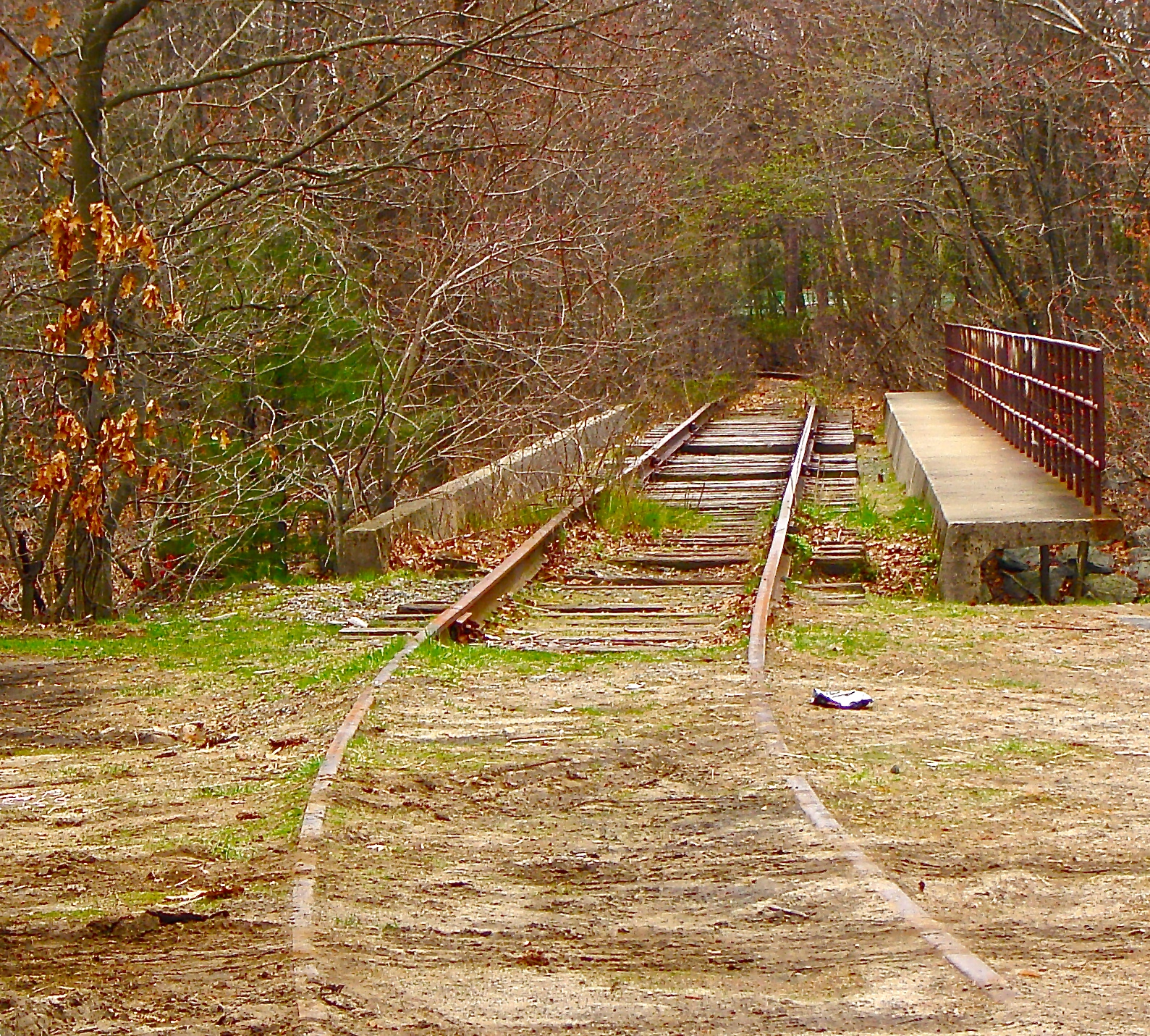
And now, as you might imagine if you have spent time near abandoned railroad tracks in the past 20 years, Pettee's labor of love has been turned into a walking/bike path.

(A picture from a few years ago after the tracks had been torn up to make way for the Newton Upper Falls Greenway).

(Looking northeast from the greenway's terminus at the Charles River.)

(View from the greenway. I love the back of 1211 Chestnut Street, which was built in 1918 and now houses a dry cleaner, a hair salon and two apartments.)

(Former Newton Upper Falls train depot, built in 1852, now a coffee shop. The walking path goes right behind it.)

(Old something-or-other along the Upper Falls Greenway.)

(Old sewer structure along the greenway.)

(Tower for WHDH TV, along the greenway. According to Makers of the Mold, this site once housed the United States Fireworks Company, which moved to Upper Falls in 1886. The company went into decline after an explosion and fire in 1919, per Newcomb's book.)

There was a spur track that ran from just a little north of where this tower stands now, across Needham and Christina streets, over the Charles River and into a Needham industrial park. There are still remnants of this system.

(Long-abandoned rail spur on the property of H.C. Starck, a "supplier of technology metals, high-performance ceramics and thermal spray powders," per the company LinkedIn page.)

The H.C. Starck complex sprawls across several buildings along Charlemont Street. Perpendicular to the very busy retail strip of Needham Street, Charlemont used to connect all the way through to a quiet residential neighborhood. At the back of the Starck property there is a small walkway that knits the two ends of this street perhaps named after a town in County Armagh, Ireland.

(Looking south across the Charles River, at a set of tracks that isn't there any more, although the bridge is. I took this photo several years ago.)

Now, back to the greenway. At its western terminus, an easy slide down the embankment next to the Charles River, is the Charles River Pathway. Acquired by the City of Newton in 1980, this 1.5-acre conservation area is one of many great little nature preserves in the city.

(The Charles River Pathway.)

(Anchors for the WBUR radio tower, which is located on the other side of the greenway.)

In addition to the Upper Falls Greenway and the Charles River Pathway, this village is home to part of the Quinobequin Trail, much of which (and, honestly, perhaps all of it; as I've said, it's often hard to tell exactly where the boundary is between villages) lies in Waban (see June 3, 2016, "I Seek Newton, Part IV: Waban").

(Funky blue hydrant on the Wellesley side of the Charles River, seen from Upper Falls section of Quinobequin Trail.)

The Charles River is a prominent and obvious feature in Newton. But there are two other water systems running through the city that fewer people are aware of.

What, you don't see this one? It's right there!

It's the Sudbury Aqueduct. Built between 1867 and 1876, the underground conduit brought water from the Sudbury Reservoir to Boston until 1978, when use was discontinued. The Massachusetts Water Resources Authority maintains the system as a backup source of water (for more on Newton's aqueducts, the other of which is the Cochituate Aqueduct, see November 11, 2011, "History Flows On, Part I").

I've covered walking paths and aqueducts, which provide great trails for touring Newton. Finally for this first of three installments about the village of Upper Falls, I want to discuss two old streets.

This is the middle section of Pennsylvania Avenue. Not quite as impressive as the one in our nation's capital that the White House sits alongside, is it? Still, it's kinda cool. Located in a neighborhood that includes Ohio Avenue and Indiana Terrace, Pennsylvania Ave. appears as though it was washed out at some point. In the 1929 Newton Atlas available on the city's web site, Pennsylvania Ave. goes straight from Oak Street to Chestnut Street. Now, as you can see here (I hope), the road dies just a short distance up from Chestnut. There is then a paved walkway up the hill, where Pennsylvania reconnects and heads on up to Oak Street.

I'll wrap up this post with another dirt road with an even better story, and one that I didn't even have to make up.

Curving from Chestnut Street to Elliot Street, Sullivan Avenue is "all that remains of an ancient highway laid out in 1688 by a joint agreement between Cambridge and Cambridge Village (Newton) from 'the Village Meeting-house to the Falls,'" according to the above-referenced brochure for walking tours of historic Newton. As Vanessa Bayer channeling Miley Cyrus on "Saturday Night Live," would say, "That's pretty cool!"

Thanks for checking out the first of three posts about Upper Falls, the eighth village of Newton I've covered on the blog. The next two parts will feature memorials, bridges, parks, houses, hotels, restaurants, churches, schools, retail stores and much more.

The link to the seventh post in my Newton series is near the top of this page; below are the links for the other six, beginning with the most recent.

December 5, 2016: Chestnut Hill (#6)

September 26, 2016: Oak Hill (#5)

June 3, 2016: Waban (#4)

March 23, 2016: Newton Highlands (#3)

September 20, 2015: Auburndale (#2)

May 21, 2015: Newton Lower Falls (#1)

Scrambling Through Boston's Egleston Square

From Dave Brigham: I've danced around Boston's Egleston Square quite a bit over the years I've been publishing this blog. I...