Monday, December 26, 2022

Drivin' on 20

From That Same Old Guy:

As regular readers of this blog know, I have the memory of an elephant when it comes to places I want to explore. My recall for other things, alas, isn't all that great.

Anyway, several years ago, traveling from my home in Newton, Mass., to a Thanksgiving celebration in Connecticut, I ended up driving on Route 20, rather than the Mass. Pike, because the traffic was (marginally) better. As I drove along what is the longest road in the United States -- stretching from Boston's Kenmore Square to Newport, Oregon -- I was spotting backside destinations left and right. "Man," I thought, "I need to check this out for the blog someday."

Well, that day came recently, as I made the decision to once again bypass the Pike in favor of Route 20, this time traveling west to east on a trip home from visiting my mother in the Nutmeg State. Doing a tiny bit of Google Maps research ahead of time, I had only one destination I wanted to hit: the Yankee Diner in Charlton. After that, I just winged it, racing against the fading sun as I drove east. I found a slew of abandoned properties and another diner, this one run by the daughter of a local sports legend.

Sharing a parking lot with a shuttered tattoo shop and located across the street from an abandoned factory/warehouse complex, the Yankee Diner has been in this location since 1969. It's "a 1939 Worcester (#735)," according to the Roadside Architecture blog's Massachusetts diner page. "It was originally installed in Leominster, MA."

This place is neat and tidy on the outside, so I'm guessing the inside follows. There is a takeout window, too, which detracts from the front-view aesthetics, but is obviously necessary to keep the place in business. The diner is closed on Mondays and Tuesdays, but is open the remaining five days of the week, including for dinner Thursdays and Fridays.

Just west of the Yankee, on the north side of Route 20, is an abandoned building that I'm guessing was a service station at some point.

I've been unable to find out any information about this place.

Just up the hill from that pile of ruins is a place once known as Charlton Mills.

LoopNet, which lists commercial properties for sale or lease, indicates this building dates to 1902, and was once known as the Charlton Box Factory. It was at one time, perhaps originally, known as the Charlton Woolen Mill.

From 1990 to 2010, this complex was home to Charlton Mills, a "craft emporium full of hard-to-find items" that also specialized in making boxes of all sizes, as well as wrapping materials, according to this Telegram & Gazette story from May 2010. Charlton mills owner John Carpenter started the business inside the former Independent Box Makers of New England, Inc., facility and within a few years took over the entire first floor, according to the article.

This place was also a UHaul facility at some point. I assume it will get torn down eventually. I hope I'm wrong.

I drove 16 miles -- past CrossFit facilities and stove shops and Walmarts and newer restaurants and car dealerships and Home Depots and gas stations and fast-food joints and weed shops and probably stuff that when I return some day I will deem important to the Backside of America -- before I found my next quarry.

I was heading east, and the sign is on the westbound side, so I had to turn around. As I pulled into the lot, next to Gracar Auto Center Repair & Towing, I said to myself, "Where the heck is the diner?" I even pulled out of the lot and drove about 200 yards down a side street. "There's no diner down here," I said. As I drove away, heading east again, I saw a slab and realized that the diner had been moved.

From the Roadside Architecture blog: "The Edgemere Diner is a Fodero [Dining Car] from 1940. It had been here since 1954. It was previously located in the Boston area where it was known as the Englewood Diner. The diner was sold to the city [of Shrewsbury] in 1995 and closed in 2005. It reopened in 2008 as 'The Edge' which focused on hot dogs rather than normal diner fare. In 2014, new owners reopened it as a diner again. The name, Edgemere Diner, was also back."

In November 2021, Michael Cioffi was the winning bidder in an auction for the diner. In May of this year, Cioffi loaded the diner onto a flatbed truck and hauled it to somewhere in New York.

I'm glad to see it will be saved.

Further along on Route 20 in Shrewsbury, I did a double-take when I saw the statue below.

Once again, I had to bang a uey and check out the former Tanela Restaurant & Lounge.

"For a number of years during the mid-1970s, the Tanela Restaurant was a fairly popular location for local people to get some Polynesian cuisine," per the MyTiki Life web site. "The Tanela was known for its large Moai statue and Polynesian-themed décor on the outside of the building. The business added several motel-like apartments at the rear of the property, but soon fell on hard times, the restaurant closing down, but the motel units remaining in operation.

"During the early 2000s, an attempt was made to revive the location, and it re-opened as a heavy metal-type venue called 'Trance Buddha.' That didn’t work out either, and soon closed. Within a few more years, the apartments were closed."

Man, I bet both Tanela and Trance Buddha were quite the scenes during their heydays.

A friend who grew up in Shrewsbury recalls that this place was also once known as the Honolulu.

The vacant apartment building is still attached to the old restaurant. I have to say, I find adding "motel-like apartments" an odd real estate decision.

The final stop on this tour was Northborough's Chet's Diner, which opened in 1931 (!).

"Chet’s Diner is #177 from the Worcester Lunch Car Company," according to this Patch article. "These lunch cars were hand-built at the factory, then transported to their sites with a large truck. Diner #177 was shipped in two pieces and assembled on-site because of its extra length."

Check out the video below from 2012 to get a feel for the place. Notice that the chef/owner contradicts the information from the Patch article cited above about the diner being delivered. She says, "1931, built on location" to the question of how long the diner has been along Route 20.

Oh, and that chef/owner's name? Jessica Fidrych. That surname ring a bell? She's the daughter of former Detroit Tigers pitcher Mark Fidrych, who grew up in Northborough and was the American League Rookie of the Year in 1976. Known for his eccentric personality while on the mound -- talking to himself, talking to the ball and "throw[ing] back balls that 'had hits in them,'" per Wikipedia -- Fidrych was nicknamed "The Bird" by a minor league coach who thought he resembled Big Bird from "Sesame Street."

After his stellar rookie season, unfortunately, Fidrych suffered a series of injuries and pitched his last professional game in October 1980. After retiring, he and his wife and daughter lived on a farm in Northborough. He died in 2009 after an accident on the farm, at age 54.

Jessica Fidrych's grandmother, Nancy Pantazis, acquired the diner in 1964. So cool that the same family has run this place for decades.

I hope to travel this route again in order to make photos of places I simply didn't have time to explore.

Below is an Ed's Redeeming Qualities video that inspired the title of this post.

Saturday, December 17, 2022

Paddy's Lunch: Serving Cold Beer and Warm Friends

From Dave Brigham:

I have driven past Paddy's Lunch, an institution in Cambridge's unimaginatively named Neighborhood Nine area, approximately 1,273 times in my life, but it wasn't until recently that I walked by with a camera and snapped a few pics.

"The oldest family owned pub in Cambridge. Serving cold beer and warm friends since 1934," declares the eatery's web site. Think about that: This place has been around for 88 years, since before World War II and color television and Lou Reed. This definitely seems to be the kind of place where everybody knows your name. Sure, it's not the friendliest looking place from the outside, but Paddy's sponsors local events and surely is doing something right after nearly nine decades.

Again, from the web site: "Paddy’s was started in 1934 by Patrick and Margaret Fennell, immigrants from Ireland. In the 1960s, the Fennell’s daughter Margaret 'Peggy' Fennell Ryan took over the operation with her husband Harry 'Bubby' Ryan. In 1998 Peggy’s daughter, Ruth Ryan Allen, took over and remains the current owner today."

I'm sure there's good craic to be had here.

Saturday, December 10, 2022

All About the Alewife Area

From Dave Brigham:

In my last post, I ended my review of North Cambridge at Jerry's Pond, a former clay pit/swimming hole within sight of Alewife station, a bus and subway terminal run by the MBTA (see December 3, 2022, "Tip-toeing Through North Cambridge"). The pit was contaminated from years of use by both the brickmaking industry that flourished in the area in the 1800s, and the nearby chemical companies of the 20th century. In 1961, Jerry's Pond was closed to the public.

I pledged in the North Cambridge post to further explore the Alewife area, as I was curious about the companies that polluted the pond, as well as what the area once looked like, and what it will become in the near future.

Here's what I found.

As I mentioned in the North Cambridge piece, W.R. Grace & Co. manufactured chemicals in a plant just steps away from Jerry's Pond for 40 years. Other companies conducted similar operations prior, leaving the site contaminated with asbestos, among other things. According to the Alewife Study Group, from 1919 to 1940 Dewey and Almy Chemical Co. manufactured rubber and rubber-based products at a facility along Whittemore Avenue, a short distance from Jerry's Pond.

(Ghost sign chiseled into a brick building where Dewey and Almy once operated. Seen from Harvey Street, which is close to Russell Field, a football and soccer complex built over contaminated ground.)

By the mid-1960s, W.R. Grace had acquired Dewey and Almy and then phased out the chemical company's work at the North Cambridge site. In the late '80s, the Cambridge Planning Board granted a special permit for an office complex to be built on the former Grace site. Over the years, other developments were proposed for this area. I'm not clear on the age of the buildings that were on the site as of the beginning of this year, and how much, if any, clean-up work Grace may have done or paid for.

In 2020, IQHQ, a life sciences real estate development company, acquired the former Grace site, with plans to construct new buildings and "safely expand public access for the area surrounding Jerry’s Pond," according to a press release the company issued.

As I found out on my expedition, demolition for that project is well under way.

Known as Alewife Park, the development will update two existing buildings, as well as construct three structures, all to be used as office and/or lab space. In addition, the developers will add a "landscaped promenade" through the site; restore the MBTA's Alewife headhouse plaza; improve public access around Jerry's Pond; and improve stormwater management, per the project's web site.

After checking out the IQHQ site, I mosied on over toward Alewife station.

(Tunnel under the Alewife Brook Parkway, with the MBTA station in the background.)

(Shopping carts in a retention pond near the headhouse plaza that IQHQ has pledged to restore.)

(One of several entrances to Alewife station.)

I walked along the Alewife Linear Path, which skirts along the northern edge of the station complex and leads to the Minuteman Bikeway. From there, I saw Yates Pond, one of several small bodies of water in this area.

This is a good time to talk about water and about alewives.

An alewife is a fish, specifically "a diadromous species, meaning they migrate between fresh water and salt water to complete their life cycle," according to the Mass. Division of Marine Fisheries. "Alewife populations are considered depleted on the east coast," the DMF continues on its web site. "Recreational and commercial harvest of alewives was prohibited by DMF in 2006 out of concern over their status."

The Alewife Brook Reservation, a wetlands and recreational area situated just north of the MBTA station, runs from Belmont to Cambridge to Arlington to Somerville. The reservation includes Little Pond, Alewife Brook and the Little River, which runs east to the Mystic River. Squeezed between office parks, a bike path, residential neighborhoods, very busy roads, industrial areas and recreational fields, the reservation was established in 1900. "The Alewife Brook was straightened and channelized next to the parkway between 1909 and 1912, with road construction completed by 1916," per Wikipedia.

Prior to road construction and the development of commercial and residential properties, this area was part of what was known as the Great Swamp. "It was known for its Alewife, and there was an important weir near what is now the intersection of Massachusetts Avenue and Massachusetts Route 16," per Wikipedia. "Most of the swamp was drained and developed as farmland, then mining for brick clay, tanneries, and landfill."

I will talk below about just how much development has come to this area in recent years. For now, let's get back to the MBTA station and adjacent walking path.

At the beginning of what's known as the Fitchburg Cutoff Bikepath, in the shadow of a disused entry ramp to the train station's parking garage, there are some lovely paintings on electrical boxes.

The path runs into Belmont, ending at Brighton Street, hard by the commuter train tracks.

(The aforementioned shuttered entrance to the MBTA garage.)

(Graffiti on the wall of the parking garage; litter, including a bike, in the foul water.)

Naturally, I had to walk along the main path, as well as a side route that allows one to commune just a little bit with nature, as opposed to the backsides of buildings and so many walkers and joggers.

(View to the north of an office park that includes biotech and research firms.)

"Forebay Inlet 335 Acres," this tunnel under the bikepath is marked. A forebay is, simply put, an artificial pool of water in front of a larger body of water. They can be used in flood control, which I'm guessing is this inlet's function, given that it's surrounded by a river and brooks and ponds and wetlands, and the area just to the south of this forebay has been built up to fill just about every inch between the bikepath and the commuter train tracks.

So let's talk about all that development.

While a number of residential and commercial construction projects rose in the Alewife triangle between 1998 and 2013, it was in 2014 that the square footage volume in the area exploded, according to a Cambridge City Council Transportation Committee report from 2014. That year, more than 700,000 square feet of residential properties was built in the form of large apartment/condo buildings. From 2015 onward, nearly 600,000 square feet of apartment buildings were on the docket.

I've been unable to confirm the square footage total of all the buildings in this area. Looking at Google Maps, I count at least 15 buildings, all of them quite large, filling this area, in addition to the MBTA station and some smaller buildings housing a restaurant, a dance studio, a church and a childcare center. Many of the newer residential buildings have restaurants in them, as well as pools outside. But there is no "neighborhood" feel here, with small shops, a grocery store (there is a Whole Foods very close by), a school, a playground, a library, etc.

I imagine that the aforementioned smaller buildings, which are surrounded by a large parking lot, will be redeveloped at some point.

(Looking west on Cambridgepark Drive, from near the Alewife MBTA station, past multiple commercial and residential sites.)

If you know the Alewife area, you know traffic is a major concern. Just north of the MBTA station, Route 2 meets up with the Alewife Brook Parkway in a formation that, from above, looks a bit like the Mind Flayer from "Stranger Things," and can be almost as scary. Route 2 is a major feeder from the west into Cambridge, Somerville, Arlington, Medford and Boston. It connects with Route 128, a major north-south highway. In addition to the MBTA station, the parkway runs past the Fresh Pond Mall and connects to the Fresh Pond Parkway on its way to Watertown and toward Newton. This is a busy nexus.

As a post on the Fresh Pond Residents Alliance web site put it on May 25, 2014, "So why are we galloping ahead to develop every buildable parcel along this fragile area? The southern end of the Reservation is sandwiched between Cambridge Park Drive and Acorn Park Drive, where millions of square feet of residential and office space are encroaching. Within just a couple of years there will be 1,562 apartments on Cambridge Park Drive (sic), a dead end street bounded by the Fitchberg (sic) commuter rail tracks on one side and the Reservation’s wetlands on the other. The street’s sole outlet is onto gridlock-prone Route 2 at the already D-rated Rindge Avenue intersection."

Jan Devereux, a West Cambridge resident who founded the Fresh Pond Residents Alliance in 2014, said in a December 29, 2014, Boston Globe article about this very topic, "The planning process in Cambridge is broken...The city allows these projects to be planned and approved one at a time, instead of looking at how you build out an entire neighborhood and a city as a whole.”

I'm surprised that Cambridge, with a well-known progressive government, populace and history (it's known as the People's Republic of Cambridge in some circles), allowed this corner of the city to become dominated by faceless corporate buildings and residential towers. And with new lab/office space slated for the old W.R. Grace site nearby, traffic is sure to become more miserable. Maybe the eggheads in those offices can figure out a solution, such as a mini-Hyperloop.

But of course, traffic isn't the only concern, as was pointed out in the same Fresh Pond Residents Alliance post cited above: "A state park, the 120-acre Alewife Brook Reservation is part of the Mystic River floodway; it is our safety valve when — not if — we experience one of those 100-year storms. Even a 'mere' Category 1 hurricane would flood the entire Alewife area as well as parts of East Arlington, North and West Cambridge. And that’s not even taking into account the certainty of rising sea levels and the possibility of a major storm arriving during a full moon at high tide."

The point here being that if the waterways and wetlands of the Alewife Brook Reservation aren't maintained and, perhaps, opened up, this area of Cambridge could end up looking like Kevin Costner's "Waterworld."

We won't finish this tour of the Alewife area on a high note, but it will be slightly less depressing than the potential for this area of Cambridge to turn into a waterbound "Mad Max."

There used to be a Bertucci's restaurant here, in the subway station. Was for years. I went there several times to meet friends or eat with my wife and kids. Unfortunately, this location of the local Italian eatery chain closed in September 2020. I have to believe that with all the office/lab workers and residents literally steps away, something will fill this space before too much longer.

There's your optimism.

Saturday, December 3, 2022

Tip-toeing Through North Cambridge

From Dave Brigham:

OK, let's get my headline explanation out of the way. Thomas P. "Tip" O'Neill, former Speaker of the U.S. House of Representatives who served in those hallowed halls for 34 years, was a North Cambridge guy. Born and bred. Below I'll feature a great mural dedicated to the man known for the quote, "All politics is local."

I knew about O'Neill's connection to this area of Cambridge, but I learned plenty on my exploration. For instance, I stumbled across the one-time location of a locally famous recording studio, and discovered that North Cambridge was once a major player in the brick-making industry.

Let's start this tour on Massachusetts Avenue, just outside Porter Square, which I recently featured (see November 26, 2022, "Drinking in Porter Square").

I was drawn in by the sign above the front door of Rinaldo Realty Company. It's simple and clean and looks like it's been there for quite a few decades.

The Mansard-style house dates to 1880, according to the Cambridge assessor's database. The real estate firm was established in 1923, per Dun & Bradstreet, which tracks business information. A Google search indicates that the business is temporarily closed. There are apartments in this old building, which would look a LOT better with some colorful details.

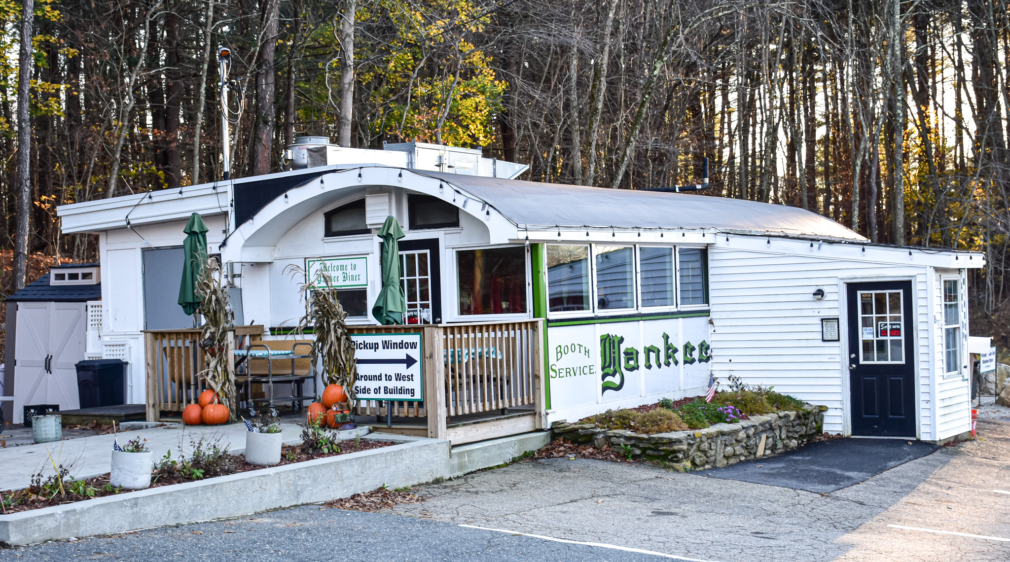
Moving along, on the opposite side of the avenue is a North Cambridge institution: Pemberton Farms Marketplace.

Begun in 1930 as a fruit and vegetable shop run by Tofic Saidnawey, Pemberton today is run by his descendents, and sells produce, seafood, garden products, cheese, beer and wine, and much more. The assessor's office indicates that at least one of the buildings on the site dates to 1923. I'm not sure if that's that main structure seen in my photo above, or the brick building at the rear of the property.

Directly across the four-lane boulevard is Foodland, a Bangladeshi, Indian & Pakistani market with a halal butcher.

I love small markets like this, which are the lifeblood of so many immmigrant communities.

Right next door is Scholars Guest House.

I haven't found much online about this place, which seems to be a boarding house/inexpensive solution for travelers on a budget. The house dates to 1910.

Back across Mass. Ave., at the corner of Meacham Road, is Cambridge Greenhouse Antiques & Collectables, which was founded in 1980.

There is a sign in the window indicating this place is open by appointment, but I'm not sure that's still true. The shop's Facebook page hasn't been updated in 13 years. The assessor's database lists the house as dating to 1890, and the greenhouse to 1936. I assume there was a florist/garden shop there prior.

(I like the carriage house at the back of the property.)

Pinballing back across the street, we find a beer supply business that was ahead of its time, but which unfortunately is now tapped out.

Modern Homebrew Emporium opened along Mass. Ave. in 2001, the third in a small chain run by two entrepreneurs. The store's history actually goes back to 1990, when it was founded under different owners, according to this Boston.com article. "'Twenty-five years ago there was no good beer,' says [former owner Roger] Savoy. 'If you went to the beer market you had American crap beer, and European stale beer. If you wanted something good you made it.'"

With so many local breweries offering a wide variety of beers these days, and taprooms opening over the past decade or so, the need to brew your own tasty suds has waned, I guess.

A store named Momma's Grocery & Wine is slated to open here.

Next, another North Cambridge mainstay, Frank's Steakhouse.

Around since 1938, the restaurant has an interesting, if apocryphal, origin story. "According to local legend, originally there was no name of the restaurant in its beginnings; however, there was a neighborhood friendly drunk named Frank who was always on the first stool in the bar. Evidently the owners looked at each other and said 'why not?' and named the place after the friendly lush," according to the eatery's web site.

In the building next to Frank's is the Notre Dame Association French Club.

Established 1920, the club seems to be a pretty social place, based on signs in the windows that include ones advertising Bud Light ("COLDEST BEER ON THE BLOCK") and "POOL, LOTTERY AND MORE INSIDE."

Across Mass. Ave. I spied a cool architectural detail on the facade of a circa-1920 house that is now law offices.

Slingshotting across the avenue once again (understand this: the way I'm presenting things here isn't the way I checked them out during my tour), I loved the signage for Greek Corner, a restaurant that's been in business since 1989.

Across the way is an MBTA bus garage, which is located where car barns of one sort or another have stood since 1874.

"The first carbarn on this site, a handsome brick building with a great clock and monumental doors, was built in 1874 by the Union Railway and remained in use until the introduction of electric streetcars in 1889," per the above plaque, which was placed here in 2002 by the Cambridge Historical Comission. "The West End Street Railway put up a larger and more impressive carhouse around the original structure in 1897, but this was razed by the Boston Elevated Railway in 1937. The present structure was built in 1979 to house the trolley buses that replaced streetcars on this route in 1958."

Just up the street, at the corner of Mass. and Cameron avenues, is a boring old building and a bland new apartment development. Would you guess that this corner was once the home of a groundbreaking Americana and bluegrass record label, as well as a Civil War training camp?

I lived in Somerville from January 1995 to November of 1997, and had friends who lived in the city as well. One of them lived at the northeastern end of Cameron Ave., so I drove down this street with some regularity. The photo above shows the southwestern end, which is, duh, in Cambridge. Behind the odd little brick building that is home to a law office (perhaps Bob Loblaw?) once stood the headquarters of Rounder Records.

Founded in 1970, the independent label "first struck musical gold with the 1975 release of J.D. Crowe & The New South (featuring future stars Ricky Skaggs, Jerry Douglas and Tony Rice)," per Rounder's web site. "[T]his seminal recording revitalized bluegrass music and inspired a generation of artists including Rounder's own Alison Krauss, the most decorated female artist in the history of the Grammy Awards."

"Rounder's catalogue of more than 3,000 titles includes records by Alison Krauss and Union Station, George Thorogood, Tony Rice, and Béla Fleck, in addition to re-releases of seminal albums by artists such as the Carter Family, Jelly Roll Morton, Lead Belly, and Woody Guthrie," per Wikipedia. "...Rounder releases have won 54 Grammy Awards representing diverse genres, from bluegrass, folk, reggae, and gospel to pop, rock, Americana, polka and world music."

The label was acquired by Concord in 2010, and has been based in Nashville for many years.

The Rounder building sat vacant for a while before a developer knocked it down and put up 7 Cameron, a development of one- and two-bedroom apartments. There is also a nice park there.

Looking at this site on Google Maps before my trek, I noticed "Camp Cameron" listed there. "What the heck is that?" I wondered. Here's what I found at The Cambridge Room, a blog offering "Historic tidbits, facts, and notes of interest on Cambridge, Massachusetts brought to you by the Cambridge Public Library's Archivist."

"In 1861 North Cambridge and West Somerville was a very thinly settled area. Camp Cameron (Later named Camp Day) was a Civil War camp of Rendezvous and Instruction located on the North Cambridge / West Somerville town line. The Massachusetts First Regiment occupied the camp on June 1, 1861 and the last troops left in January 1863. The camp sat between what is now Mass. Ave. and Broadway. Cameron Ave. runs through the center of it.

"For twenty months thousands of troops were both recruited and trained at Camp Cameron. The camp consisted of thirty permanent buildings and several smaller temporary buildings and tents."

Cool, right?

Boy, that's a lot of words about a building and an old military camp that don't exist anymore....

Cameron Ave. crosses Mass. Ave. and becomes Harvey Street, which is where I found the storefronts below.

Optometrist David Conway has been in business since 1992, according to the Better Business Bureau.

Two doors down is New England Friends of Bosnia and Herzogovina.

Founded in 2012, this organization promotes Bosnian-Herzegovinian heritage, through cultural, educational and festive programs; runs the Bosnian Language School; raises genocide awareness through human rights campaigns, lectures and commemorations; and fosters partnerships and collaborations with like-minded organizations, State and City institutions, in the United States, Bosnia and Herzegovina, and elsewhere, according to its web site.

Back out on Mass. Ave., heading northwest, is Norton's Liquors, which has been in business for an amount of years that I have been unable to determine.

I'm happy I spied a brick building as I peeked down Edmunds Street. "Is it an old factory or mill?" I asked myself, full of hope. Before I got to that building, however, I stumbled across The Bridge Sound and Stage, a recording studio founded in 2009.

The two-studio set-up was formerly home to Fort Apache, a locally legendary place where artists including Pixies, Radiohead, Juliana Hatfield, Dinosaur Jr., The Mighty Mighty Bosstones, Weezer, Yo La Tengo and Warren Zevon recorded over the years, per Wikipedia. The studio's "first location was 169 Norfolk Avenue, a warehouse in the Roxbury neighborhood of Boston, Massachusetts," according to Wikipedia. "As Bill Janovitz of Buffalo Tom noted, it was the height of the crack epidemic, and Roxbury was a dangerous place. As a result, [founder Joe] Harvard [not his real name - D.B.] gave the studio its name after the 1981 movie 'Fort Apache, The Bronx,' which was set in a crime-ridden neighborhood."

Founded in 1985, Fort Apache moved from Roxbury to Cambridge's Camp Street (above a Rounder Records warehouse). This Edmunds Street location was a secondary studio. Eventually, the operation moved to Bellows Falls, Vermont.

After checking out the studio location, I found the brick building I'd spied from Mass. Ave.

Now a condo development called Emerson Lofts, this building rose in 1909 as a factory for the J.H. Emerson Company. The manufacturer was known for its improvements to existing "iron lung" machines, as well as for developing the galvanometer, which measures voltages using quartz fibers; "the micromanipulator, which made it possible to move a slide under a microscope"; and the BarcroftWarburg apparatus for the Harvard Botany Department, which held vials of liquids and shook them to keep them in motion, according to this History Cambridge article about company founder John "Jack" Emerson.

Back out on Mass. Ave., I spied Jack's Gas, housed in a building that dates to 1934, per the assessor's office.

Across the avenue is Fast Phil's Haircuts, which has been here around 20 years, I believe.

The business is one of a handful along this stretch of Mass. Ave. that's tacked onto the front of an older house. Notice the window tinting business next door.

My final stop on the avenue, just short of Alewife Brook Parkway, was an old service station that looks like it's been boarded up for quite some time.

The assessor's database says at least one of the buildings here dates to 1886. This was formerly home to Executive Automotive, Geno's Mutual Gas and Mass. Plumbing, Heating and Cooling. I'm not sure what the fate of this property is.

I hoofed it back southeast to Rindge Avenue, which is one of the main east-west thoroughfares in North Cambridge. It was here that I found the great mural featuring many scenes from the life of the aforementioned Tip O'Neill.

Located on the side of the O'Neill Branch of the Cambridge Public Library, which opened (not as the O'Neill branch) in 1902, this work was done by Joshua Winer and David Fichter (I have discussed Winer's work here and here; and Fichter's murals here, here and here).

Called "All Politics is Local: The Tip O'Neill Story," the mural "depicts the U.S. Congressman and Speaker of the House with family members, his constituency and his mentors, along with stories from O’Neill’s life and ties to the local community," per the library's web site.

(Verna's was a donut shop on Mass. Ave., located where Cafe Luna Catering is now. There is still a sign for Verna's on the exterior wall.)

We're going to take a detour down Sherman Street, which runs north-south from North Cambridge and into what is known as Neighborhood Nine. While researching North Cambridge ahead of my visits, I learned that this area was once lousy with brickyards.

"In the nineteenth century, most of North Cambridge was dug up for brickyards," according to the Cambridge Considered blog. "North of Harvard Square and west of Porter Square, the North Cambridge areas that became brickyards had always been thought undesirable," the blog continues. "The land was swampy and bad for farming, although most of it was owned by farmers. It turned out that this area was rich in clay, the raw material for a profitable industry. In 1844, Peter Hubbell and Almon Abott leased some of this land and created a brickyard. When it proved successful, it sparked a 'clay rush' as entrepreneurs took notice and entered the brick industry. Some of the most famous companies were the Bay State Brick Company and the New England Brick Company, but by the end of the century, the area had at least half a dozen companies operating side by side."

On Sherman Street, nestled between one- and two-family homes, apartment buildings and a large public park (the history of which I'll get to in a minute), is Brickyard Cambridge Office Park, which "is the renovation of a pottery manufacturing building built in 1930," according to the office park's web site. "Originally the building was part of the Cambridge brick industry with a kiln running the length of the building and clay pits in the rear."

Today, the office park is home to many small businesss, a restaurant and a Montessori school.

(The entrance and patio for Italian restaurant Gran Gusto.)

Across Sherman Street is Danehy Park, which features a splash pad, multiple baseball fields, a playground, a grilling area, a track and field oval and soccer field -- all of it built on fill covering a former dump that was built on old brickyards.

Sherman Street forms the eastern border of the North Cambridge Catholic Cemetery. Rindge Avenue defines the northern line of the graveyard. I checked it out for a few minutes.

Heading west along Rindge Avenue, I found a shuttered business.

Rigazio Dry Cleaners may have moved to Waltham.

Further along Rindge Avenue is another reminder of the former brickyard industry.

The Wyeth Brickyard Superintendent's House was built in 1848. "Nathaniel Wyeth, a local entrepreneur, was a key figure in the establishment of the brick industry in Northwest Cambridge," according to MACRIS. "He helped finance the railroad extension in 1840, so that ice could be transported from Fresh Pond to the markets in Charlestown. In the 1840s Wyeth opened his own brickyard and it was for this operation that the superintendent's house at 336 Rindge Avenue was built."

I believe it is a private home today.

Dominating this corner of North Cambridge, between Rindge Avenue, the Alewife Brook Parkway and commuter train tracks, is the Fresh Pond Apartments complex. Comprised of three, 22-story towers, the complex has 504 affordable-housing apartments. Completed in the late 1960s, the development rose on land that was once a clay pit for the brickmaking industry.

In the photo below, one of the Fresh Pond towers rises above New England Transmission, which features a nice Mobil Pegasus logo.

The last stop on this tour is Jerry's Pond (aka Jerry's Pit), another former clay pit that has been off limits to the public for decades.

"Jerry’s Pond sits at the heart of the Alewife neighborhood of North Cambridge and for nearly 100 years, it was a vital and thriving community resource for the working-class citizens of Cambridge," according to the Cambridge Community Foundation. "It attracted hundreds of daily visitors to swim and enjoy the natural habitat. However, since 1961 it has been fenced off from public access and has become an eyesore."

According to the sign in the photo below, which was erected by the Cambridge Historical Comission, "Soon after Jerry's Pit filled with water an icehouse was built nearby to store blocks of ice that were cut there each winter. In the 1920s, when ice was no longer harvested from the pond, the insulated buildings were occupied by J. B. Johnson, an ice cream maker.

"From 1946 to 1951, fifteen barracks-like buildings next to the pond provided temporary housing for returning veterans."

The obvious question here is, "Was it really safe for people to be swimming in a former clay pit filled with God-knows-what chemicals and other nasty stuff?"

In 1979, an Alewife Revitalization Plan proposed by the City of Cambridge called for the pond to "be cleaned up and expanded to act as an amenity for nearby W.R. Grace Company development. The pond needs dredging, and its banks need easing and landscaping. It could also be stocked to promote fishing and boating activities."

That never happened, and since W.R. Grace had manufactured chemicals nearby, I assume the company would have borne a significant portion of the cost to clean the pond up. More than 40 years later, IQHQ, a life sciences real estate development company, acquired the former Grace site, with plans to construct new buildings (demolition is under way) and "safely expand public access for the area surrounding Jerry’s Pond," according to a press release the company issued.

Meanwhile, there are "Signs of Life" near the pond.

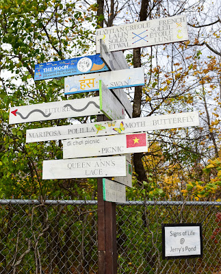
I'm not sure who is responsible for this collection of signs, which includes ones extolling the virtues of Queen Ann's Lace, butterflies and the varieties of herons in Ethiopia, as well as ones about Haitian Creole vs. French, the distance from the Earth to the moon and information about the Great Wall of China.

Make sure to check back soon for a write-up of my exploration of the IQHQ demolition site, as well as all things Alewife in North Cambridge, from the subway station to the linear path, the surrounding commermcial/residential developments that have sprung up in recent years and much more, all of which abuts or is close to Jerry's Pond and Rindge Avenue.

An Excellent Concord Barn

From Dave Brigham: I usually get cutesy with headlines, or riff on a song title or lyric. For today's post, I went with a straight-a...