Showing posts with label hidden history. Show all posts

Saturday, October 25, 2025

One Potato, Two Potato, a Million Potatoes

From Dave Brigham:

According to Spud Webb, this is the best monument in Boston. Spuds MacKenzie agrees. The Potato Shed Memorial along what's left of the Millers River in Boston's Charlestown neighborhood is something you have to seek out. I was willing to get fried in the sun one recent summer day in order to make a photo for y'all.

Sited near the end of a Route 1 off-ramp near New Rutherford Avenue, the memorial -- a stack of potato bags made of cast stone -- isn't something you happen upon. You have to know it's there, you have to have the starch to persevere and you have to care about this obscure bit of tuber history.

Many years ago, I was in this vicinity, checking out the North Bank Pedestrian Bridge with my son, and tried to find this monument. But I gave up, because my son wasn't into the hunt and we had other places to explore (see December 21, 2018, "The Under / Over from Cambridge to Charlestown").

But once I get a place like this -- obscure, a bit goofy and dedicated to a staple food -- in my head, I don't forget it. So I recently came at the monument from the other direction, and found it with ease. So Dave, I can hear you asking, what's the deal with the Potato Shed Memorial?

Ore-Ida, I'll tell you.

"In this area between the mid-1800's and the 1930's millions and millions of potatoes were off-loaded into storage sheds along the sidings of the Boston and Maine Railroad," the plaque begins. This area southeast of Bunker Hill Community College and next to the Charles River was once lousy with railroad tracks. The college is located on the former site of Charlestown State Prison, in the area known as Prison Point (see October 17, 2017, "Set Yourself Free on Prison Point").

The plaque continues: "Many residents of the Charlestown neighborhood regularly came to the Miller's River (Millers / Miller's, po-tay-to / po-tah-to) potato sheds to purchase their weekly supplies. Long-standing community members have first hand (sic) memories of their trips to the sheds. The potato storage sheds burned in the mid-1930's and were not replaced."

According to this Boston.com article, one man, artist Ross Miller, is "perhaps most responsible for the statue."

A visual artist who worked on the Big Dig’s Central Artery Arts Program in the 1990s, Miller "says he encountered Charlestown residents with vivid memories of the potato sheds and was amused by the idea of memorializing them," per the article. “'I sort of spearheaded the idea,' Miller said, adding that the pedestrian aspects of the massive infrastructure project were relatively 'overlooked.'"

He took charge. “There was a lot of freedom,” he said.

I hope you don't think this post was half-baked.

Saturday, March 29, 2025

Holy Moses! Look at These Old Tablets

From Dave Brigham:

Unlike Moses, I didn't need to ascend an Egyptian mountain to find amazing hand-carved tablets. Rather, my Mount Sinai moment came at the foot of a former trash heap in the leafy outskirts of Boston.

Somewhere, somehow (I really need to keep track of this stuff), I learned while minding my own business on the World Wide Internet about two large carved-stone blocks located along the Charles River in West Roxbury's Millennium Park. In a flash, I was gobbling up information at this blog post at And This Is Good Old Boston.

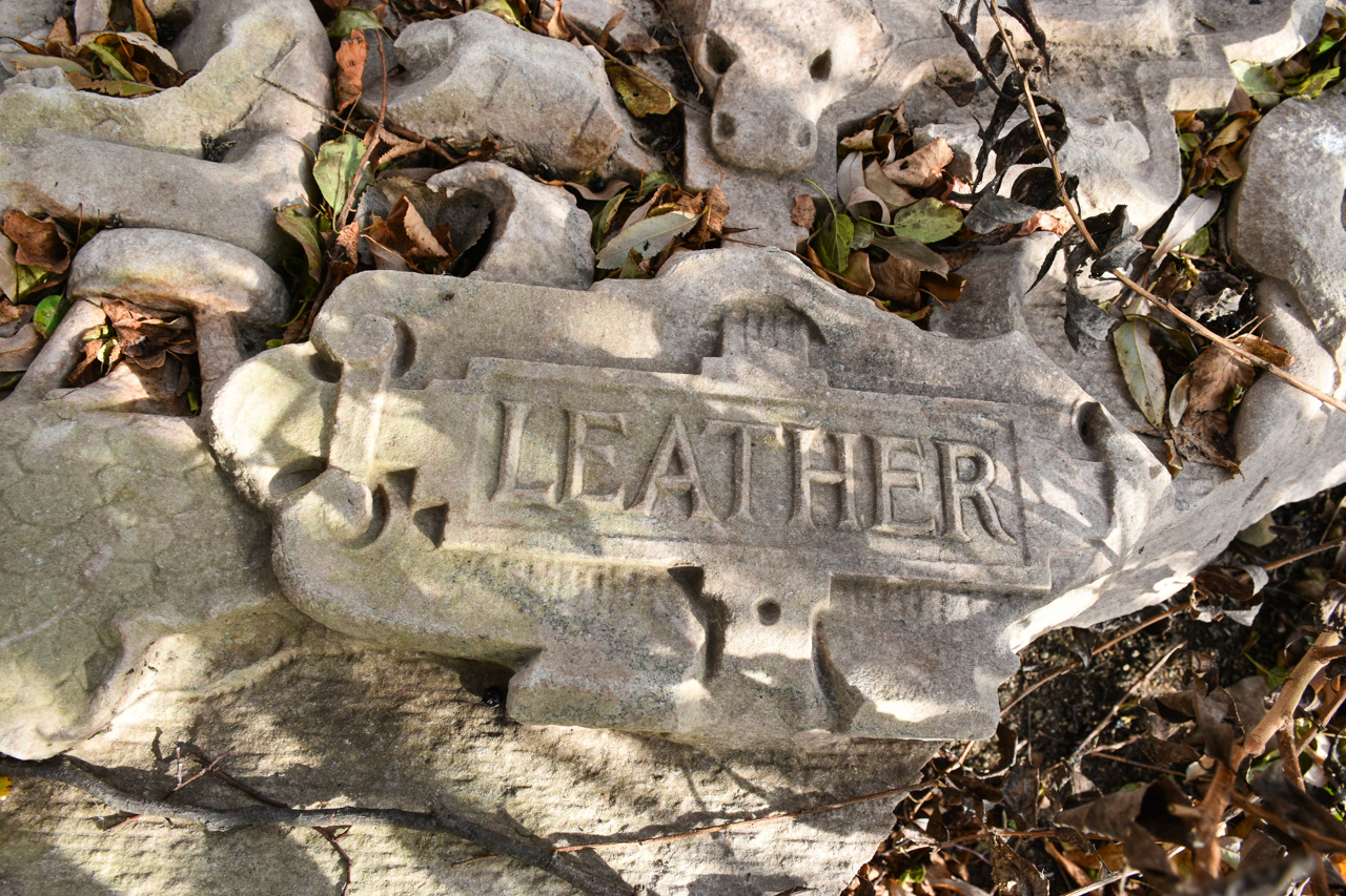
"The first is labeled 'Machinery' above the word are two machine gears, and to the sides are two classical figures swinging hammers," I read at the blog. "In the middle of the stone is a large shield, with a smaller American stars and stripes shield above it. On a ribbon running behind the American shield are the words E. Pluribus Unum....The second block is labeled Leather. Again, there is an elaborate shield in the center of the carving. This time, the smaller shield at the top represents the shield of the Commonwealth of Massachusetts."

Within relatively short order, I drove due south through several Newton villages and into West Roxbury. I parked in Millennium's kayak launch lot and followed the path at the western end, as instructed in the blog post. There were lots of families and couples walking dogs and generally enjoying a cool yet still warmer-than-normal autumn day.

I'd hiked a bit at the park a few times over the years, but I was still surprised at the steep angle of the former dump. At the top of the landfill cap are a handful of athletic fields, walking trails and a parking lot. But my quarry was located at the bottom of the hill, near the Charles River.

Sciatica pain be damned, I hobbled down the paved path, took a wrong turn, doubled back, and found a dirt path that seemed promising. I thought perhaps I was on the wrong trail, but when it turned left along the Charles River, I began to get a good feeling. And sure enough, about 30 feet past the lookout area where some folks had stopped to observe the river's drought-stricken water level, I found what I was looking for.

Despite knowing I would find them here, still I was fascinated (and dumbfounded) by these slabs. Measuring perhaps 5 feet by 3 feet, they are heavy and ostentatious and nearly otherworldly laying there just a few feet from where people hike every day. I sense your puzzlement. "What the hell are those things, and what are they doing there?"

"The seals were part of the 'First National Bank of Boston' façade," according to an anonymous commenter on the above-linked blog post. "I found some photos/ artist renderings along with a news article describing the building as having 5 of these carved 'plaques' in recognition of Bostons (sic) significant contribution to the textile industry."

While a subsequent commenter doubted whether that bank was the origin of the panels, further research by a Boston Globe reporter and the Boston City Archeologist confirmed that theory. "We pored over image archives and were able to find that the Boston Public Library had an image of the bank from 1910," the Globe article reports. "The tablets are just visible on the right side of the image, enough to confirm that the leftmost tablet is the 'Leather' tablet and the far right tablet is 'Machinery.'"

To see video of the tablets, check out this separate Globe article (I apologize if it's behind a paywall).

As I made photos, several people walked by. Since I was just a few feet off the trail, I assumed that to these folks, the discarded stone slabs were old news. I'm so happy I stumbled across mention of this bizarre treasure, because I never would have found myself walking along this part of the park, and if by some miracle I had, I likely wouldn't have noticed the large stone blocks.

While the detectives mentioned in this post were able to determine where the tablets came from, no one has definitively been able to say how they ended up in their current position. The First National Bank of Boston was demolished in 1944. "In the mid-20th century, the hill [now known as Millennium Park] was first used as a gravel quarry, resulting in a massive hole in its center," according to the Globe article featuring the city archeologist. "That hole became a convenient place to dump trash, so the city turned it into the Gardner Street Landfill, a municipal dump that was used into the 1980s. As the First National Bank was demolished during a time when the landfill was active, it’s likely that these and other fragments of the bank were dumped unceremoniously in West Roxbury."

These big chunks are pretty far from the old landfill site, located very close to the river. It's likely somebody dragged the stones there. But how long ago? And why?

For a post about another slab of stone sitting in a puzzling site, check out "I Seek Newton, Part III: Highlands", a March 23, 2016, post about the Newton Highlands neighborhood and Cold Spring Park.

Saturday, July 20, 2024

Going Coo-Coo Over a Dovecote

From Dave Brigham:

I suppose the word "dovecote" was in my lexicon before reading about such a thing on the web site of Antique Homes, but once I finished the article, I decided I needed to find the closest one to my house.

A quick Google search turned up one on the campus of Bentley University, less than three miles from where I live.

Located on Bentley's south campus, near Fenway Hall and the sports complex, the dovecote was once part of the Lyman Estate, a late-18th century National Historic Landmark also known as "the Vale." I'm not sure what the university uses the building for -- some sort of academic or administrative purpose, I guess. Dovecotes are used to house pigeons or doves, which is likely how the Lyman family used it.

The estate was built by Theodore Lyman, a successful shipping merchant from Maine and father of a Boston mayor by the same name, as well as grandfather to Theodore Lyman III, a U.S. Representative from Massachusetts in the 1880s.

Like me, you may be wondering, "Why did rich people keep doves and pigeons?" The National Trust in the United Kingdom has our answer: "On a practical level, doves and pigeons provided a source of food for the table, as well as feathers for the aristocratic household and manure for the estate. Doves were also valued for their religious significance due to their associations with the Holy Spirit in Christian thought....[T}o have a dovecote was an easily recognisable status symbol."

Coo coo....

Saturday, December 16, 2023

Ghost-Sign Busting Around Boston, Part I: Introduction, Inspiration and Indoctrination

From Dave Brigham:

INTRODUCTION

In June of 2020, I gave a Zoom presentation about Boston-area ghost signs to the Historic Resources Committee of the Boston Society of Architects. The committee's chairman, Jack Glassman, had enjoyed Nora McGreevy's article about these relics of the outdoor advertising world in the Boston Globe from October 2019, in which I was featured. Over the course of a few months, bit by bit, I put together a PowerPoint about these signs, which I document here on the blog (and on the Backside Instagram) whenever I spot them.

I'd never done anything of this sort before, so I was honored that Jack had tracked me down and made the offer. I've decided to serialize that presentation for my blog readers. While I post about these signs with some frequency, this series gives me an opportunity to share some of the history of the sign-painting industry, along with photos and context.

Many local photographers love these old signs as much, if not more, than I do. And most of them make better photos. But because of the volume of material I've cranked out here over the last 13+ years, for a brief period, I became the go-to guy for the old ghosts. I was also featured in Danny Mortimer's 2022 video about old Boston signs.

Without further ado (and a little bit of editing), here's part one of my Zoom presentation:

INSPIRATION

When I was a kid I collected several things: beer bottle caps, coins, baseball cards, pimples. The cards I collected mainly because my older brother did, and it was fun to take special trips to the small department store in my hometown -- Leaders -- that stocked everything from TVs and radios to candy cigarettes, posters, toys, small appliances and, of course, baseball cards.

I loved baseball, but unlike my statistics-obsessive brother, unless the cards featured Red Sox players, I didn’t care that much about them.

The coins and bottle caps were more important to me. They were mysterious. I couldn’t get them at the store. I had to hunt for them. And that meant walking around the neighborhood, the elementary school behind my house, the Little League fields where I played baseball, the nearby park where the volunteer firemen held their annual summer carnival.

My favorite bottle caps were from faraway places: England (Watney’s), Canada (Red Cap), Hawaii (Primo), Norway (Ringnes). They were much more exotic than the Piel’s caps that my dad popped off those little brown bottles once in a while.

Coins, however, became my true passion. My obsession began in elementary school one day, when I got a penny from Trinidad and Tobago in the change I received when buying milk. I was further inspired when I dug in the dirt behind a Little League field and unearthed a Mercury dime. Once I discovered a cache of old European coins among my dad’s Army stuff in the basement, I was totally hooked. I learned to check every penny to see if it was a “wheat,” which meant it was minted between 1909 and 1956. I closely monitored my change to see what other surprises would pop up.

My grandmother regularly mailed me old pennies. Before long, I had a box full of coins from countries including England, Germany, Russia, India and Canada, and American coins such as buffalo nickels, JFK dollars, Indian Head pennies and a seated Liberty dime, one of my prized possessions to this day.

This gives you some background on my longstanding interests in both collecting things and learning about history. While I still look for interesting coins in the decreasing amount of change I receive at stores, my current collecting obsession is shooting photos of the backside of America.

As regular readers known, the backside of America is where you’ll find collapsing factories, old railroad trestles, abandoned rail beds, historic named buildings, rusting cars in the woods, historic plaques and, of course, ghost signs.

INDOCTRINATION

From the late 19th century into the middle of the 20th, large-form murals painted on the sides of brick buildings and barns boldly advertised everything from soft drinks to cereal, restaurants to furniture businesses, tobacco products to livery stables, and much more. They were relatively inexpensive and were guaranteed to catch the eyes of folks walking and, increasingly, driving by.

Mass-production billboards competed with these more singular, single-business advertisements. By the middle of last century, electric signs began coming into vogue. And, after that, signs printed on vinyl were introduced. These were more economical and easier and quicker to install.

But as you’ll see later in this series, hand-painted signs are having a resurgence.

Being that they were painted, these older ads began to fade and peel in the elements. Or they were painted over or demolished along with whatever building they happened to be on.

Hunting them down has become something of an obsession with me and many other folks around the world. Any place there are old brick buildings or barns with large blank spaces, you might find an old advertisement, a fossil from a previous marketing age. For me, these faded signs are a connection to a more personal form of art. They offer a sense of mystery and intrigue: What does the sign say? Does that product still exist? What long-gone business used to be in that building?

I’d like to share with you some of the signs I’ve found in Boston and surrounding cities and towns. I’ve separated the signs into 10 categories, with some sub-genres included within that list. To finish up this first post, I'm going to focus on Drinks and Food, followed by Markets, Grocery Stores and Liquor Stores.

Coca-Cola ads are fairly popular as far as ghost sign subjects go.

This sign was on the side of a former dive bar in Waltham called Michael J’s. I don’t know how long it was there or whether it pre-dated the bar. Unfortunately, it was painted over a few years ago when the bar closed and Michael J's space was converted to apartments.

This ad is along Main Street in Watertown. It is located on the side of a building that for years housed Jack’s Smoke Shop. I don’t know whether the sign was related to the store or not. Nowadays, the space is occupied by Blue Moon Smoke Shop.

The next two signs combine Coca-Cola with restaurants, although the specific names of the eateries aren’t displayed.

This one is located in Boston’s South End. It is for a Southern fried chicken restaurant whose name has perhaps been lost to time.

This sign in Somerville's Union Square is an example of a ghost sign that has been restored. And then defaced, as you can see.

The next sign is different than what we traditionally think of as a ghost sign.

This isn’t a painted wall ad, but it’s still an advertisement of sorts from times gone by. Ice Cream Works operated in Brookline, Newton and Boston going back at least 30 years. This store is in Brookline. I’ve found out little about the mini-chain of stores. Subsequent to Ice Cream works, this space was home to an Emack & Bolio’s store. It’s now a veterinarian’s office.

As I've stated before on this blog, I document old signs and store names to preserve the past, to bring back people's fond memories of the hazy past. The next two signs, located in Cambridge, are some of the most iconic old ads in Greater Boston.

Located in Central Square, the Quaker Oats ad is a favorite of ghost sign junkies. The Quaker Oats trademark of a man in "Quaker garb" was registered with the U.S. Patent Office in 1877, according to the cereal maker's web site. The company eventually grew to a nationwide behemoth, and signs such as the one in Cambridge cropped up everywhere. There used to be one in Boston's Roxbury neighborhood, on Tremont Street.

The other Cambridge stand-out is one that has been restored almost to the point where I hesitate to call it a ghost sign.

Founded in 1888 in Boston's Roxbury neighborhood, Squirrel Brand is still a going concern. The company, which makes a variety of nut products, moved to Cambridge in 1899; it is now part of John B. Sanfilippo & Son out of Elgin, Illinois. The former factory was converted to 20 units of permanently affordable housing in 2002.

Let's wrap up this installment with some signs for Markets, Grocery Stores and Liquor Stores.

Mansfield Market once stood at the corner of Mansfield and Washington streets in Somerville’s Union Square, and sold Royal Crown Cola. I wish all ghost signs were this self-explanatory and easy to read. This space is now occupied by another small store.

The sign above is on Dartmouth Street in Boston's Back Bay, and is also fairly easy to read. I’m not sure whether D.A. Keefe & Company was located at this address, or somewhere else nearby.

Not all ghost signs are painted relics from 90+ years ago. I have no idea what the name of the next store was, although if I read Chinese I might.

Located in Boston's Chinatown, this market is next to a restaurant that has also shuttered in recent years. I recall walking by this store in the early ‘90s, when I worked in the Leather District, and seeing fresh fish flopping out of buckets of ice onto the sidewalk. That’s a cool thing about ghost signs: they can connect you with memories of places you once shopped or ate or walked by or wondered about.

In the course of working on this presentation, I discovered the great utility of Flickr, the online photo-sharing community. There, I found people who had done more research into, or had prior knowledge of, many of the ghost signs I was unable to identify. The one below is in the Field’s Corner area of Boston's Dorchester neighborhood.

I didn’t know what it said until I checked Flickr. It advertised Hackett & Company’s store, which sold groceries and liquor.

In Boston’s West End, I found a similar sign, along Friend Street.

Here again, I turned to Flickr. A user there who’d posted a shot of this sign identified it as The Old Marlowe Wine Company. Further, I found a user at another web site who provided additional information: “Bald Eagle Whiskey / Old Marlowe Wine Co. - Medicinally Pure”

Fascinating, right?!

In the next segment of this series, I will feature ghost signs for automotive/transportation companies, miscellaneous and unknown businesses, warehouse/storage operations, laundry outfits and more.

Saturday, December 9, 2023

Une Belle Surprise Along the French River

From Dave Brigham:

I explored Webster, Mass., recently, and the most impressive thing I stumbled across was in neighboring Dudley (see December 2, 2023, "Webster: Founded by a Famous Industrialist, Named for a Well-Known Statesman").

As I walked along Main Street in Webster, making photos of the many great late-19th century buildings, my gaze drifted up and to the west, toward two imposing gray towers rising in the near distance. "Is that a prison up ahead?" I wondered. "Or a Scottish castle?" I'd driven into Webster from that direction, but hadn't noticed that building, whatever it was.

It was, of course, an old mill, the one-time Stevens Linen complex, located on the western banks of the French River, right on the town line with Webster.

Founded in the 1840s by Henry Hale Stevens, the linen production company was built on the site of the former Merino Woolen factory, which rose in 1812, according to MACRIS. "The Merino Woolen Factory was one of the earliest textile manufacturing concerns established in the United States. It was a contemporary of Samuel Slater's mills established on the Eastern side of the French River in present day Webster."

I believe parts of the Merino mill were incorporated into the Stevens facility.

More from MACRIS: "The Steven's Linen Works prosperity and expansion (by the early 20th C. it was the largest enterprise in the United States devoted to the manufacture of linen towelling) is largely responsible for the decidedly urban character of East Dudley." According to the National Register of Historic Places registration form for the former mill's historic district, the Stevens facility was the "first, and last, factory in the United States to spin flax and weave linen cloth by machine."

The mill, which operated under other names, but by the Stevens name for the longest time, is slated for redevelopment, I was pleasantly surprised to find out. I wrote that sentence after reading this press release from the Town of Dudley, which was issued in February of this year. Further research, however, leads me to believe I might need to put a pin in my above statement about a new life for the old mill.

In August 2020, property owner "Stevens Mill Owner LLC of Columbia, SC, bought the 6.95-acre property and its 267,000-square-foot mill at 8 Mill Street," according to the press release. "Project developer Camden Management Partners, who holds Stevens Mill Owner LLC, proposed a $43 million plan to renovate the mill into 156 apartments, a public event space, a possible tap room, and a river walk along the adjoining French River."

Sounds good, right? But despite a quote in the release from a financial consultant indicating, "The project isn’t at risk," and that "The delays up to this point are normal and customary as it related to making sure we have an accurate historical renovation," I saw no signs of anything happening at this site. And online searches for Camden Management Partners and its financial consultants, Weddle Real Estate Investments, didn't overwhelm me with confidence. The former has no web site, while the latter's indicated that the connection isn't private, and I was warned that the site might be an imposter. Here's hoping things move forward with this project.

Saturday, October 1, 2022

Head Out On the (Colonial) Highway

From King Nutmeg:

Get your horse and cart runnin', head out on the Colonial Highway!

What's that you say? You have not a horse nor a cart? Well, then put on your best hobnail boots and walk alongside. We're going over the mountain! We'll gather nutmeg and pippins to accompany our potted meat and pepper cake. What a feast we shall have when we dost arrive in Hartford!

Hmm. Methinks this path has been overtaken by Satan! Or perhaps the glawackus has frightened away those who maintain the highway. Oh bugger!

Shall we gather our scramasaxes and carve a path? No, well what then?

What ho! Dost I spy an inn? There shall be much jollification this evening!

...Sorry, lost my mind there for a minute.

I stayed at the Avon Old Farms Hotel in Avon, Connecticut, recently. A friend told me about a sign for an old pathway behind the hotel. So I found it. What I couldn't find was any information about this "Colonial highway." I find it odd that a hotel would erect a sign for the sole purpose of driving history buffs like me absolutely crazy. But that's what these fine folks did.

Is this a remnant of a private turnpike, like many others built in Colonial New England to allow greater ease of movement throughout the territory? Perhaps. These turnpikes charged tolls to pass through, but the private companies that operated them weren't necessarily raking it in.

"The financial success of individual Connecticut turnpikes varied greatly, depending on the volume of traffic and the availability of nearby public roads that travelers could use to avoid a particular turnpike or toll gate," per the article linked above. "Only 20 of the 100 operating turnpikes in Connecticut during the 19th century showed profits ranging from 3-10% for 10 years or longer....Many individual turnpike corporations found themselves unable to maintain their routes as required by their charters due to low revenues, so their roadways were returned to public ownership and toll-free travel."

Anyway, it's a cool little bit of hidden history.

Here's the inspiration for the headline on this post:

Saturday, June 4, 2022

Brewing Up Memories of Boston's Past

From Dave Brigham

Beer, as somebody once said, is neat.

Arye Gross's character on the "Ellen" sitcom may have been the first to utter that praise. He was mocking some wacky young folks who were half in the bag. Anyway, the who, what and where aren't important. Rather, it's the sentiment that counts. Beer is, indeed, neat. Or, as folks living in Boston at the heyday of the city's brewery industry in the late 19th and early 20th centuries might have said, beer is the cat's pajamas.

For years, I've wanted to explore Boston's Jamaica Plain and Roxbury neighborhoods, where in the early 20th century there were two dozen beer breweries located near Stony Brook. I recently made that dream a reality. I found nine former brewery sites, and, unfortunately, missed at least one. But I'm ok with that. I just wanted to learn some history, walk around parts of Boston I've never visited and make some photos.

Some of the old breweries have been turned into housing, office, retail and storage space. One even has a brewery in it! As you'll see, some have been sitting vacant for decades and are falling apart and, most likely, are awaiting the wrecking ball.

Let's start at the western end of Heath Street, near the Jamaica Plain VA Medical Center.

The former American Brewing Company complex has been redeveloped into 79 loft-style condominiums. The American Brewery Lofts "feature soaring 14-23 foot ceilings with historic brick walls, exposed modern metal beams, and bamboo floors," according to a listing on the Maloney Properties web site. "Most units come with a private deck or porch."

The brewery was active from 1891 to 1918 and from 1933 to 1934, according to this Jamaica Plain Historical Society web page, which I will use throughout this post.

"The American Brewing Co. was associated with James W. Kenney a native of Ireland who came to the U.S. in 1863," per MACRIS. "Kenney was the founder in the Roxbury/Jamaica Plain area of the Amory Brewery on Amory Street (1877), and the Park Brewery (1882) and Union Brewery (1893-4)-- both located on Terrace Street, off of Heath. In addition, Kenney also was active in the establishment of the American Brewing Co. and initially was a member of its board."

MACRIS continues: "During Prohibition, the brewery was occupied by the American Storage Warehouse Co. and was used on its lower floors for the storage of baled cotton and wool. When the 18th amendment was repealed, the Haffenreffer Brewing Co. purchased the complex and used the plant primarily for storage of stock and bottles. In 1958, the buildings were sold to Fraser and Walker a Brookline-based business needing additional space for their furniture storage and moving operations."

While the American Brewery Loft complex represents the best possible outcome for a former beer-bottling plant, the old John R. Alley Brewery just a short distance east on Heath Street showcases the worst.

(Notice "JRA" carved above the door.)

Alley started his own brewery after leaving Rueter and Alley, a beer maker active from 1867 to 1885, according to the historical society article. I'll discuss that company below. Active from 1886 to 1918, Alley's brewery "was also known as the 'Eblana' brewery because it produced 'Eblana' Irish Ale; Eblana being the Greek word for Dublin," according to the article. "Frederick and George Alley took it over in 1898 when John R. died. It continued operating until Prohibition.

So, Prohibition.

From History.com: "The 18th Amendment to the U.S. Constitution – which banned the manufacture, transportation and sale of intoxicating liquors – ushered in a period in American history known as Prohibition. Prohibition was ratified by the states on January 16, 1919 and officially went into effect on January 17, 1920, with the passage of the Volstead Act. Despite the new legislation, Prohibition was difficult to enforce. The increase of the illegal production and sale of liquor (known as 'bootlegging'), the proliferation of speakeasies (illegal drinking spots) and the accompanying rise in gang violence and other crimes led to waning support for Prohibition by the end of the 1920s. In early 1933, Congress adopted a resolution proposing a 21st Amendment to the Constitution that would repeal the 18th. The 21st Amendment was ratified on December 5, 1933, ending Prohibition."

And just like that, an entire industry was wiped off the face of the nation. Well, officially anyway. Many of these breweries found new purposes during Prohibition. The Alley brewery was used as...something. The historical society indicates the site became a Canada Dry Ginger Ale bottling plant during and after that odd time in U.S. history.

MACRIS, however, indicates that the soda company didn't acquire the facility until the late 1930s and used it through the following decade. During and immediately after Prohibition, the Massachusetts Historical Commmission resource says, "the Alley brewery buildings were used for wool warehousing and by the Randall-Faichney Co. -- manufacturers of surgical, veterinary, and medical equipment."

"In January 1960, Hampden Automotive Mfg. Co....was granted permission to block-up most of the windows,and the former brewery became used...to function as a manufactury for the repair, construction, and assembling of automobile parts," MACRIS continues. That report dates to 1985; I'm guessing Hampden was the last manufacturing occupant of this building. I suppose squatters and others have used, and continue to use, this site.

There is a second building on the site, which is also in horrible shape.

I don't know whether anything here is salvageable, or if these buildings will be torn down someday.

Continuing east/southeast on Heath Street, just before reaching Columbus Avenue, is #31, former home of Roxbury Brewing Company. I drove past this building and took notice of it, but didn't realize at the time that it was part of Boston's brewing history. "It was active from 1895 to 1899 and was owned by William G. Titcomb of Providence," according to the historical society. "Its short life was due to under-capitalization. Rueter & Company bought it and produced 125,000 barrels a year there."

A short distance away, where Heath Street becomes New Heath Street for about 200 feet, is where we find the refrigeration building of the former Rueter & Alley Highland Spring Brewery.

(Bracing holding up the left side of the building.)

(Lovely detail on the old storage building.)

Active from 1867 to 1885, according to the historical society document, the Highland Spring Brewery "produced Irish style ales and it was the largest ale and porter brewery in the United States in the 1870’s." The company name changed to Rueter & Company after John Alley left to start his aforementioned own brewery on Heath Street. Rueter & Co. operated under that name from 1885 to 1918."

In the large parking lot next to this building, there was a larger brewery building. I'm not sure when that was torn down. According to MACRIS, it connected via underground tunnel to the building below, which is located on Terrace Street, backing up to the Orange Line/commuter rail tracks.

Of course, we know that in 1918, Prohibition became the law of the land. "This plant closed in 1919 and was thereafter used as a warehouse by Oliver Ditson Company, the Boston music-publishing firm," according to the historical society. You can see the name of that company, one of the major music publishing firms in the country, at the top of the building, chiseled into stone for all eternity.

According to MACRIS, the building during the 1920s was also "owned and used by the Highland Chocolate Co."

During the Depression, "Croft Company, making Croft Ale, remaining active from 1934 to 1953, reopened it as a brewery after Prohibition. Mr. Croft had been a brewmaster for Rueter and Alley. One of the buildings stayed active until [the late '90s or early 2000's] as Rosoff Pickle factory until it was bought by Hebrew National Co. and moved to New York," according to the historical society.

At some point, this building was converted to the Oliver Lofts residences.

There were more breweries further north on Terrace Street. "[A]t 94 Terrace Street, the Park Brewery, active from 1881 to 1918, produced only Irish Ales," according to the historical society. "One building, now Frank’s Auto Body Shop, remains on the site. The wood siding on the building covers the original brick." I believe that is the building is now occupied by D&M Auto Body. I did not make a photo of that building, as I didn't realize when I was exploring, that I should have.

Across Terrace Street was the Union Brewery, which was in operation from 1893 to 1911. "It produced only German Lager beer. It had a large six story, arched, main building and two smaller buildings housing a stable and a powerhouse," the historical society indicates. "The two smaller buildings and the mural-decorated smokestack, which now also does duty as a cell phone tower, remain."

The murals are unbelievable. They served as great marketing tools to draw customers in to Mississippi’s Restaurant, which for many years occupied the former stable.

I'm not sure when the eatery went out of business, but I'm guessing this place was amazing while it was open.

Follow Terrace Street north a short way, cross Tremont Street and you'll be on Gurney Street. In a quick minute, you'll be looking at the former A.J. Houghton & Company Vienna brewery at the corner of Station and Halleck streets.

"[A]ctive from 1870 to 1918....[i]t occupies the site of the old Christian Jutz brewery built in 1857," according to the historical society. "The Vienna Brewery had originally been located across the street where it was owned by Messrs. Houghton and Cole of Maine and Vermont. They bought the Christian Jutz property and moved their main operations across the street, converting their original property to a stable to house their several transport horses. Here they produced Vienna Lager from a German recipe. The lighter German and Austrian Lager beers came into favor in the 1850’s and 60’s displacing the heavier English/Irish Ales. Besides Vienna Lager, they made Pavonia Lager Beer, Vienna Old Time Lager and Rockland Ale."

The name "Rockland" will show up again below.

MACRIS indicates that this property's common name is the Great Eastern Packing and Paper Stock Compamy.

This property is now owned by Wentworth Institute of Technology, which operates a parking lot on the majority of the site. The parking lot is where the Burkhardt Brewery once stood, wrapping around the Vienna beer-making operation. Active from 1850 to 1918, Burkhardt was where a certain Rudolph Haffenreffer began his career, eventually rising to brewmaster. We'll learn more below about the man whose progeny created the infamous "Green Death" malt liquor in later years.

Gottlieb "George" Burkhardt and his son, Gottlieb Jr., ran the brewery until Gottlieb Senior died in 1884, according to the historical society. That operation continued until -- wait for it -- Prohibition. "It stayed open, however, until 1929 producing cereal and other grain products during the dry period," according to the historical society. Wentworth planned at one point to put a hockey rink on this site, until it was made a Boston Landmark. I'm not clear at what point that designation was ignored, and the building was torn down.

Below are some more shots of the Vienna brewery.

After checking out the Vienna site, I headed to Washington Street to admire the wonderful old Franklin Brewery building.

Built in 1894, this Queen Anne fortress was a brewery until -- you guessed it -- 1918. Iin 1900, "the Franklin Brewery became a branch of the Massachusetts Brewery Co., a consortium which included the American Brewery at 249 Heath Street, the Alley Brewery at 123 Heath Street, H. and J. Pfaff Co. at 1276 Columbus, and the Robinson Brewery at 55-71 Amory," per MACRIS. The brewery was named for nearby Franklin Park. "Its beautiful façade was hidden from view by the elevated railway from 1912 until 1988," according to the historical society article.

"Around 1918, the Franklin Brewery building was vacant and a year later was owned by the Union Wool Co. and used for storage. By the 1920's, 3179 Washington had become the home of the D.W.. Dunn Storage Company.

Today, this beauty is home to Extra Space Storage.

(The rear of Franklin Brewery.)

One-third of a mile west of the old Franklin place is the old Haffenreffer Brewery on Bismark and Germania streets.

(The smokestack was refurbished in late 2016. See my December 9, 2017, article: "Artist Thinks: I HAF to Fix That Smokestack").

The Haffenreffer brewery "was active from 1870 to 1964 and reigned as queen of the Jamaica Plain fleet of breweries," according to the historical society. "Rudolph Haffenreffer had been brewmaster at Burkhardt’s brewery and had married Burkhardt’s niece. He then left Burkhardt’s and started his own brewery which was to become the last operating brewery in Boston."

"It was a 14-building complex with a tower building, main brewery, storage building, paymaster’s office, stables, and an extensive bottling plant, etc.," the historical society continues. "...Underground steam pipes connected many of the buildings, including Haffenreffers’s house next door at 21 Germania Street....After closing in 1964 it was a storage warehouse including garages and artists’ accommodations as well."

I drank Haffenreffer a few times during my high school and college years. I enjoyed the rebuses inside the bottle caps more than the malt liquor itself.

For years, the old brewery complex has been owned by the Jamaica Plain Neighborhood Development Corporation. Fifty percent of the small businesses located on site are owned by women and people of color, according to the organization. More than 500 people are employed here.

Among the tenants are: Bikes Not Bombs, which refurbishes and sells used bicycles; the Children's Music Center of J.P.; Fresh City Kitchen; silkscreen printer Migrant Winds; and Boston Beer, brewer of Samuel Adams, which brings the orignal use of this complex full circle.

(There is some cool artwork on the outside walls of the complex.)

I am saving my favorite old brewery for last. While researching this post and another one in which I covered other cool stuff in this area (see May 21, 2022, "Circling Boston's Geographical Center"), I found myself cruising down Amory Street on Google Street View. And I swear, people, I thought I saw a mirage. And I hoped and prayed that by the time I got to this location, the building I was ogling would still look the way it did on my computer, for I knew that there was redevelopment afoot.

Well, I needn't have worried.

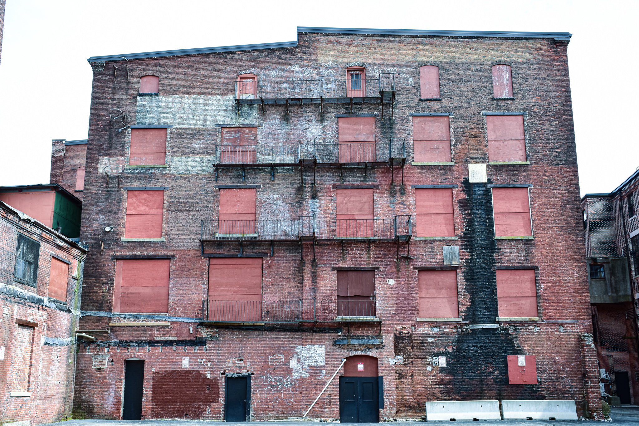
Something about the faded and white-washed red brick, combined with the boarded-up windows and the ghost signs -- one easy to read, the other indecipherable to me -- gives me the feeling I'm on a movie set. For such an iconic building, there isn't a very lengthy brewery history here. This site was only active from 1884 to 1902, according to the historical society, apparently as the Robinson Brewery and the Rockland Brewery.

After that short tenure, the buildings were in use as a plant for the Trimount Manufacturing Company, which made plumber's tools. In more recent years, it was home to a futon factory and artist lofts, per MACRIS. I believe at this point there are apartments, offices and small-business space in part of this complex.

(I'm not sure whether this sign advertises a bike shop, or is just a random sculpture.)

(This building has recently been redeveloped. An image on Google Maps shows a ghost sign, perhaps for Trimount, on the side.)

(For the life of me, I can't read these signs.)

Of course, I had to check out the backside of this backside treasure.

If I had to guess, I'd say this section of the complex is being used for storage. Of a LOT of stuff.

So, I hope you had your fill and drank in all of these great old breweries. Of course, we are living in a new age of beer brewing in Boston. In addition to Boston Beer Comapny, brewers in the area include: Harpoon, Trillium, Night Shift, Dorchester Brewing, Turtle Swamp and Jack's Abby.

For more about this area of Boston, see October 16, 2019, "A Mission to Find the Mission of Mission Hill."

New Balance Draws a Red Line with Diner

From Dave Brigham: I can't be expected to know everything about the backside of America, nor of Massachusetts or even of Boston. But I...