Showing posts with label nature. Show all posts

Saturday, September 21, 2024

Franklin Park Is Ruin-ed

From Dave Brigham:

Like Ben Franklin with the kite, gettin' over with the key, I was shocked into action when I realized how little I knew about the jewel of Boston's park system, the largest component of Frederick Law Olmsted's Emerald Necklace: Franklin Park.

In May of this year, I wrote about the wonderful remnants of a Franklin Park superintendent's office (see May 11, 2024, "Learning About Boston's Schoolmaster Hill"), as well as the stadium at the park (see May 18, 2024, "Stadiium Tour in Franklin Park"). Near the end of 2019, I posted about the Franklin Park Zoo's old bear dens (see December 18, 2019, "Having a Bear of a Time at the Zoo").

Still, I realized after those most recent adventures just how much more there is to the park. So I explored further. Here's what I found.

I started my tour at the Ellicott Arch and adjacent 99 Steps.

(The lower end of 99 Steps, located in the southwestern corner of the park, just off Circuit Drive.)

(Ellicott Arch, which passes under Circuit Drive.)

(Inside the arch's tunnel.)

As mentioned above, this expanse was designed by renowned landscape architect Frederick Law Olmsted. It is his nephew and adopted son, however, who gets credit for designing the Ellicott Arch. John Charles Olmsted and his brother, Frederick, Jr., took over their father's firm after the elder man retired. The arch, constructed of Roxbury puddingstone taken from the area, was completed in 1899. The 99 Steps, which are made of the same stone, wind up into the wooded area of the park known as the Wilderness.

I've been unable to find out for whom the arch is named.

Mid-way up (or down, I suppose) the steps is a plaque detailing things that were illegal when the park first opened (and, presumably, today).

"It is against the law for anyone when in the park...to make outcries, orations, or harangues...play hand-organs...use vile, profane, or threatening language..." the sign says in part.

Not too far away from these architectural beauties is a more rough-hewn work of art, albeit one that's had a tough time of things in recent years.

Located near a swampy area below some cliffs, the Wizard of Franklin Park is a shadow of its former self, from what I understand. In late May 2021, Universal Hub ran an article about the rebirth of the Wizard: "Earlier this month, as people were beginning to notice fires being set in Franklin Park, whether intentionally or through cigarette carelessness, a Jamaica Plain resident discovered that among the victims was the tree wizard that had long sat in the hollow of a tree in the park's Wilderness area off Forest Hills Street - not just set on fire, but hacked up as well."

Pardon my French, but what the fuck is wrong with people? Who sets fires in a park as glorious as Franklin Park? And who attacks a harmless wizard painted on a tree?

The article continues: "Alex Cook, who knows something about outdoor art, went out a few days ago and rebuilt and repainted the tree wizard." So that was more than three years ago. When I visited in March of this year, the tree looked like it had perhaps been set ablaze again.

While I knew about the Wizard, the arch and 99 steps from advanced research, I wasn't aware of other sites of interest I would come across.

These stone walls are located in the northeast section of the aforementioned Wilderness area, near what are called the Valley Gates. According to this excellent blog post, this area was to be known as The Ante Park, a section "[s]eparating the two halves [of the park], putting a physical and psychological barrier between the natural enjoyment and the community uses of the park."

The natural enjoyment section included the Wilderness and the Country Park, the latter of which is now Franklin Park Golf Course. The community-oriented part was the Greeting (now the Franklin Park Zoo) and the Playstead, home of White Stadiium and other ruins that I will discuss below. The wide lane you see in the first photo above was once known as Glen Lane, a road running through the Valley Gates from Washington Street to Blue Hill Avenue, according to the blog.

Like me, the blog's author was mystified as to the original purpose of the stone walls. I highly recommend reading the entire post, but here's a summary of what the writer found out: he thought at first maybe these were remnants from the zoo, but learned quickly that that wasn't a good guess. He next considered it was an area for park visitors to keep their horses. Nope. Finally, after more intense map reviewing, "I saw that the rocky alcove existed in 1884! [On the map] the space is clearly marked right where I saw it....Which means that it was not part of the Franklin Park plan, but a remnant of some pre-Park farm or home."

Nice detective work!

OK, let's move on to the ruins near White Stadium.

This is what's left of the Overlook, "an 800-foot-long viewing platform elevated above The Playstead," according to this Boston Preservation blog post. "There was a shelter heavily designed by Olmsted on top of the The Overlook. The City allowed it to fall into disrepair and a fire took the building. It is now only a ruin today."

The Overlook was a place for people to gather and watch sports, ceremonies and other exhibitions taking place below, in the Playstead. Judging by the ruins, it was quite a structure.

(Remnant of a water fountain near the Overlook.)

The last two features I want to highlight are two statues at the Playstead entrance to the zoo. I've walked past these works of art many times over the years, but hadn't really appreciated them.

You are likely familiar with the Lincoln Memorial in Washington, D.C. Well, the same artist who sculpted the massive seated figure of our nation's 16th president, Daniel Chester "D.C." French, created the works outside the zoo. The one above is known as Labor; it is "fifteen feet high and consists of a seated Labor in leather apron with his right arm on an anvil which also protects a mother cradling her baby," according to this Jamaica Plain Historical Society blog post. "At his right is the rhythmic figure representing Arts."

The statue's full name is Labor Supporting the Arts and Domestic Life.

Labor and its partner, Science (The Forces of Steam and Electricity Subdued and Controlled by Science) (seen below), were created in the late 18th century for the former Boston Post Office and Subtreasury Building. "[T]he figure Science is a seated woman with her foot resting on a closed volume, representing her concealed secrets," per the historical society blog post. "Crouching at her feet is a gigantic slave with his hands chained to a steam locomotive wheel. Standing at her right is an energetic young man clutching a thunderbolt as the Spirit of Electricity, his youth symbolizing the emerging potential of the new resource."

Erected in 1885, the statues were situated approxiately 100 feet above Congress Street flanking a two-story entry arch. "They were among [the] largest sculptures in the city; they joined the Soldiers and Sailors monument on the Boston Common...the Charlestown Soldiers and Sailors monument...and the George Washington monument at the Public Garden," according to the blog post.

As amazing as the statues are, and as beautiful as the post office building was, the pairing would not last. "The Pubic Buildings Act of 1926 authorized $165 million for new federal buildings and the city of Boston applied for and received an appropriation to replace the 1885 Post Office and Subtreasury Building," the historical society continues. "By the end of December, 1929, the massive city block-long building had been razed."

The statues were removed from the building before its demolition, and offered to the City of Boston. On September 17, 1930, the statues, with new granite pedestals, were revealed to the public at the zoo as part of the celebration of the 300th anniversary of Boston's founding. The site where the statues originally stood is now the John W. McCormack Post Office and Courthouse Building, located in the heart of Boston's Post Office Square.

I strongly encourage my readers to explore Franklin Park. There is still plenty of the site that I haven't checked out; I hope to return soon.

Saturday, June 29, 2024

Skirting a Superfund Site to See Some Ruins

From Dave Brigham:

Located in a "four corners" area where Acton, Sudbury and Maynard meet with the southwest corner of Concord, Powder Mill Woods Conservation Area is a peaceful little oasis with an explosive past.

Nestled between residential developments, the Thoreau Club (about which more below) and a Superfund site (also about which more below), Powder Mill Woods is the latest tucked-away area of intrigue I've explored in Concord (see April 20, 2024, "More Military Relics in the Home of the American Revolution" and December 4, 2012, "Concord, Part I: Old Rifle Range").

"The area has a 100-year history of gunpowder manufacture, the depressions in the landscape ideal for protecting individual buildings," according to the Town of Concord's Powder Mill Woods Trail Guide. "Trails follow 19th-century cart paths and narrow gauge railroad beds once used to move materials among separate buildings of the production process."

I knew from looking at the trail guide ahead of time that I'd stumble across the twisted rails shown below, but I still was pleasantly surprised.

"These narrow-gauge rails are relics of a railroad used by the American Powder Mills and other gunpowder manufacturing companies that once operated here," according to a sign posted next to this display of gnarled metal. "Horse-drawn rail-mounted carriages hauled materials on the railroad from as early as 1880 until at least 1913."

There are other small remnants spread throughout the woods.

As I strolled along, I was aware of fences and "No Trespassing" signs along the northern perimeter. That's because between the conservation area and Main Street, there is the Nuclear Metals, Inc., site. "The Nuclear Metals, Inc. site – also known as the Starmet Corporation site – is located on a 46-acre parcel in Concord, Massachusetts," according to this U.S. Environmental Protection Agency web site. "Nuclear Metals made depleted uranium products, primarily for armor-piercing ammunition. It also manufactured metal powders for medical applications, photocopiers, and specialty metal products such as beryllium tubing used in the aerospace industry. From 1958 to 1985, waste was discharged into an unlined holding basin. Facility operations contaminated soil and groundwater with hazardous chemicals. Following immediate actions to protect human health and the environment, the site’s long-term cleanup is ongoing."

I'm not sure what will become of the site once it has been cleaned up entirely.

I knew from the trail guide that there were ruins in the area, so I kept tromping until I found them.

Gunpowder production began on this site in 1835. "At its peak, production involved forty buildings scattered throughout the 400-acre area in Acton, Concord, Maynard, and Sudbury," according to the trail guide. "The mills produced 1,000 lbs. (450 kg) of gunpowder per day during the American Civil War."

"Ruins of these buildings and the roads between them can still be found in the land along Forest Ridge Road, both sides of Route 62, and in the Thoreau Club property. Remnants of a large concrete building can be seen beside the old roadbed that passes through the northeast corner of the Thoreau Club land."

Those concrete ruins are what I photographed here.

Nearby I checked out some cabins associated with the Thoreau Club's summer camp.

The club was founded in 1951 by Clifford and Dorothy Pulis. The camp "was the fulfillment of a dream to create a day camp where they could share their love of nature, the outdoors and their camping expertise," per the club's web site. "Incorporating their own wilderness camping experiences and a quote from Henry David Thoreau’s Walden, 'Every morning an opportunity to make life of equal simplicity with nature,' the...Pulis team created a unique camp environment that captured the feeling of the deep woods of Maine in rural Concord, MA."

Saturday, April 20, 2024

More Military Relics in the Home of the American Revolution

From Dave Brigham:

My hour-long hike through the Annursnac-Baptist Brook Conservation Area would have been perfect, but for the distant whine of leaf blowers. Sure, I was wandering through Concord, Mass., not the Australian outback, but is it too much to ask on a Sunday afternoon in late fall for folks to lay down their gas-powered lawn tools so an ordinary schmuck can have a peaceful walk through the woods while looking for ruins?

While I enjoy walking in the woods just for the heck of it, or to exercise my dog, I prefer doing so if there's a backside payoff. So when I learned that this conservation area had a history including not only military vestiges, but also remains from research done by the World's Greatest University, I knew I had to check it out.

This isn't the first time I've hiked through Concord seeking military relics. In the early days of the blog, I learned about a World War I-era rifle range in the tony Boston suburb, and sought it out (see December 4, 2012, "Concord, Part I: Old Rifle Range").

As for my Annursnac hike, within two minutes of setting out, I was looking at the foundation of an equipment storage building that was part of Harvard University's antenna research and test site in the late 1940s and into the following decade. Harvard purchased 63 acres of farmland in this area in 1949 for use by its Departments of Physics and Applied Science, according to this Town of Concord trail guide.

According to the web site for Harvard's John A. Paulson School of Engineering and Applied Sciences, in 1938 Ronold W.P. King joined the school's faculty (he would remain at Harvard until at least 1972). From King's Wikipedia entry: "His research group at Harvard spent the 1940s and 1950s developing the theory of antenna (radio), using the cylindrical antenna as a boundary value problem subject to Maxwell's equations....King is responsible for the inverted-F antenna, the most widely used antenna in mobile phones. However, he did not develop this antenna for that purpose. Rather the intended use was missile telemetry."

Further along the trail, I spied more ruins, this time a long-fallen antenna base.

After spotting the remnant of that downed radio tower, I was on high alert. Soon after, I was able to make out what was left of a utility pole.

Also in this area, I saw a curious site, which may not date to the days of Harvard's research program, but it surely is pretty damn old.

While all these sightings were great, the best was yet to come.

"At the northwest corner beside the main trail are the ruins of a 41-foot by 24-foot concrete structure and radio tower," per the Town of Concord trail guide. "Coinciding with the development of Hanscom Air Base in 1941, the U.S. Army Air Corps leased 16.5 acres to build and operate a facility for tracking aircraft arrivals and departures from the airfield, and as a radio direction/finder station. The structure is believed to be part of that installation....From 1959 to 1969 it was an off-base installation known as the U.S. Air Force Strawberry Hill Electronics Research Annex."

Man, I love to learn about stuff like this. What was once farmland was turned into not one, but two, installations related to antennas and aircraft tracking, and then, after the lifespan of those projects ended, nature reclaimed the land (helped by conservation efforts).

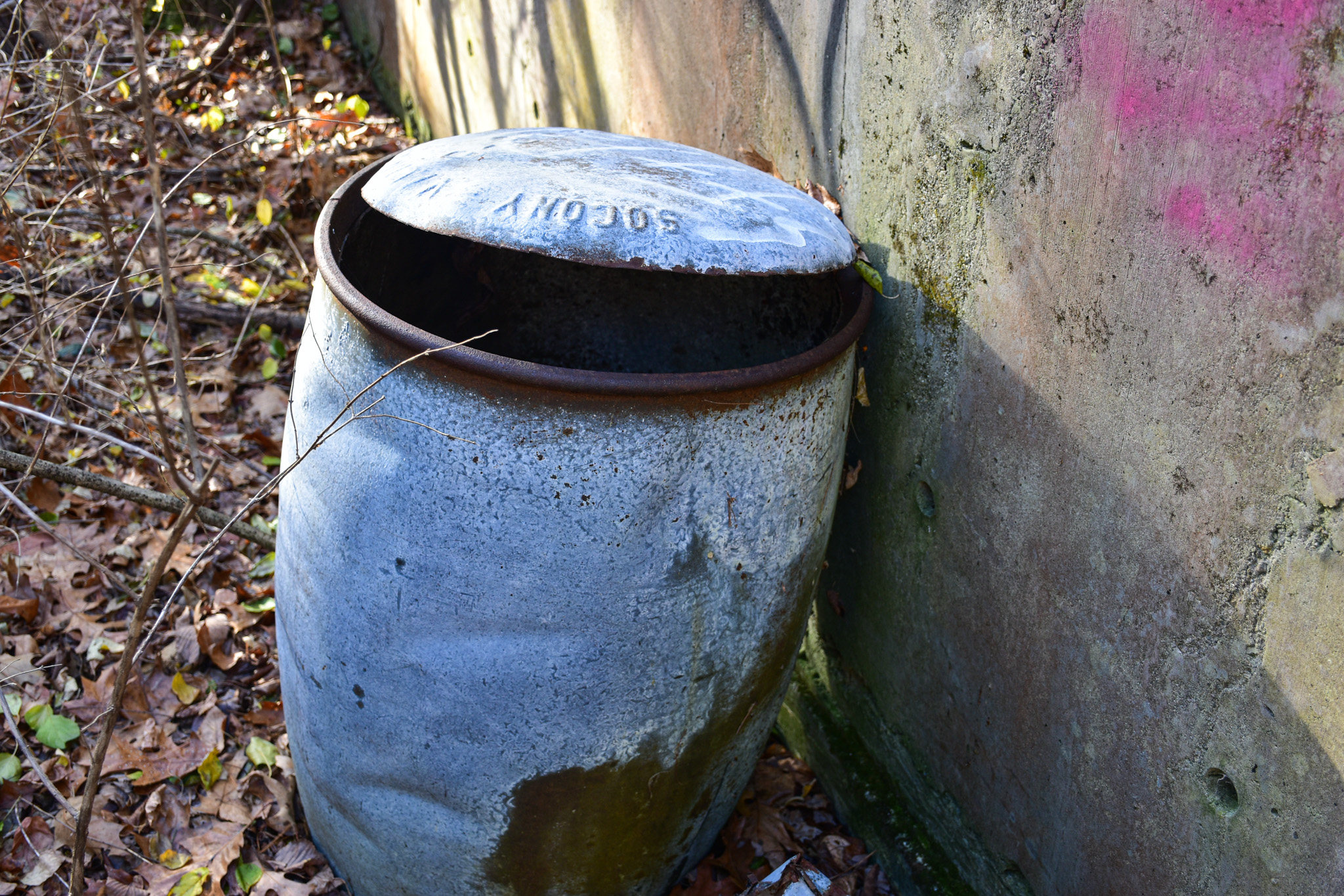
As with many places like this I come across, it's obviously a major hangout for kids/teens/twentysomethings. I was intrigued by a barrel at this site, with the word "SOCONY" on the top.

A quick Google search turned up that SOCONY stood for Standard Oil Company of New York, one of the 43 entities created by the 1911 Supreme Court decision breaking up Standard Oil. In 1931, SOCONY merged with Vacuum Oil Company, "from which the Mobil name first originated," according to Wikipedia. "Over time, Mobil became the company's primary identity, which prompted a renaming in 1955 to the Socony Mobil Oil Company, and then in 1966 to the Mobil Oil Corporation."

I can't be sure that this barrel is one used for oil on the old U.S. Army Air Corps site, but I'd like to think that some kids dug it out of the woods a long time ago.

As for the Annursnac trail, it continues north into neighboring Acton, and becomes the Stoneymeade Conservation Land. Click that link and read about what you'll find on the conservation land, and learn about the history of Stoneymeade Farm, which dates to Revolutionary War days.

Saturday, March 30, 2024

Finding the Fascinating Ford's Folly

From Dave Brigham:

After easing into the parking lot for Nobscot Conservation Land in Sudbury, Mass., I hiked down a relatively easy path, stones and tree roots here and there adding a small degree of difficulty. Stone walls ran along the path and through the woods, marking off long-ago property lines for farms. I passed a friendly middle-aged couple and their two dogs, as well as an unfriendly youngish dad and his young daughter. The occasional acorn fell through the leaves, bouncing its way to a short-lived freedom. Birds chirped lazily. Critters skittered through the underbrush.

In less than 15 minutes I'd made it from the parking lot on Brimstone Lane, which sounds like it was named by a craggy-faced Colonial minister, to a failed dam built nearly 100 years ago by the man who revolutionized factory production with his assembly line schemes.

In a somewhat posh neighborhood in the southwest corner of town, located in the middle of the woods on the opposite side of Boston Post Road from the famous Wayside Inn, stands the 900-foot-long, stone-and-concrete wall that has come to be known as Ford's Folly. It is named for the industrialist and namesake of the Ford Motor Company, Henry Ford, who had a long and ultimately frustrating relationship with the area.

The dam, which has a fence on each side of a walking path along the top, seems shorter than 900 feet, but is nonetheless quite impressive and such a shock to the mind to see it in the middle of the woods that its length hardly seems to matter. Hop Brook, which Ford had hoped to trap behind the dam to create a reservoir for the nearby village, trickled along on each side of the dam, a pleasant sound of nature that nevertheless likely came to drive Ford mad.

So how did the man who founded and based his car company in Detroit, end up in rural Massachusetts paying for the construction of this damnable dam?

From the Town of Sudbury's web site about the Nobscot land: "In 1923, Ford stepped in to protect the Wayside Inn as a 'splendid example of colonial America.' He purchased nearly 1,500 acres surrounding the Inn and built a traditional New England style white chapel and a field grist mill...in the Wayside Inn area. Ford had a dam built to attempt to create a reservoir for firefighting for the Wayside Inn area....Obsessed with historic authenticity, Ford made sure all construction and renovations were accomplished in 'the traditional manner' using only man and oxen power."

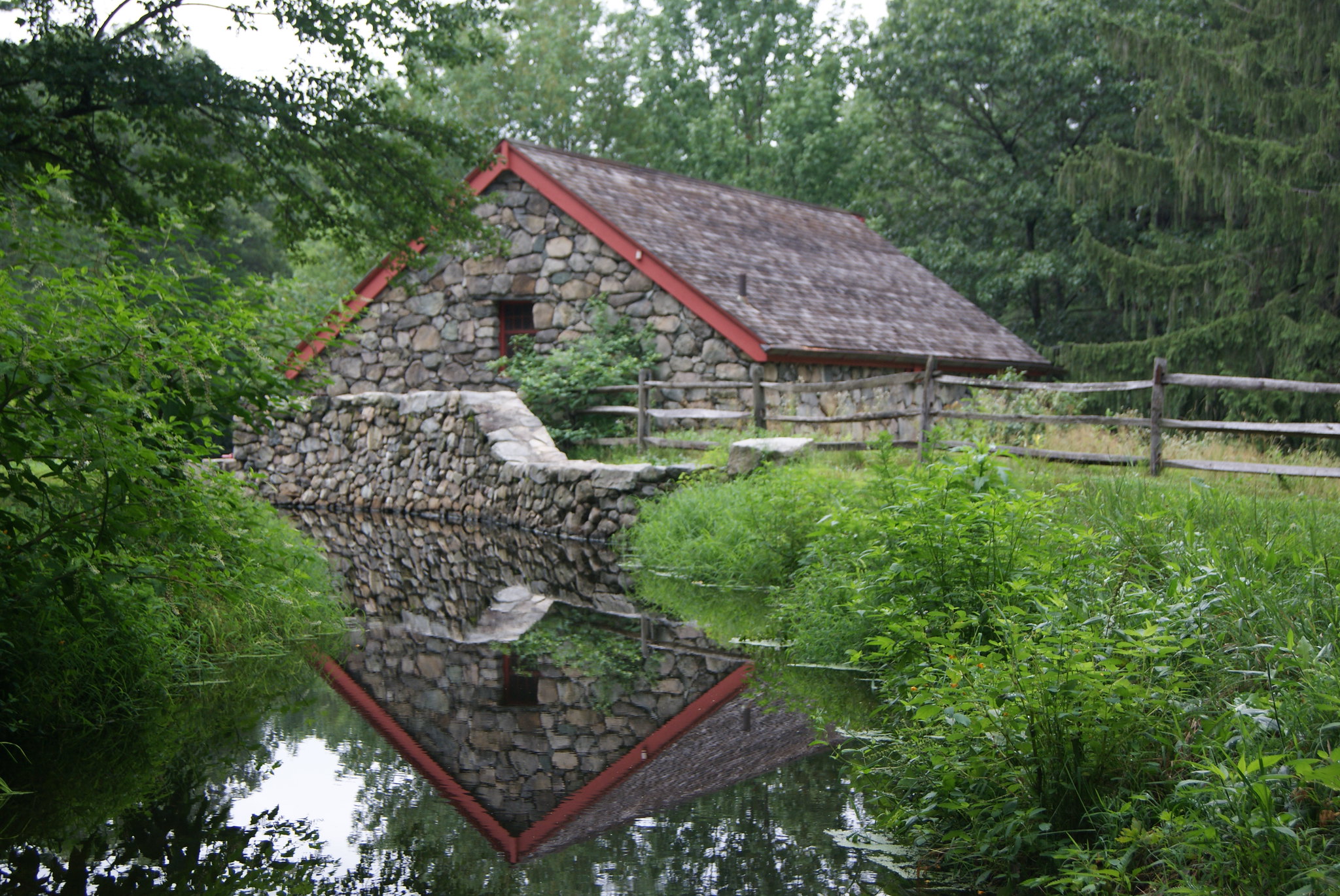
In the early days of the blog, I wrote about my brief visit to the Wayside Inn. But me being a consummate backsider, I didn't write about the inn or even the impressive grist mill on site, but rather a somewhat homely old barn on the property (see October 24, 2011, "Love Barn"). Below are some photos I made at that time of the grist mill.

Anyway...back to the failed dam, again from the Town of Sudbury web site: "It succeeded in holding back only enough water to form a wetland. The reasons given were that the soil is too porous behind the dam, and the feeding stream has very little water most of the year."

I'd love to know who coined the term "Ford's Folly," which I imagine came about many decades ago. Per Wikipedia, a folly in architecture is "a building constructed primarily for decoration, but suggesting through its appearance some other purpose."

According to Atlas Obscura's write-up about the dam, "Ford’s property manager, John Campbell, spent 16 years, from 1930 to 1946, attempting to fix the dam so it would hold water. His efforts can be seen in several large blocks of concrete on the left side at the bottom of the dam. None of them worked and he was forced to abandon the project."

I haven't found a good explanation for why Ford decided to buy the Wayside and so many surrounding acres. The inn's web site offers this: "In 1923, Henry Ford purchased the Wayside Inn....The move was striking for the famous industrialist who just seven years earlier declared that 'history is bunk.' Over the next twenty-four years, Ford not only preserved the Inn, but also moved additional buildings to the site and constructed new ones. Later, he opened the Wayside Inn Boys School where the instructors blended the pedagogical methods from Ford’s childhood with the more progressive 'learning by doing' approach."

I'd read on the Atlas Obscura site that "a wrecked car or two" could possibly be seen at the bottom of the dam, "because local teenagers used to push them off the top." Well, I HAD to check that out.

So I looked over the edge and lo and behold....

...there was a lemon-yellow Dodge Something-or-Other resting in the brook, pulverized from its fall from the top of the dam, a small collapsed tree adding insult to injury.

If there's another car at the bottom of the dam, I didn't see it. My sources who know cars better than I do tell me this one is a Dodge Colt, which Mitsubishi Motors manufactured for Dodge from 1971 to 1994.

New Balance Draws a Red Line with Diner

From Dave Brigham: I can't be expected to know everything about the backside of America, nor of Massachusetts or even of Boston. But I...