From Dave Brigham:
My hour-long hike through the Annursnac-Baptist Brook Conservation Area would have been perfect, but for the distant whine of leaf blowers. Sure, I was wandering through Concord, Mass., not the Australian outback, but is it too much to ask on a Sunday afternoon in late fall for folks to lay down their gas-powered lawn tools so an ordinary schmuck can have a peaceful walk through the woods while looking for ruins?

While I enjoy walking in the woods just for the heck of it, or to exercise my dog, I prefer doing so if there's a backside payoff. So when I learned that this conservation area had a history including not only military vestiges, but also remains from research done by the World's Greatest University, I knew I had to check it out.
This isn't the first time I've hiked through Concord seeking military relics. In the early days of the blog, I learned about a World War I-era rifle range in the tony Boston suburb, and sought it out (see December 4, 2012, "Concord, Part I: Old Rifle Range").
As for my Annursnac hike, within two minutes of setting out, I was looking at the foundation of an equipment storage building that was part of Harvard University's antenna research and test site in the late 1940s and into the following decade. Harvard purchased 63 acres of farmland in this area in 1949 for use by its Departments of Physics and Applied Science, according to this Town of Concord trail guide.


According to the web site for Harvard's John A. Paulson School of Engineering and Applied Sciences, in 1938 Ronold W.P. King joined the school's faculty (he would remain at Harvard until at least 1972). From King's Wikipedia entry: "His research group at Harvard spent the 1940s and 1950s developing the theory of antenna (radio), using the cylindrical antenna as a boundary value problem subject to Maxwell's equations....King is responsible for the inverted-F antenna, the most widely used antenna in mobile phones. However, he did not develop this antenna for that purpose. Rather the intended use was missile telemetry."


Further along the trail, I spied more ruins, this time a long-fallen antenna base.

After spotting the remnant of that downed radio tower, I was on high alert. Soon after, I was able to make out what was left of a utility pole.


Also in this area, I saw a curious site, which may not date to the days of Harvard's research program, but it surely is pretty damn old.

While all these sightings were great, the best was yet to come.


"At the northwest corner beside the main trail are the ruins of a 41-foot by 24-foot concrete structure and radio tower," per the Town of Concord trail guide. "Coinciding with the development of Hanscom Air Base in 1941, the U.S. Army Air Corps leased 16.5 acres to build and operate a facility for tracking aircraft arrivals and departures from the airfield, and as a radio direction/finder station. The structure is believed to be part of that installation....From 1959 to 1969 it was an off-base installation known as the U.S. Air Force Strawberry Hill Electronics Research Annex."
Man, I love to learn about stuff like this. What was once farmland was turned into not one, but two, installations related to antennas and aircraft tracking, and then, after the lifespan of those projects ended, nature reclaimed the land (helped by conservation efforts).


As with many places like this I come across, it's obviously a major hangout for kids/teens/twentysomethings. I was intrigued by a barrel at this site, with the word "SOCONY" on the top.
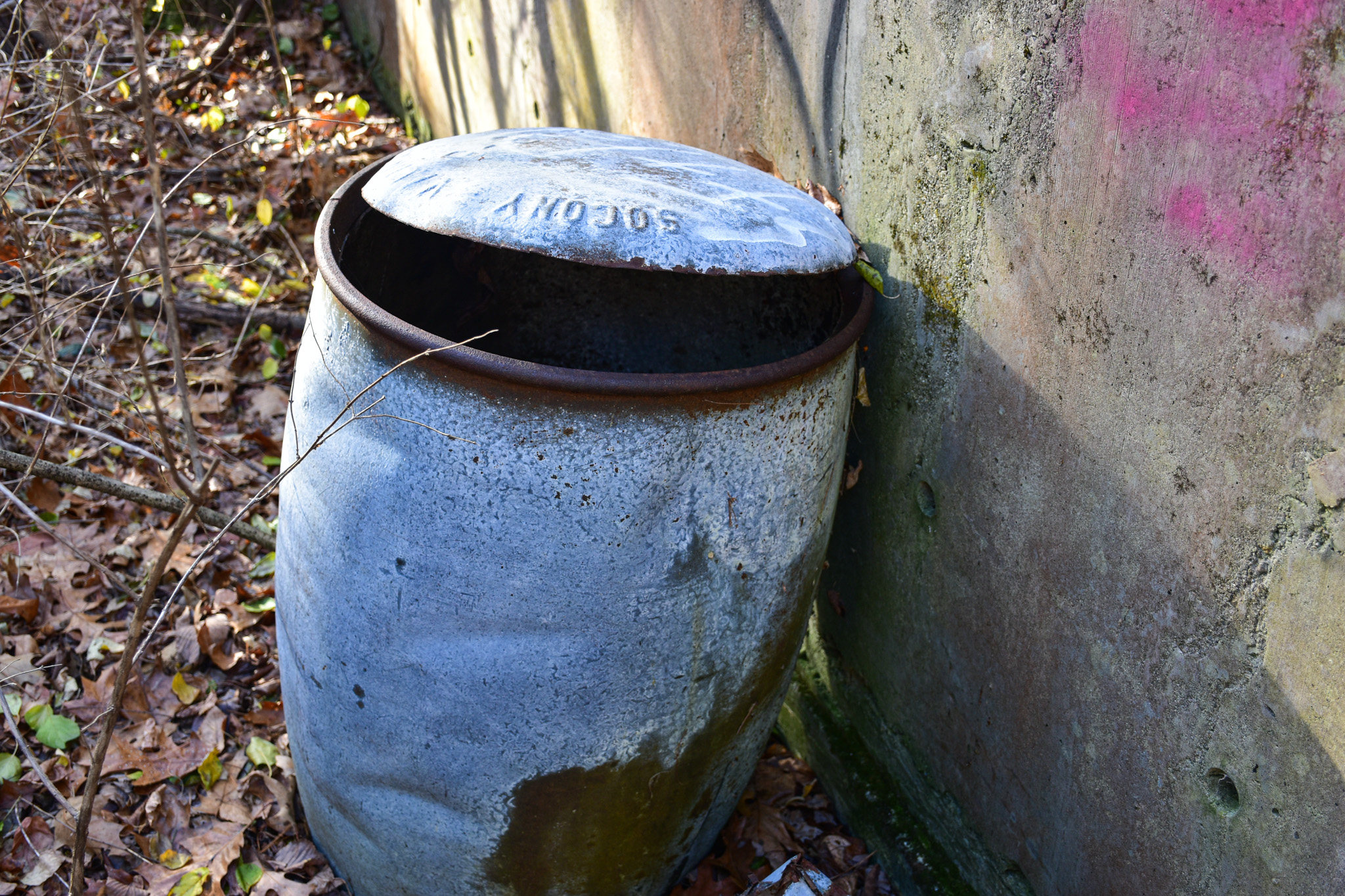

A quick Google search turned up that SOCONY stood for Standard Oil Company of New York, one of the 43 entities created by the 1911 Supreme Court decision breaking up Standard Oil. In 1931, SOCONY merged with Vacuum Oil Company, "from which the Mobil name first originated," according to Wikipedia. "Over time, Mobil became the company's primary identity, which prompted a renaming in 1955 to the Socony Mobil Oil Company, and then in 1966 to the Mobil Oil Corporation."
I can't be sure that this barrel is one used for oil on the old U.S. Army Air Corps site, but I'd like to think that some kids dug it out of the woods a long time ago.
As for the Annursnac trail, it continues north into neighboring Acton, and becomes the Stoneymeade Conservation Land. Click that link and read about what you'll find on the conservation land, and learn about the history of Stoneymeade Farm, which dates to Revolutionary War days.


No comments:
Post a Comment