From Dave Brigham:
New Bedford, a former whaling industry powerhouse located on the south coast of Massachusetts, wasn't really on my backside radar - until it was. Don't get me wrong: I was well aware of the city on Buzzards Bay, and figured it would be a cool spot to check out, along with Fall River (stay tuned...). But I knew it would be a long slog from my house outside Boston, so I never considered going there. But then one day, I was on the Cape with my son, realized I had a morning to kill, and well, the rest is history.
I will break down my visit into three installments, divided into relatively equal parts of about two dozen places each, posted in the order in which I visited them. I started my adventure at a great old theater, which I'd found while doing some online research.


The Zeiterion Performing Arts Center was opened by the Zeitz family in April 1923 as the last new theater in the city's downtown. "Designed by Frank Leary and Frank Walker, the two-story tapestry brick building is an adaption of the Georgian Revival style," per the theater's web site. "Inside, décor included marble-columned walls, the Zeitz family 'Z' shield accentuating the proscenium, silk tapestry on the walls, a frieze of gold leaf Grecian dancing muses, a large oval sunset scene on the ceiling, an orchestra rail of solid gum wood, and a $7,000 cut glass Czechoslovakian chandelier. The total project cost more than $12 million in today’s dollars."
The Zeiterion is the only vaudeville theater remaining in the city, according to MACRIS.

The new theater didn't thrive at first, so later during its first year, it reopened as a silent movie house, The State. As time went on the theater showed "talkies" and occasionally featured live performances. In the early 1970s, the owners renovated and updated the theater. By the end of that decade, per MACRIS, the theater had been abandoned and was "in a state of deterioration and disrepair. Paragon Travel, the building owner, planned to demolish the theatre portion of the building to make a parking lot. The Waterfront Historic Area League (W.H.A.Le.) convinced the owners to donate the theatre portion of the building, to W.H.A.Le., under a condominium arrangement, which allowed the travel agency to retain ownership of their space and maintain their operations. W.H.A.Le. began planning for the restoration and operation of this last downtown New Bedford theatre as a full performing arts center."
"Thanks to the dedication of many, the Zeiterion was ultimately restored to its original grandeur," per the theater's web site. "Its original Mighty Wurlitzer Organ was discovered in a private residence, rehabilitated, and returned. Each frieze repaired so the muses could dance around the ceiling once again. The project was a challenge to complete, and some corners were cut, including second-hand seats in three different sizes."
W.H.A.L.e transferred the building's title to the City of New Bedford, and the theater was reopened in 1982. Renovations have continued at various points across the ensuing four decades.


On the corner of School and Purchase streets, behind the Zeiterion, I was entranced by what I dubbed the Peace Building (zoom in to see why).

Looking like something Charles Dickens would write about in a novel, 636 Purchase Street is currently used by the Pilgrim United Church of Christ located across the street. Built in 1883 as a public school (I think), it was used by the Trinitarian Church before the UCC took over the space.
I headed north on Purchase Street, then went west on Spring Street, where I was rewarded almost immediately with a ghost sign.

The sign is for the long-gone A.E. Coffin Press, which was located, oddly enough, in the A.E. Coffin Building. Founded in 1890, the company's "main income was derived from business advertising and calenders," according to MACRIS. "It also had modern linotype presses and bookbinding equipment. It was known all over New England and the Mid Atlantic States for its fine work," MACRIS continues. A.E. Coffin's wife, Carrie, was a direct descendent of Myles and Barbara Standish - he being one of the original signers of the Mayflower Pact, per MACRIS.
Below is the main entrance to the Coffin Building, which dates to 1911. Zoom in to check out the sidewalk detail.

More than a decade ago, this building and others in the area were rehabbed and turned into studios, apartments and retail space as part of a project to create a 24/7 neighborhood.
On South 6th Street, near the intersection with Union Street, I spied a very charming building housing Sixes & Sevens, a "bar and food joint."

"The stone building, as it is presently known, is the only building in the Center District with this particular type of granite facade with its round headed door and windows," according to MACRIS. "John F. Vinal built the structure in 1852 as a stable and woodworking shop. It was later used soley (sic) as a shop."
The building dates to 1852.
Right next door, at the corner of South 6th and Union streets, I was captured by the look of Cottage Antiques, which is located in a circa-1891 building known alternately as the George Emerson Building, the Dartmouth Club and American Legion Post #1.

I shoot a lot signs of all sorts when I'm out and about. Below are two that caught my eye, right across Union Street from each other.

(Downtown Smoke Shop.)

(Minerva Pizza.)
After Minerva Pizza, I continued walking west along Union Street, past numerous beautiful, old homes. I spied a smokestack in the distance and, figuring it marked an old mill, continued walking in that direction. Before long, I realized that the stack didn't signify a factory of any sort, but rather a prison. I wasn't expecting that.


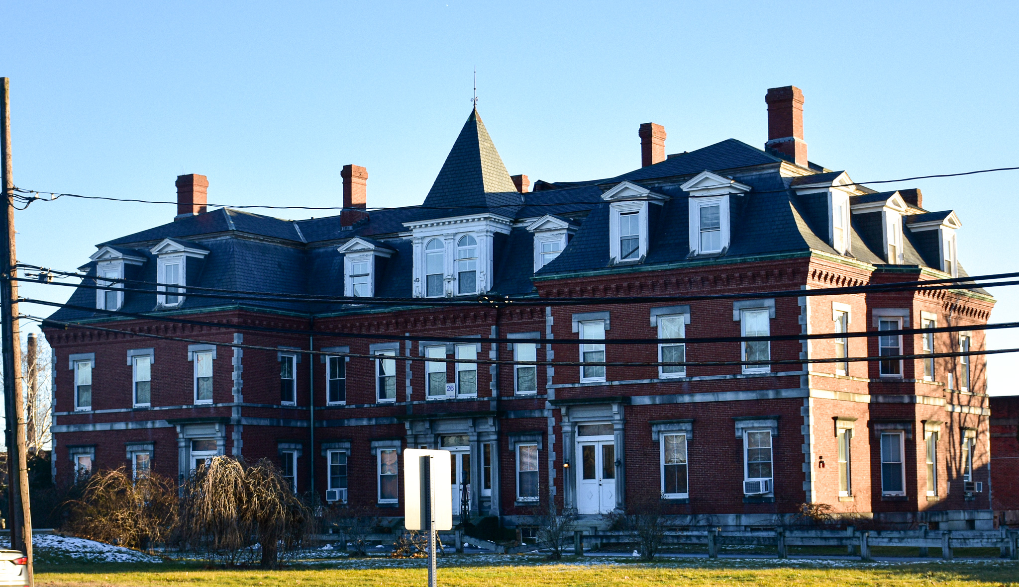
I have stumbled across a few former jails and prisons in my years of wandering the backside, but nothing like the Bristol County House of Correction. The oldest part of this big house dates to 1829. The most recent additions date to 1895. Known today as the Ash Street Jail and Regional Lock-Up, the facility "holds over 200 prisoners who are awaiting trial," according to the Bristol County Sheriff's Office web site. "Approximately a dozen sentenced inmate workers are also housed at the facility."
Directly across Court Street from the prison is Union Baptist Church.

Built in 1899, the Shingle Style church is located in a neighborhood once known as New Guinea, an area populated by African-Americans in the 19th century. "The Union Baptist Church was organized on April 18, 1895 as a result of the union between members from the Second Baptist Church and the Salem Baptist Church," according to MACRIS, naming two primarily (or perhaps exclusively) African-American congregations.
Just up the street, at the corner of Cottage and Court streets, is one example of the many great old houses in New Bedford.

Built in 1856, this three-family home is located in the County Street Historic District. From MACRIS: "The residential area reflects the historical and architectural growth of New Bedford from the years 1780-1890. The oldest homes remaining in this area were the residences of the city's wealthy men from 1780-1820."
Next, I headed north on County Street, where I saw a somewhat dilapidated church.

The church dates to 1858, according to the City of New Bedford Department of Planning, Housing & Community Development, and was known most recently as the Centre Trinity United Methodist Church. A brick exterior was added in 1924 covering the original facade.
The church sold the building in August 2018 to Southcoast Grecian Marketplace. That organization applied for rezoning from residential to business, and indicated potential uses included a performing arts/convention/events center, offices and/or apartments. I'm not sure of the status of any of those proposals.
A little north on County Street is the Bethel African Methodist Episcopal (AME) Church.


Built in 1915 as the First Christian Science Church of New Bedford, this building is the only stucco-covered, Romanesque church in the city, according to MACRIS. I'm not surprised by that, because I can't say I've ever seen a church anywhere that looks like this one. Bethel AME took over the church in the 1970s. The congregation traces its roots in New Bedford to 1822.
Continuing in a religious vein, I scooted west down North Street to make a photo of the former Holy Family School.

Not a great photo, but I wanted to chronicle the fact that this circa-1914 Catholic high school has been redeveloped into apartments.
At the corner of County and Hillman streets, I was enchanted by the small commercial building housing a florist shop, Bloomtopia.

This place dates to 1930. Nearby is a less-than-enchanting former civil defense building.

Constructed in 1892 as a fire station, this place was decommissioned and became a civil defense center in the 1950s, according to this November 2019 SouthCoast Today article. At the time that article was published, the building was in pretty rough shape -- "rotting wood, holes in the roof, drooping ceilings, and a mismatched array of vintage furniture and dusty arcade games with an unknown history," per the article -- and it doesn't look like much has changed, except perhaps for the worse.
The aforementioned W.H.A.Le purchased the building and plans to renovate it. I'm not sure of the status of that project.
OK, back to enchanting.

Dillon's Restaurant has been in business for more than 30 years, in a building that dates to 1920.
Below are two more great old homes. Located along County Street they are situated in what's known as the North Bedford Historic District.

At the intersection of County and Smith streets is a fantastic mixed residential-commercial building.

This big blue building looks well taken care of. It dates to 1896.
Across County Street is Mark's Beverage, which didn't appear to me to be open.

The building dates to 1920. I don't know anything about the store.

(Rear of Mark's Beverage.)
Heading east on Sycamore Street, I came across the New Bedford Army National Guard Armory, at the corner with Pleasant Street.

"The New Bedford Armory was constructed in 1904 to serve as a training, meeting, administrative and equipment storage and maintenance facility for the Massachusetts Army National Guard," according to MACRIS. "The New Bedford Armory is...typical of the medieval-influenced armory architecture first developed in the 1880s, which was also prevalent in armories constructed in New York, Rhode Island, Connecticut and other states."
At the corner of Willis and Pleasant streets I made a photo of yet another great house.

Just steps away on Willis Street is a simple old building with a cool history.

Built in 1850, the building served as a watch house for the New Bedford Police Department, according to a plaque on the facade. I believe the building functioned as a neighborhood station. Perhaps prisoners were kept here on a short-term basis.

This place is currently home to Dr. C.E. Burt Chapter 7 of the Disabled American Veterans.
At the eastern end of Willis Street, I began heading south on Purchase Street. I was tempted to make my way to the waterfront (along the Acushnet River), but decided to save that for a future visit. The first place I saw was the former Glaser Auto Glass complex.

The family-run glass operation was founded in 1921; the company merged with JN Phillips Auto Glass in 2019. The building dates to 1949, and is (or will be) the home of New Bedford Research & Robotics, a non-profit organization that hosts entrepreneurs, businesses, students, researchers, creatives and community members, per its web site.
The final stop for this installment is the former New Bedford Textile School.


The school was established on August 1, 1895, according to MACRIS. The first building was constructed starting in 1898, and the first classes began in October the following year. "During 1918 New Bedford Textile became a state institution by an act amending the State Constitution, and became financially supported by the City of New Bedford and the State of Massachusetts," MACRIS continues. "In 1947 the name of the school was changed to the New Bedford Textile Institute.
"From the 1950's to the 1970's the school went through many changes. In 1953 the school purchased property located on the east side of Purchase Street, directly across from the existing facilities. The purchase came about due to the rapid increase in the student enrollment year after year. Later in the fifties the name of the school was once again changed to Southeastern Massachusetts Technological Institute (SMTI). The name change came about with the combining of Fall River Textile School with New Bedford Textile Institute."
The old school is owned by the City of New Bedford, which operates the Quest Center. The center provides "entrepreneurial training and a supportive environment for startup activity," per its web site.
Make sure to check back next week for part two of this three-part series, in which I will feature a landlocked lighthouse, two funky little art galleries, ghost signs, murals and much more.