Friday, June 3, 2016

I Seek Newton, Part IV: Waban

From Dave Brigham:

Named for a 17th century chief of the Nonantum Indian tribe, Waban is one of the least commercialized villages of Newton, Mass. I knew I wasn't going to find graffiti-covered factory walls, abandoned mills or cars rusting in the woods of Waban, one of the toniest zip codes around, but I was confident I'd find something backside-y and worth your visit to this blog.

This is the fourth post in an ongoing series about my adopted hometown. Here are the three prior installments:

May 21, 2015, "I Seek Newton, Part I: Lower Falls"

September 20, 2015, "I Seek Newton, Part II: Auburndale"

March 23, 2016, "I Seek Newton, Part III: Highlands"

Waban's commercial zone is small, but has some cool buildings with good back stories.

Strong's Block, the primary commercial building in Waban, was built in 1896. It was named after William C. Strong, a tree farmer and developer who was instrumental in securing the right of way through Waban for the construction of the Highland Branch of the Boston and Albany Railroad.

(Detail from Strong's Block building)

Now home to a Starbuck's, an ice cream store and a shoe repair shop, the building formerly known as Waban Hall was built in 1890. It once was a school, and also featured small shops before being "renovated." According to the Newton Villages Alliance, the hall was also host to Waban Improvement Society meetings in years past.

(Waban Hall today)

Here's what the hall looked like back in the day.

(Photo from Newton Villages Alliance web site)

Heading east on Beacon Street, the main thoroughfare in Waban, I came across the former St. Philip Neri Church.

Built in 1930, the building housed a Catholic church for decades, until the Archdiocese of Boston closed it in 2007. A Korean congregation used the building until late 2014, I believe.

A developer has been talking about demolishing the church and building homes here for quite some time. After hearings, discussions with neighbors and at least one return to the drawing board, the developer has scaled the proposed project back from 48 units -- 12 townhouses and a 36-unit apartment building -- to 10-12 apartments and two single-family homes, according to the Newton Tab.

As I said up top, I knew I wouldn't find too much in the way of typical Backside features in Waban, but I was taken aback when I spotted this broken window in the rear of the church.

The church is located on a busy street, near a busy intersection, amid homes assessed at between $750,00 and $2.4 million, just down the street from the Windsor Club, a neighborhood social club whose history dates back a hundred years. Shuttered churches with smashed windows allowing easy access to vandals and adventure seekers aren't featured on realtors' web sites for this area code.

At least the doors seem secure.

While this village doesn't have visible dilapidation or rust, it does have old aqueducts, which I'm quite drawn to (see November 11, 2011, "History Flows On, Part I," and May 18, 2012, "Aqueduct, My Friend").

The Cochituate Aqueduct was built between 1846-48 and conveyed water from Natick's Lake Cochituate through several towns before reaching its final destination, Boston. The aqueduct was taken out of service in 1951, replaced by other systems.

(Path following the course of the old Cochituate Aqueduct, right through the backyards of some very nice homes.)

(Stone marker along the aqueduct path. I'm not sure what it indicates; perhaps telephone lines?)

(Locked entry into the aqueduct.)

At what I initially believed was the western fringe of Waban, a nursing home sits where the Woodland Sand & Gravel Co. was once located. After consulting ZipMap online, however, I learned that this site is actually part of Lower Falls. Since I missed this in my previously cited post on Lower Falls, I'll mention it here.
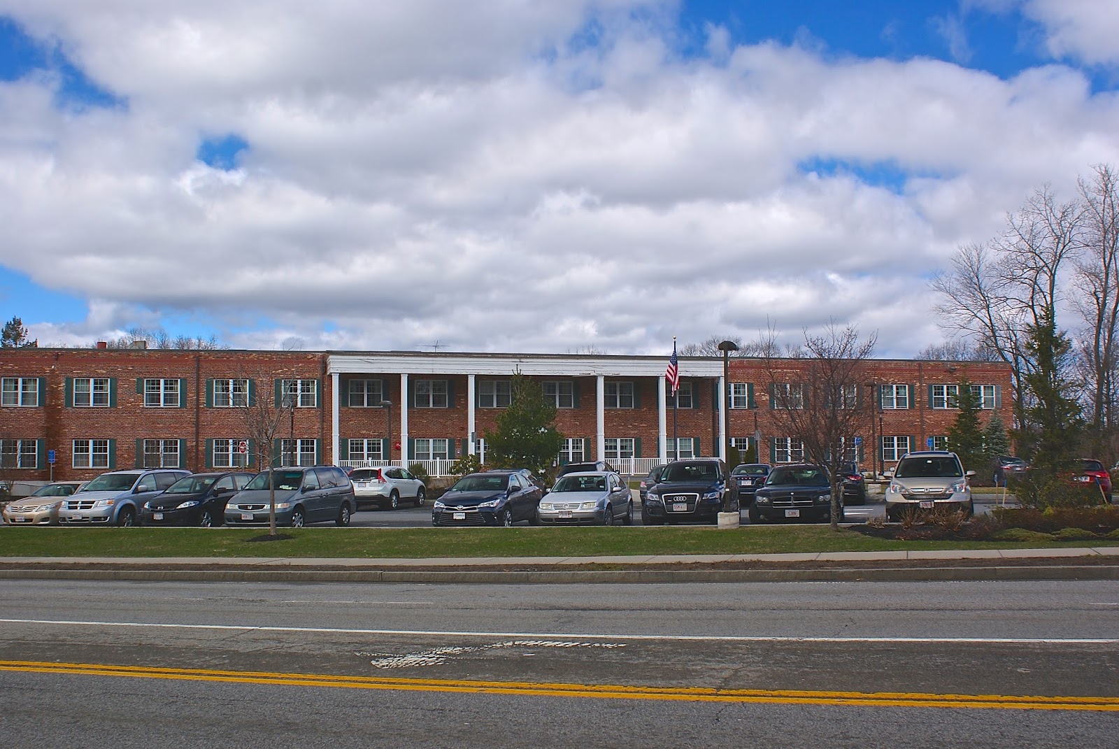
The gravel business comprised approximately nine acres. I have found no other information about the company.

Almost directly across the street from the old sand and gravel site stands this striking building, the former Fire Station 6.

Built in 1917, the firehouse was decommissioned in the late '60s. In subsequent years it was used for a number of purposes, including as a space for a Boy Scout troop and an office for a hospice. More recently, however, this beautiful building was the source of controversy in Waban.

Three years ago, the City of Newton aligned with Pine Street Inn, arguably the most well-known homeless shelter/job training/low-income housing advocate in Boston. The partners agreed to convert the station into permanent housing for nine chronically homeless people and one supervisor. At a meeting in the summer of 2013 held by Pine Street Inn and its partner, Metro West Collaborative Development, however, residents asked many angry questions about what types of people would live there. It was a classic "not in my backyard" scenario, with some well-to-do Wabanites professing to care about homeless people, but having no desire for them to live amongst them.

Long story short: the project was eventually scuttled and now three condos are being developed in the old station. For the whole story, read this excellent Boston Magazine article.

Just behind the fire station sits Neshobe Road, which appears as though it was washed out a long time ago.

There is a road like this close to my home in Newtonville. I take pleasure in the fact that there are broken-down side streets in a city filled with so many busy thoroughfares.

Newton-Wellesley Hospital is in this area of Waban, as well, but ZipMap places it in Lower Falls as well. The Woodland T stop is right on the border with Auburndale, as is the old water tower below.

I love how the tower looms over the parking lot. I always think of "War of the Worlds" when I see towers like this, because some residents of Grover's Mill, New Jersey, who didn't realize the Orson Welles radio play was fictional, mistakenly thought a water tower in their town was an alien invader. I wrote a little more about this tower a few years ago (see June 27, 2011, "War of the Worlds.").

Finally, a trip down by the Charles River.

I love any area where two different environments bump into one another, be it a blue-collar neighborhood rubbing up against million-dollar homes, the ocean lapping on a beach or walking paths along a river. In this latter scenario, I feel a part of history, and I imagine the Native Americans and colonists before me treading these paths looking for fish or game, or engaging in or attempting to avoid a confrontation.

In recent years, a group of Waban and Upper Falls citizens decided to reclaim this area of the Charles, which runs between Routes 9 and 128/95 and looks over at neighboring Wellesley. Calling themselves the Friends of the Quinobequin (so named for the Native American word for the river, and for the roadway that runs alongside at this point), the group clears trash, cuts away harmful vines and maintains a path and short lengths of boardwalk that cross small streams as they head into the river.

This web site features great photos of the wildlife one sees along the trail.

Here's a shot of some type of sewer/drainage structure along the path.

So there's Waban. Keep an eye out for the fifth installment, which will feature Oak Hill, another quiet village that at first seemed like it would present difficulties to this Backside seeker.

Friday, May 27, 2016

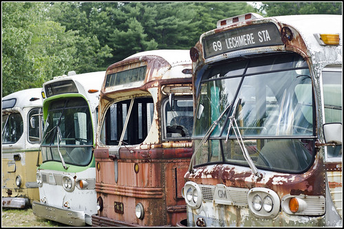
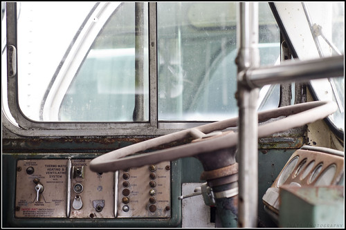
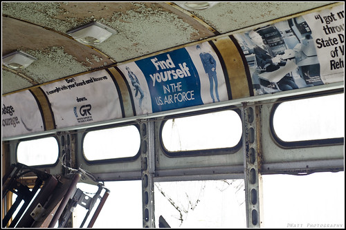
Last Stop

From Derek Watt:

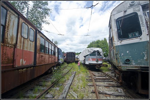
(Derek Watt took these great photos of a transportation graveyard somewhere in New England -- D.B.)

6 Aug 15 01 6 Aug 15 14 6 Aug 15 08 6 Aug 15 15

Saturday, May 21, 2016

Pumps Are Empty

From Dave Brigham:

I don't have much to say about this place. It's been torn down since this Google Maps image was made. Located along Route 9 in Brookline, Mass., it was just a gas station, and not even a historic one (for some cool old gas Midwest gas stations, see June 6, 2012, "Fill 'er Up").

This is what it looks like now:

I haven't been able to find out what's going to be built here. Five years ago, the Chestnut Hill Neighborhood Association posted on its web site the following:

There is a "proposal to demolish the US Petroleum gas station on the northwest corner of Route 9 and Reservoir Road and replace it with a five-story masonry and glass medical/office use structure with retail space on the ground floor....Parking would be provided on three below-ground levels."

Stay tuned.

Sunday, May 15, 2016

Get On Your Bikes and Ride!

From Dave Brigham:

As a kid in the '70s tearing around my neighborhood and through the woods, I figured the bike I rode was an invention as old as time itself. There were no mountain bikes in those days, kids, just cruisers, three-speeds, five-speeds and ten-speeds that you rode anywhere and everywhere, treating them alternately like motorcycles, horses, moving trucks and, well, bicycles.

The history of two-wheeled transport goes back centuries, but the advent of what we recognize today as a bicycle began in the 19th century. For a time in the late 1800s and early 1900s, bicycle racing captivated America the way that NASCAR does today. And the fastest dirt bicycle racing track in the country was located in good ol' Waltham, Mass., the city I've written about more than any other on this blog.

Opened in 1893, Waltham Bicycle Park was the first track in Massachusetts built specifically for bike racing (others were also used for horse racing), according to this article on HubTrotter. Numerous world records fell at the park during its heyday.

The park had a grandstand and bleachers that could hold as many as 9,000 spectators. On opening day, more than 15,000 bike racing enthusiasts crammed the park, according to the HubTrotter article. According to a Boston Globe article, on opening day (and probably other days), people sat on the roofs of nearby buildings, as well as hills adjacent to the park.

Here's an illustration from the article:

Racing was very popular at this park, as at many others, but a serious accident, in which two racers were killed, in June 1900 put a damper on the enthusiasm. Two years later, the city of Waltham purchased the park and turned it into a football field. Nowadays, the site, known as Nipper Maher Park, includes Little League fields, tennis courts and a playground.

Here's what the park looks like now:

Here's a current shot of the hospital where some spectators may have watched races:

Here's a current shot of a hill behind where the grandstand once stood. Paths lead up to a neighborhood.

I just recently learned about the history of this park, so I set out to see what, if anything, remained from the bicycle racing facility that had so captured the attention of locals more than 100 years ago. When I saw some stone pieces in the woods and on the perimeter of the park, I thought perhaps they had been part of the grandstand.

It's hard to know what sort of structure these stones were part of. Are they simply leftovers from a more recent set of bleachers or small buildings. Anybody know, or have any guesses?

Monday, May 9, 2016

Shedding Tears (Sometimes) for Teardowns

From Dave Brigham:

Is the word "teardown" in your town's lexicon? No? Well, then let me define it for you: "the process of buying an older, sometimes rundown house, knocking it flat to the ground and building an often oversized house in its place." What ever happened to renovation? My wife and I watch TV shows all the time where builders buy a house, take it down to the studs and turn it into a beautiful new place without the need to rip up a piece of a neighborhood's history.

Unbeknownst to me at the time, I lived in a future teardown in Newton, Mass., several years ago. Called La Casita Flatita (roughly translated as "the little flat house") by our landlord, a 70-something Italian-American guy who grew up in the house, the place was small, of course, but it was cute.

Our landlord's father built the house on a decent-sized lot that was cursed by a giant rock ledge that extended into the basement. He chipped away at the stone in there, our landlord said, to make the basement bigger. In the furthest part of the basement, where you had to duck your head, there was an old wine barrel. Our landlord's father grew his own grapes and made his own vino.

That's a great piece of history that I'll never forget. My wife, Beth, and I lived in the house for about two and a half years until our landlord told us he was going to put his childhood home on the market. Beth and I went back and forth about whether to make an offer. There were only two bedrooms and one bathroom, but it was on a quiet street that was walking distance to Newton Center, where there were stores, restaurants, banks and a trolley line. We were also right around the corner from two malls.

We decided to go for it, but our landlord rejected our offer. We decided to look elsewhere, and found a place not too far away, in the West Roxbury neighborhood of Boston.

We were sad to find out a few months later that the house had been sold to a developer, for not much more than we had offered. Before long, the house was leveled, the ledge blown up and two townhouses went up in its place. La Casita Flatita was gone, and so was its history.

Developers in Newton and surrounding towns have been mad for teardowns for years. I understand the economics: buy an out-of-fashion Cape or ranch house for $600,00-$700,000 (real estate around here is kinda crazy)....

...bulldoze the offending property and replace it with a much larger house that will sell for $1 million or more.***

Often times, the smaller homes are replaced with two or even three town houses, because the lots are decent sized and the zoning laws allow for this. Read this February 2015 Boston Globe Magazine article for more on teardowns in Newton and surrounding communities.

Also see our March 18, 2011, post, "Anatomy of a Teardown."

I'm not saying every old Cape, ranch or bungalow needs to be saved. I know that some places are simply beyond restoration, although Nicole Curtis might beg to differ with me on that. But when developers scoop up a house, erase the memories and history of that place, erect a bland structure with little architectural detail or sense of scale, and sell it to people who want a move-in ready home rather than being willing to put a bit of themselves into a place, it can be easy for neighbors to take offense.

The house at the top of this post was right around the corner from mine until about a year and a half ago. A nondescript brick ranch house, it was leveled, with the exception of one wall, and a new, multi-gabled house went up in its place. Eventually that one wall was torn down -- I imagine this had something to do with zoning/teardown regulations in Newton.

Within the last year or so, several other houses in the vicinity have been knocked down, along with dozens across the city of Newton.

The house that once stood here was featured in a John Travolta movie, "The Forger." Here's a brief article about the shoot, featuring a photo of the place.

Any smart developer/realtor could have squeezed some extra cash out of a potential buyer if they mentioned this fact. But no, somebody tore the damn thing down and put up a house that wasn't in a movie, and most likely won't ever be.

The place below was built in 1920, and purchased for $500,000 in May of this year.

When I saw this piece of heavy machinery parked in the yard, I knew the house's days were limited, despite my wife's insistence that somebody might just be planning a renovation.

The house was emptied first, and the prior owner's belongings were plowed into a big, dirty mess.

Still, amid the rubble there was life, personality, a sense of who the former owner was.

In November 2014, the Newton Board of Aldermen voted to reject a proposed moratorium on teardowns involving homes greater than 120% of the original structure’s floor area.

The primary argument against teardowns comes down to economics: by taking potential starter homes (albeit fairly expensive ones compared to towns a bit further out from Boston) off the market, these developers are catering to a certain class of folks -- rich ones.

As a liberal and someone who loves old homes (mine is from the early '20s), I agree with these arguments against allowing one home to be demolished and replaced with a McMansion or two or more expensive townhouses. At the same time, I don't think you can legislate against developers trying to maximize their profits. I hope there's a meeting place for the two sides in this argument, but rezoning neighborhoods and reworking the details of a replacement house's footprint are big issues that few in Newton's government want to take on.

***These houses are both currently in Newton's Oak Park neighborhood; I offer these photos as an example of the types of houses being torn down, and what replaces them.

Tuesday, May 3, 2016

No More Bell to Toll

From Kris Smith:

Wisconsin isn’t an old state, relatively speaking; it’s only been one since 1848. To this native New Englander, the Badger State is pretty new, and the differences between regions are interesting. New Hampshire has way more old cemeteries, but a lot fewer abandoned buildings. With this find, I got both. Kind of.

Estonian Church

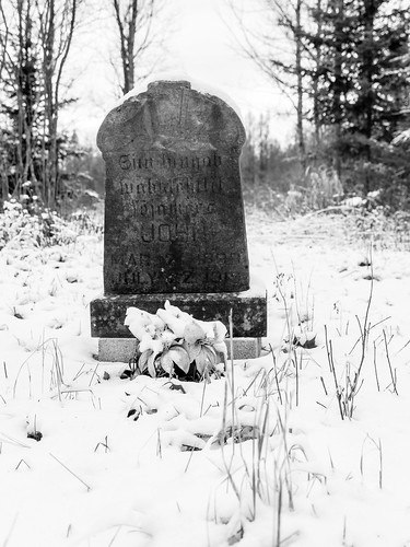
This is the country’s first and oldest Estonian Lutheran church. It was built in Gleason around 1914 or 15 by immigrants fleeing Russian oppression, who decided the Wisconsin River Valley would remind them of their lost homeland and provide plenty of farm and timber land. The congregation was only about 30, but the church, once they built it, became their community center. The cemetery was consecrated before the church went up. Eleven of the original 14 interments remain and many have new markers, although I preferred to photograph one of the originals.

Dwindling

They had an altar, pews and a lectern; all made with rough-hewn planks. Women sat on one side of the aisle, men on the other. Decoration came from their own hands or gardens. What they didn’t have was a bell. Bell-lessness didn’t last long; soon Sears & Roebuck sent “one of their smallest bells” as a result of a donation request from church elders, who stated that Estonians were good customers and the company should give them a bell.

The church saw sporadic, but consistent use by the Estonian immigrants for the next half-century, but tragedy struck soon after the 50th Anniversary celebration. Vandals began to desecrate and destroy the tiny building. Everything was smashed or stolen, including the much-loved bell. In 1970 the people decided to board up their church and leave it alone, figuring that if something looked unloved and useless the vandals would leave it alone. They were right.

Today the church stands alone in its clearing. Some renovation has been done over the years with efforts to preserve the rustic little building. It’s charming and sad and once again has no bell.

Wednesday, April 27, 2016

Train Wreck???

From Mick Melvin:

I was driving in New Britain, CT, one day and I did a double take.

Untitled

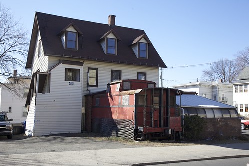
I couldn’t believe my eyes when I saw a train sticking out of a house. It was actually a big red caboose, which is in fact, attached to the house. Well, it's actually attached to the house and another room is attached to the side of the train.

Some folks from New Britain told me the place was called Reno's Cafe. The records show it was established in 1990 and incorporated in Connecticut. I searched reviews for the place, and the last mention of the restaurant was in 2013. The review said the place was nice and it was more of a bar than a café. They actually applied for a liquor license in 2013-2014, but I could find no other mention of the place.

Wednesday, April 20, 2016

Washington Walked Here

From Dave Brigham:

It's always better to get out and walk. Seems obvious, no? Driving is faster, sure, but you miss so much. People sometimes ask me, "How do you find all these places to write about and take pictures of?" All you gotta do, I say, is walk around a bit.

After driving through the intersection of Main Street/Rte. 20, Weston Street/Rte. 117 and South Street in Waltham, Mass., numerous times, I found myself focusing on two stone monuments on the grounds of the former Banks School. So one day when I had a few minutes, I parked in the school lot and walked up to see what these big slabs are all about.

This one commemorates the so-called Henry Knox Trail, the path that the general took in late 1775/early 1776 from Fort Ticonderoga in New York to Boston to deliver 59 cannons to Gen. George Washington. Other markers along the trail are located in New York towns and cities including Glens Falls, Hudson Falls, Schuylerville and Albany, and Massachusetts towns and cities including Palmer, Marlborough, Framingham and Cambridge.

Here's a detail from the marker.

This marker is for the George Washington Memorial Highway.

The highway -- aka Route 20 -- was created in 1932 to celebrate the bicentennial of Washington's birth, and the route that he took on his way to Boston to assume command of the Continental Army. "There were parades from Agawam to Cambridge," at the time, according to Bryan Farr, founder of The Historic U.S. Route 20 Association, quoted in the MetroWest Daily News in June 2014. "They had a guy dressed up like Washington ride a horse along the route. The streets were lined with people."

The state, however, declined to officially name Route 20 after Washington.

Here's a detail of the marker.

You never know what you'll learn when you go for a little jaunt.

Wednesday, April 13, 2016

The Ones That Got Away, Part IV

From Dave Brigham:

It's ironic that Anthony's Pier 4, the venerable waterfront restaurant in Boston that was once the place to see and be seen, is being torn down as the neighborhood around it has risen to become the hottest spot in the city.

I went to Anthony's once, to celebrate when my girlfriend (now wife), Beth, graduated from law school. I'd heard of the place from Beth's family, and knew somewhat of its reputation as a special occasion destination and place where celebrities hung out when they were in town.

We took pictures on the back deck, which overlooked Boston Harbor and had great views of the city and the airport. The food was good, not great, but I reveled in looking over the dozens of photos in the hallway leading from the front door into the restaurant: owner Anthony Athanas with Liz Taylor, Judy Garland, Merv Griffin, Johnny Carson and many other A-listers.

Athanas opened his restaurant in 1963. He died in 2005 but the restaurant lived on for eight more years. In its later years, Anthony's Pier 4 fought for customers with a crowd of high-end restaurants in downtown Boston, as well as more options along the waterfront, which was christened the Seaport District in recent years.

I wish I'd taken some photos of the place in its heyday and in more recent years as it sat waiting for its fate. I didn't, but the Boston Globe recently ran some photos from the salad days of Anthony's Pier 4 -- including one of the former passenger liner that was used as a cocktail lounge until it sunk during the blizzard of '78 -- as well as images of the place stripped, unfortunately, of its glory. You can see them here.

Demolition crews began ripping the restaurant down yesterday.

Here are three previous nods to ones that got away:

May 2, 2010, about the former Metz Automobile Factory in Waltham, Mass.

June 1, 2010, about the former Whalom Park in Leominster, Mass.

June 5, 2015, about Veronica's Spa in Waltham, Mass.

Thursday, April 7, 2016

Sweet and Junky

From Dave Brigham:

Somerville, Mass., was once the car-theft capital of America, according to Wikipedia, and, more importantly, my friend Jim who grew up there in the 1960s and '70s. The city was much grittier back then, with the Winter Hill Gang in cahoots with the infamous Whitey Bulger, and factories and small industry dominating much of the business landscape. In more recent years, the city, a tightly packed mixture of blue collar workers, hipsters, college students and professionals tucked between Cambridge, Medford, Boston and Arlington, has become a mecca for bars, restaurants, clubs and funky shops and start-up companies.

It was while checking out one of these newer companies -- Taza Chocolate -- a while back that I stumbled across a part of the old Somerville that I suspect not many of the newer residents know about.

Located in a large factory building that once housed companies including Consolidated Bag & Foil Corp. and Sugarman Brothers, according to the Somerville Historic Preservation Commission, Taza offers regular tours of its operations -- and free samples! As my kids and I drove down Windsor Street toward the factory, we passed by a junkyard, with stacks of cars and trucks on both sides of the roadway looming behind corrugated metal fences.

We enjoyed learning how the confections are made, as well as eating the free samples of dark chocolate mixed with all sorts of fruits, peppers, nuts and other ingredients. Well, I liked them anyway.

I made a mental note to visit the area again to take photos of the junkyard, and finally got around to it a few months ago.

The place -- Nissenbaum's Quality Used Auto Parts -- made an even bigger impression on me the second time. Around since 1910, the company is operated by fourth and fifth generations of the founding family, in the same location, I believe.

This gives you a sense for the history of the place, which is the favorite junkyard of the "Car Talk" guys.

And this gives you a sense of how tight things are in this neighborhood, which is very close to a set of train tracks, and which formerly hosted slaughterhouses and meat packing companies.

But this being Somerville, a community increasingly filled with eco-conscious folks, the junkyard backs up to a community garden.

Below are views of the front and back of the junkyard.

In addition to at least one other junkyard in this area, there are auto parts stores and repair shops. Here are two shots of Columbia Auto Parts.

I highly recommend checking out both the chocolate factory and the junkyard. And there are countless great bars, restaurants and shops a short distance away, as well as the Slumbrew tap room.

Scrambling Through Boston's Egleston Square

From Dave Brigham: I've danced around Boston's Egleston Square quite a bit over the years I've been publishing this blog. I...