Tuesday, August 30, 2016

The Tavern of Death

From Dave Brigham:

A lot of what I post here comes about through stumbling.

A few months ago I set out to explore a set of long-abandoned railroad tracks in Wayland, Mass. (see August 1, 2016, "I Rail Against Trails (Not Really, But I Don't Want Every Abandoned Set of Train Tracks Converted for Cyclists and Roller Bladers)"). Driving there after dropping my son at school, I cruised past a small parking lot for a conservation area in neighboring Sudbury. I made a note of it, and doubled back after my Wayland quest.

I'm always up for a hike in the woods. When I saw "King Philip Woods" on the sign in the parking lot, I got excited. King Philip is notorious in New England for the war he fought against the European colonists in 1675.

I grew up in Simsbury, Connecticut, one of numerous towns throughout New England that was set ablaze by Indians loyal to King Philip, who was called that by British colonists because of his "haughty manners," according to this article. His real name was Metacom, and legend in Simsbury has it that he sat in a cave on Talcott Mountain and watched the town burn. The story is likely apocryphal, but the shallow recess has long been known as King Philip's Cave. Metacom's name was borrowed for the Metacomet Trail, a 63-mile trail that runs through central Connecticut, including Simsbury.

The Sudbury conservation land has at least one tall tale attached to it, as well, but also features some great ruins and hiking trails.

Above is a remnant of the Old Berlin Road, a stagecoach route that ran west-northwest from Boston to Lancaster, Mass. in Colonial times. Legend has it that the notorious highwayman Captain Lightfoot (aka Michael Martin) and other unsavory characters lay in wait at a tavern along the road for unsuspecting travelers. Lightfoot had fled England ahead of authorities due to, well, let Adam Ant explain:

During some undetermined period of time in an unmentioned year, according to the official Town of Sudbury web site, "it was noticed that several travelers who left by stage for Lancaster failed to arrive at their destination, and warnings were posted advising travelers of the hazards of stage travel."

The tavern lost business after signs were posted in the area warning travelers of the dangers, so the story goes. The place fell into disrepair, and was sold. The buyer, "investigating a stone in the basement unearthed 13 skeletons — apparently the unfortunate travelers who never made it to Lancaster," according to the web site. "Some have said that when the moon is over the river and the mist creeps in, if you listen carefully you can hear the stagecoach rolling along and who knows — maybe even a hoarse voice calling 'stand and deliver’."

This is an excellent story, one that resulted in the drinking establishment acquiring the nickname Tavern of Death. It says so right on the sign in the conservation area pointing out the landmarks to be found on the site. But I can find proof nowhere online that this series of events actually happened.

Captain Lightfoot, though, was real enough.

From the August 6, 2014, Somerville (Mass.) Times web site:

In 1821, the time between mid-Colonial and Civil War America, an incident took place there which became part of historic New England lore. It was a robbery, a highway robbery, committed by a young, devil-may–care bandit named Michael Martin (alias “Captain Lightfoot”). Martin had been in America for eighteen months and was working for Mr. Derby during part of that time. No one knew he was fleeing a notorious past as a “money or your life” highwayman in the British Isles. The English called Lightfoot and his former mentor, Captain Thunderbolt, “Knights of the Road.” He was trying to shed that past, and there was to be one last robbery.

Retribution for this crime, which formerly had been branding or whipping, was upgraded to a capital offense punishment. Michael Martin, or Captain Lightfoot, was the first and last person to suffer this state’s gallows for highway robbery.

Read the entire account here. For more about Lightfoot and his British compatriot, and fellow emigre to America, Captain Thunderbolt (aka Dr. John Wilson), read this account. Check out this link for more information about the nefarious pair.

You can order a book in which Lightfoot confesses his crimes.

Whether or not a baker's dozen of victims were buried in the basement of the tavern, the ruins are real.

Bricks, possibly from a chimney in the old tavern, litter a hill above a stone wall at the site.

The foundation from what I believe was a barn sits not too far from the tavern ruins.

There's not a lot left of the Haynes Garrison House, but again, there is very good story.

From the Town of Sudbury web site:

It was to the Haynes Garrison House that the two Concord survivors of the Native American massacre at the Four-Arch Bridge (at the Sudbury River in Wayland) fled for refuge. Here, the defenders showed such courage and fierce determination to defend their homes, that by 1:00 p.m., the Native Americans gave up and faded into the woods.

There is mention on a sign at the site of Native Americans rolling large stones down a hill toward the garrison, to no avail.

Amid all that terrific official, and some likely unofficial history, and cool ruins, I was most excited by this.

I love the through-line this old truck (or possibly a car) provides the conservation area. It's a great place to hike, with nicely maintained trails and pretty stone walls. It has fantastic history going back to the earliest days of the United States. But in between those eras, this was a farm. Abutting land is known as Piper Farm; I'm not sure whether this rusting jalopy belonged to that farm or a separate one, but no matter. I get excited about old vehicles in the woods, because they leave me with so many questions: Who owned it? Why did they leave it here? Why wasn't it hauled out when the conservation land was established?

OK, stop reading now and go for a walk in the woods.
Sunday, August 21, 2016

Complex Questions

From Mick Melvin & Dave Brigham:

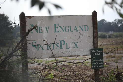
The powers that be at New England SportsPlex built it, and for several years, they came: to play softball and volleyball, throw horseshoes, frolic in the screened-in playground, or just hang out and watch. The year was 1994, and life for softball players in and around Vernon, Connecticut, was good. I recall driving past the facility on my way to and from my parents' house a little further south and west in the Nutmeg State, and thinking, "What a cool place!"

The owner talked at the time of the opening about adding a sports bar (I don't believe that ever came about), and said he'd spent a quarter of a million dollars on a lighting system for the complex. The multiple fields had computerized watering and drainage systems to keep the place looking top notch.

But like in "Field of Dreams," players at the SportsPlex headed into the tall weeds, never to return. I'm not sure how long the place has been closed, but an August 2011 article in the Vernon Patch said it closed "several years" prior.

In the Patch article, the reporter noted that the land had recently been cleared, although representatives of the land's owner were unavailable for comment. The article indicated that Home Depot and other big-box retailers had expressed interest in the site.

Shortly after that Patch article ran online, Mick Melvin visited the site and took these photos:

Untitled

(Photo by Mick Melvin, taken September 2011)

Untitled

(Photo by Mick Melvin, taken September 2011)

I've been meaning to take pictures of this site for years, and succeeded once in taking some not-so-great shots. I seized a new opportunity recently by sneaking through a gap in a fence.

(Photo by Dave Brigham, taken April 2016)

(Photo by Dave Brigham, taken April 2016)

(Photo by Dave Brigham, taken April 2016)

As you can see, the site is overgrown once again. Why did the SportsPlex fail when sites like it around the country have done well? Why has it taken so long for a new buyer or tenant to develop this site? Is it too expensive to dig up the water and drainage system? Why isn't a site right off Interstate 84, practically within site of downtown Hartford, attractive to retail/residential/hotel/restaurant developers?

Stay tuned.

Monday, August 15, 2016

Ye Olde Shoppe

From Dave Brigham:

Because I have a fascination with old-money WASPs, several years ago I was struck by a desire to figure out what family in the United States has the oldest money. Could be a Mayflower family, I thought, somebody with a stodgy British name like Winthrop or Winslow or Whittemore.

Here are some famous descendants of Mayflower families, presented in no particular order and without comment: Franklin Delano Roosevelt, Orson Welles, Marilyn Monroe, John Quincy Adams, Alan Shepard, Clint Eastwood, Sarah Palin, Hugh Hefner and Anna Mary "Grandma Moses" Robertson. Of course, being famous doesn't necessarily translate into being rich.

In the heat of inspiration, I performed a few basic online searches before giving up. Recently, however, I thought to pursue this idea again after the appearance in my Facebook feed of a list of the oldest businesses in every U.S. state.

I found an article at Forbes.com that has more or less answered my question. The duPont family (French immigrants who built their fortune on gunpowder and maintained it through a chemical company that the family no longer owns) gets credit for holding on to their fortune the longest, dating back to 1802, according to this article. The Rockefellers (oil) and the Mellons (real estate, land and banking) are on the short list, as well. (Side note: I recently read and thoroughly enjoyed Carl Hoffman's Savage Harvest: A Tale of Cannibals, Colonialism, and Michael Rockefeller's Tragic Quest for Primitive Art.)

Now, on to the business at hand. Facebook recently tossed an article by news aggregation site Thrillist my way, headlined "The Oldest Surviving Business In All 50 States."

"Down every main street in America, the old guard of independent 'Mom and Pop' business are an increasingly endangered species," the article beings. "Doors are closing and windows shuttering, with glossy chains, yoga studios, and 24/7 banks popping up between our antiquated favorites and local stalwarts."

I'm proud to say that I once worked at the oldest business in New Hampshire: Tuttle's Red Barn. Calling itself the oldest known family farm in the United States (a claim disputed by Virginia's Shirley Plantation, which is naturally also on the list), Tuttle's grew much of its own produce (strawberries, corn, rhubarb) and sold it alongside plants, flowers and high-end grocery items. I worked in the produce department there from April 1989 until August of 1990, when I moved to Boston. My boss was a cool dude who told great stories about seeing Willie Dixon play live, and about riding naked on his motorcycle to the Woodstock concert in 1969.

After approximately 380 years in business, the Tuttle family sold the farm and its buildings in 2013. The place is now called Tendercrop Farm.

I haven't been to any of the other establishments. How about you? Tell your story in the comments section, if you wouldn't mind.

Wednesday, August 10, 2016

More Action in the Lost City

From Dave Brigham:

Watertown, Mass., is booming. Well, in terms of apartment and retail construction anyway. In recent years, developers have completed, begun or proposed numerous projects that will bring thousands of apartments to the city, along with hotels, restaurants, office space and retail outlets. The Greater Boston economy is doing well, and as available land in Boston and Cambridge disappears under cranes, backhoes and dump trucks, the activity has moved a bit westward.

I've written before about the Pleasant Street corridor in Watertown. Just a few minutes from my house, this area was once home to factories and industrial buildings of all sorts. My wife's brother-in-law dubbed it the Lost City because there wasn't much going on there. It was just where you drove to get from Waltham into Watertown Square and eastward toward Boston and Cambridge.

Here are the stories we've posted about the area:

July 5, 2010, "Rebuilding the Lost City"

August 10, 2011, "Rebuilding the Lost City: UPDATE"

March 2, 2013, "Rebuilding the Lost City: SECOND UPDATE"

May 13, 2013, "Another Lost City Ghost"

December 8, 2014, "Another Lost City Ghost: UPDATE" -- after a long delay, construction at this site has begun in earnest of late.

On a large lot that backs up to the Charles River and its fantastic bike path, just down the street from the former Haartz Mason factory I've written about before, there was recently more demolition in advance of construction along Pleasant Street.

Buildings that most recently housed companies including Julian Construction Company and Casey & Dupuis Equipment were torn down. The latter company's property was notable for the giant construction crane, available for rent, that loomed over the squat building.

All of the above buildings are now gone. A developer has proposed a mixed-use development of commercial real estate and 99 apartment/condos. Stay tuned....

Monday, August 1, 2016

I Rail Against Trails (Not Really, But I Don't Want Every Abandoned Set of Train Tracks Converted for Cyclists and Roller Bladers)

From Dave Brigham:

Man, that picture just says it all for me: overgrown history; adventure awaiting; peace and quiet; possibly a little danger.

I'd driven past this spot in Wayland, Mass., several times over the years, but didn't have time to explore until recently. As I've said many times here, the world looks a lot different when you're walking through it than when you're driving past it.

What finally drew me to this location was, as is often the case, a look at Google Maps. Of late, I'd become aware of long-abandoned railroad tracks running through Waltham, Weston, Wayland and other area towns. This is part of what's known as the Wayside section of the Mass Central Rail Trail, a proposed 104-mile connection from Boston to Northampton. Looking at maps online, I zeroed in on the section in Wayland that crosses Route 20.

Starting down the tracks, the teenager inside me expected someone from the adjacent garden center to yell "No trespassing!"

There were no barriers or signs, but for the first hundred yards or so, I looked back a few times to make sure the police weren't behind me. Illogical, I know, but I'm a goody-goody who doesn't want to get busted for being someplace I'm not supposed to be.

Secure in the knowledge that nobody was going to stop me from exploring, and realizing that while the tracks weren't heavily traveled, there was evidence of human activity, I pushed forward across an old bridge over the Sudbury River.

I saw several shotgun shells along and just off the tracks. The rails run alongside part of the Great Meadows National Wildlife Refuge, so I initially assumed that poachers were at work. A check of the refuge web site, however, indicates that hunting permits are available during July, so I'm gonna give hunters the benefit of the doubt.

I had no idea what I'd find along the tracks, or how far I'd be able to go. I was just happy to be walking in solitude, imagining the time when freight and passenger trains ran through here regularly. On the north side of my route, between the tracks and busy Route 20, was a patch of woods and small, scattered pieces of broken down equipment, random chunks of manufactured stone and other detritus.

I moseyed on for quite some time, past more shotgun shells, power lines, signs for the wildlife refuge, and the rear of a landscaping supply company. I expected to see signs of teenage partying or homeless encampments, which I'm used to seeing along railroad tracks, river paths and other out-of-the-way locations. But I saw nothing of the sort.

After a while I saw buildings off to the right, one of which is an indoor sports facility. Ahead of me on the left I could see a medium-sized electrical grid complex. At this point, the tracks ended, and I didn't think it made sense to get too close to the enclosed high-voltage area.

I turned around and started heading back, with my eyes peeled for things I'd missed on the way out. I ventured into the wooded area between the tracks and Route 20. I didn't find much of interest, but I have a feeling that a longer exploration might yield something.

Then I spied something colorful through the trees, near a dilapidated building that I hadn't paid much attention to earlier.

I followed an old path off the tracks into the woods. I saw a heavily graffitied truck, but was unsure whether someone might be in there, so I made a bit of noise and after a short time I went closer.

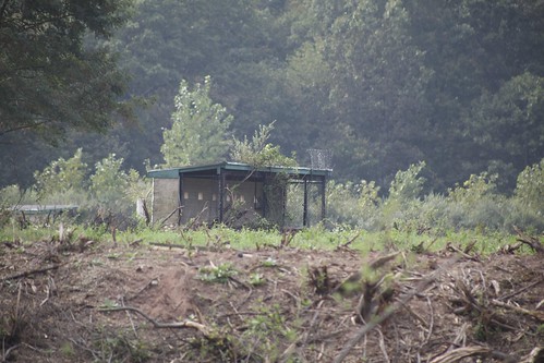
It was an old concession truck for the Wayland Baseball Association, parked at the back of a long-neglected lot and next to a crummy old building. Not sure what this site was previously used for, but I assume it's town-owned.

As I said at the top of this post, this section of tracks starts at Route 20. At some point, of course, they crossed that busy road heading east. In 2010, the Massachusetts Department of Conservation entered into a 99-year lease with the Massachusetts Bay Transportation Authority (MBTA) related to the 24 miles of tracks that run through Waltham, Weston, Wayland, Sudbury, Hudson and Berlin, according to this Wayland Patch article. The DCR has removed some railroad ties, and the Town of Wayland has established a plan for a rail trail near the town center.

I'm in favor of rail trails, at least ones that have already been constructed. There's a paved trail along the Charles River that I've used for bike rides, walks and runs over the years. It's not a rail trail, but it was carved out of little used land the way that rail trails are.

I can't argue against giving people additional places to exercise, and easier routes from Point A to Point B. But I also like the fact that there are places like these tracks in Wayland where suburban explorers can reach back into history a bit, and walk in solace if they choose.

As always, stay tuned....

Walking in Witch City

From Dave Brigham: In most towns, if you walk around looking for signs of Halloween nearly seven weeks ahead of time, you may find a half-...