Thursday, March 8, 2018

I Seek Newton, Part VIII: Upper Falls (Section 2)

From Dave Brigham:

I'm just gonna go ahead and say it: Upper Falls has the biggest backside of any of the 13 villages of Newton, Mass. It's not only big, but quite often beautiful and always worth a second look. Hey, wait, where have I read that before?

Welcome to the second part of the eighth installment in my series about my adopted hometown. For links to posts about the previous seven villages, see the bottom of this page. There will be a third part about Upper Falls.

In this post I'll share photos and information about memorials to residents of the village; a bridge that's a signature element of Upper Falls, and its accompanying dam and surroundings; churches; an assortment of random buildings that I find pretty cool; and a park.

Observant readers of the first section of my Upper Falls compendium will recall the name Kenneth Newcomb. Newcomb, who died in 2002 at age 93, compiled an amazing history of the village: The Makers of the Mold: A History of Newton Upper Falls, Massachusetts, without which I would have been unable to provide so much rich background on this village. While Newcomb never published the book, several volunteers brought it to the Internet in 1998, and then to hard-copy shortly after. The memorial in the photo above sits in a beautiful spot in Hemlock Gorge, looking up at Echo Bridge and very near the original heart of the village: the mill complex that is now home to numerous shops and other small businesses, which I detailed in my first Upper Falls post (see March 1, 2018, "I Seek Newton, Part VIII: Upper Falls (Section 1")).

Below is the other memorial to Upper Falls residents I found during my exploration of the village.

This one honors the memory of soldiers from Upper Falls who died and also those who served. I'm not sure whether it commemorates only World War II veterans, or also those from the Great War. This plaque is located along High Street, in front of the old Emerson school.

Having covered "country" with the plaque above, I shall move on to the religious part of "For God and Country."

I have a thing for churches. The more quaint-looking they are, the more likely I am to take a picture of them. I am, however, quite unlikely to step foot inside. Upper Falls has some nice churches, as well as some private residences that used to be houses of worship.

(The First United Methodist Church on Summer Street is, according to a Historic Newton brochure, the second oldest church still standing in Newton. Built by Elliot Mfg. Co. and Newton Factories in 1827, it s now home to the Buddhist Tzu Chi Foundation.)

(Built in 1833 and organized in 1835, the Second Baptist Church stands on Ellis Street and is the third-oldest church still standing in Newton.)

(The oldest Roman Catholic Parish in Newton and Needham, this church was founded as St. Mary’s in 1870 and renamed Mary Immaculate of Lourdes when this building was dedicated in 1910, when it was built.)

(The Saint Elizabeth's Center is next to Mary Immaculate and was formerly owned by the church. Built circa 1838 and eventually moved to this spot on Elliot Street, the center was acquired by a local couple two years ago. They announced plans to turn the facility into a community center. I'm not sure where that plan stands.)

The house in the photo above, located at 51-53 High Street, was built in 1842 as a Universalist church, the first of that denomination in Newton, according to the Historic Newton brochure. It is the fourth-oldest church building in the city. It operated as a church for only about 7 years before it became a public hall known as Elliot Hall. It was used as a school, for all types of entertainment, as a lodge hall, etc., until 1879, when John Howe had it turned a quarter turn and after alterations, made it over into a private dwelling, per the brochure.

And finally, the house of worship with the most intriguing story. The house at 1276 Boylston Street, below, was once a combination store and church (Church of Yahweh), according to the brochure. The church was organized in 1886 by a group of Second Adventists.

(Former Church of Yahweh on Boylston Street).

I'll turn now from spiritual buildings back to the industrial matters that made up a large portion of the first Upper Falls post. As I mentioned in that post, this village was built around mills. While the mill complex bounded by Chestnut and Elliot streets was once the beating heart of Upper Falls, it is Echo Bridge that is arguably the most stunning feature of the village. The bridge -- 500 feet long with seven arches -- carries the Sudbury Aqueduct, a dormant system that was reactivated on an emergency basis several years ago. Visitors may walk across the bridge, which connects Newton to Needham, spans the Charles River and offers views of the old mill complex.

(Looking from the Needham side across Echo Bridge into Upper Falls.)

(Looking into Hemlock Gorge from just south of Echo Bridge. Notice the observation deck at bottom right, from which visitors can yell "echo" or "fart" or whatever in order to learn why the span is called Echo Bridge.)

While there have been numerous mills and dams at this point in the Charles River over the past 300 years, the dam that stands today dates only to 1905. Known as a horseshoe or circular dam, the structure exists only to control the river's flow, not for any industrial purposes. Still, it's quite a sight to behold.

(The circular dam just south of the Route 9 bridge that spans the Charles River.)

(Remnants of a gate across a small channel that diverted water from the river toward what is now New Pond, over the border in Wellesley. The pond served as a holding area for water used for power, during dry periods, according to The Friends of Hemlock Gorge web site.)

While the Stone Barn below is in Wellesley, it is part of Hemlock Gorge and can't be ignored simply because I'm writing about Newton. Comprising 23 acres, the gorge features some steep walking paths, lovely views from underneath Echo Bridge and a cool perspective on the old mill complex. The State of Massachusetts acquired the site in 1895.

After doing some research online, I'm uncertain exactly when the barn was built. According to Newcomb's book, "Some historians believe that it was erected either as an office building for the Newton Iron Works or as a storehouse for the nail and iron products produced in the factory erected across the street by Rufus Ellis in 1853. It is known to have been the meeting place and clubhouse of the Quinobequin Club when they had a golf course across the street before 1900, between the river and Chestnut Street."

See, this is why I love Newcomb's book so much. He gives readers the straight dope about everything, including the existence of a golf course that I haven't found on any old map! From what I've read in Newcomb's book and elsewhere, I'm guessing the club was pretty loosely organized, which may explain why its existence isn't documented on maps.

Let's move on from this funky old barn to other buildings of interest, starting with another stone barn.

(Built in 1839, this barn on Oak Street was rumored at the time to be used for a nursery of silk worms, according to Newcomb's book. But this seems to be an apocryphal tale, and the barn was used as a stable and for machine storage. The barn has been used for a variety of purposes in the intervening decades.)

(This building on Linden Street has been home since 1993 to Hammersmith Studios, which creates and restores ironwork. The city's assessors database lists the construction date as 1938, but I found a listing online for the Newton Graphic in 1928 that lists this property as a three-car garage owned by the Gamewell Company, an alarm company that I referenced in the first post about Upper Falls.)

(Part of Stone Rehabilitation & Senior Living was once the home of Otis Pettee, namesake of the mills I wrote about in the first section of my Upper Falls review. That part of the building dates to 1828. Read about the site's history here.)

(The former 3-in-1 Superette on Elliot Street closed at the end of 2016, after 44 years in business, according to the Village14 blog, which tracks all things Newton. According to former City Councilor Brian Yates, the store was around for "decades beyond" the 1972 opening of the last iteration. The owners have filed a petition for a special permit to convert the building to an art studio, and add a second floor for a residence. The building dates to at least 1927.)

And finally, amid all the mills, churches, cool houses, funky stone buildings and old stores, some green space.

Established in 1909 as the Upper Falls Playground, the Officer Bobby Braceland Playground features tennis courts, soccer fields, a tot lot and a baseball field. The only reference I can find to the policeman who the park was named after comes from Jonathan T. Melick's "Oak Hill Park History" that I found online:

"Officer Bobby Braceland would park his cruiser near the Friendly’s restaurant, in Chestnut Hill, to keep an eye on those Newtonites with access to cars. He was concerned for our safety – but that concern was unappreciated, of course, by those he stopped for some violation or another."

On June 18, 2011, I wrote about the park and shared some photos, a few of which you see here: "Play Ball?"

Several years ago I took these photos. The park looks about the same now, except the building with graffiti is somewhat cleaner.

OK, one more part to go. That one will cover cool houses; former hotels, inns and taverns; restaurants; old schools; commercial blocks, retail locations and shops.

Here are the previous seven parts:

March 7, 2017 I Seek Newton, Part VII: Thompsonville

December 5, 2016: Chestnut Hill (#6)

September 26, 2016: Oak Hill (#5)

June 3, 2016: Waban (#4)

March 23, 2016: Newton Highlands (#3)

September 20, 2015: Auburndale (#2)

May 21, 2015: Newton Lower Falls (#1)

Thursday, March 1, 2018

I Seek Newton, Part VIII: Upper Falls (Section 1)

From Dave Brigham:

As I was saying....

I didn't plan to set aside my series looking at the villages of my adopted hometown of Newton, Mass., for so long. The last installment -- I Seek Newton, Part VII: Thompsonville -- went live nearly a year ago, on March 7, 2017. I was on a nice roll up until that point, but other things have taken priority lately. I was also a bit daunted by Upper Falls. When I drive through the village I feel like Mike and Frank on "American Pickers" when they stumble across a honey hole. There's just so much to look at, take photos of and schedule! And, of course, research after the fact....

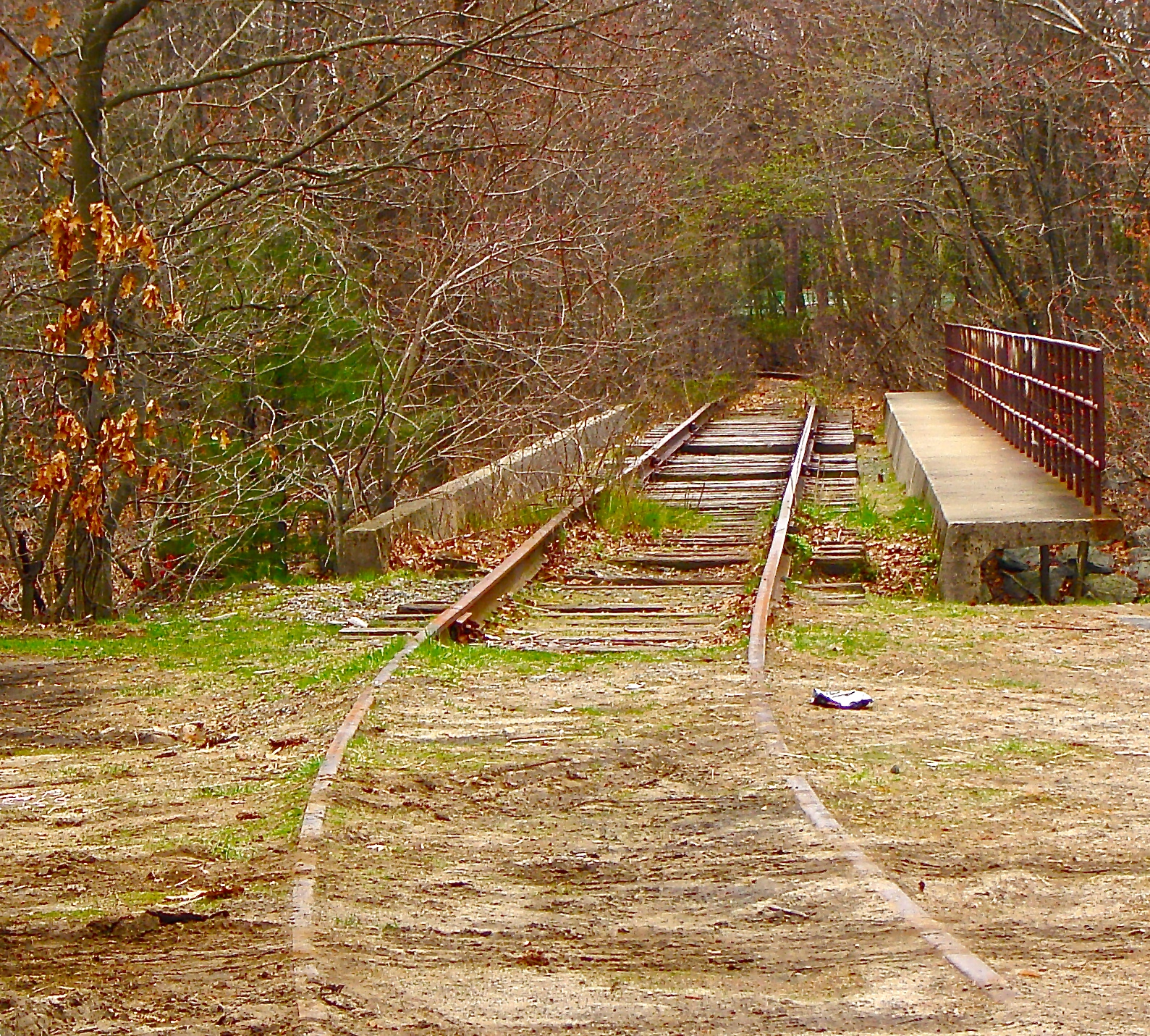
As such, I will be writing three posts about Upper Falls, covering railroad track remnants, aqueducts, old mills, walking paths, a historic dirt road, a dam and surrounding area, bridges, hotels and inns, schools, commercial blocks and much more. Some of the photos I will feature in these posts are of places or features that no longer exist. For links to the previous posts in this series, see the bottom of this installment.

So let's get to it!

In this first part I will focus on abandoned railroad tracks, unused aqueducts, buried brooks, old mills and related structures, walking paths and a dirt road with quite a pedigree.

Mills defined Upper Falls for more than two hundred years. The first mill was built along the east bank of the Charles River in 1688, according to a brochure issued by the Newton Historical Commission, the Newton Upper Falls Historic District Commission and the Newton Planning & Development Department. Saw mills, grist mills, fulling mills, snuff mills, wire mills, cotton mills, silk mills -- all of these were in business at some point along the river until 1962, according to the brochure, when the mill complex was sold and eventually turned into what stands there today: Echo Bridge Park, home to jewelry and antique stores, a musical instrument shop, medical offices and more.

(View from below Echo Bridge of the former mill complex.)

Above the mill complex on a small, wooded hill just off the intersection of Chestnut and Ellis streets, I experienced one of my proudest moments of backsiding. As I walked around the village snapping photos I looked at this little mound that I'd driven past countless times and thought, "I bet there's something up there." So I climbed up in my slides, as inappropriate a set of hiking footwear as you can find, pushed past a few small trees and found this:

BINGO!!

An 1874 atlas I downloaded from the City of Newton web site identifies this site as "Reservoir." I don't know enough about old mill complexes to get a handle on this relic. I assume the reservoir was constructed not only of brick and stone, but also wood. What was the water in the reservoir used for? Obviously the Charles River below provided the power, or most of it anyway, for the mills. Anybody got any answers or guesses?

I'll include photos and information about nearby Echo Bridge and Hemlock Gorge in a future post in this series about Newton Upper Falls. While the complex at Echo Bridge is the oldest in Upper Falls, and indeed the city, I find the Saco-Pettee Machine Shops complex far more interesting. So get ready for a bunch of pictures.

The multiple buildings on the site at Oak and Needham streets were built between 1892 and 1912, per Wikipedia. There were cotton mills and machine shops here over the decades until the 1930's, per Wikipedia. Other, smaller companies took over some of the buildings in subsequent decades, according to the indispensable The Makers of the Mold: A History of Newton Upper Falls, Massachusetts, by Kenneth Newcomb, which is available for free online (although you can also buy a hard copy, of which I own). Some of the mill buildings were eventually torn down to make way for a shopping plaza. Many of the buildings left have been abandoned for years.

Some of the buildings, however, have been restored and house businesses including a dance studio.

(At the corner of Oak and Needham streets you can spy a remnant of South Meadow Brook, which, like so many small streams in Newton, was mostly buried many years ago.)

There have been numerous proposals over the years for redeveloping this massive site. The latest comes from Northland Investment Corp., which has announced plans to raze the dilapidated buildings and other nearby retail buildings and construct new retail, apartment, office and restaurant space.

I exchanged emails with a vice president at Northland about gaining access to the site to document the old mill buildings before they are demolished or altered. Unfortunately, the company's lawyers were unwilling to grant me that chance. I was told that a professional photographer was commissioned to conduct such a project, and that his or her work will be available to the public at some point.

The circa-1890 mill building below, at 1254 Chestnut Street and not far from the Saco-Pettee complex, once made fire alarm systems.

According to Makers of the Mold, Moses Crane made fire alarm systems in this building for Gamewell Fire Alarm & Telegraph Co. Crane had previously made fire alarms in a building near Crystal Lake in Newton Centre.

Gamewell was eventually acquired by Honeywell, which later merged with a company called FCI.

I want to get back to the Pettee operation. In addition to the abandoned hulks and restored buildings I showcased above, there are other buildings in Upper Falls that were once part of the mills. But unless you own the building (and maybe not even then) or have read Newcomb's Makers of the Mold, you would have no idea that some current-day houses were once mill buildings.

At top is 50 Oak Street, at bottom, 50 Hale Street. Newcomb has this to say about these houses: "They were formerly part of the old Pettee Machine Works plant and are believed to have been moved to their new sites about 1895 when the Pettee shops were rebuilt." Sure enough, the Newton Assessors' Database lists 1895 as the construction date for the Hale Street house. Newcomb, however, assures us that such buildings are certainly older, but it's hard to determine just how old because they were moved from mill properties to private lots. As for the Oak Street house, I'm pretty sure it's the same one that Newcomb referenced in his book, but the assessors' database lists a build date of 2007. But since the database contradicts itself and lists assessments going back to 1992, I'm guessing the house was significantly modified in 2007.

Directly behind 50 Oak Street are sited three more former Pettee Machine Works buildings that were long ago converted to homes. I find it hard to picture these quaint homes as part of what was most likely a smelly, dirty mill complex, possibly being used as a blacksmith shop or storage facility.

(12, 16 and 20 Shawmut Park, former mill buildings, top photo. #20 Shawmut in bottom photo.)

The Saco-Pettee mill wasn't the only one whose buildings were repurposed. 353-357 Elliot Street, which I believe was formerly numbered 351-353, was an old building at the Echo Bridge mill complex, according to Newcomb. This house and three others along Elliot Street, if they were original mill buildings "their date of construction would be about 1785, shortly after Simon Elliot purchased the old mill site for his snuff mill operation," according to Makers of the Mold. The Newton Assessors' Database lists the construction date as 1830.

With all these mills around, of course there were eventually railroads. Before I get to the main line and what it's become, I want to mention one more house that has a past life....

86 High Street was at one time the waiting room for an electric railroad, per Newcomb. "The Newton & Boston Street Railway was the one more closely associated with Newton Upper Falls," Newcomb writes. "It had been organized in 1891 with permission to establish other lines in the city if desired. In 1892 an extension of its lines was granted on Walnut and Beacon Streets and although delayed by sewer construction it was carried to Newton Highlands and later, in the same year, to the corner of High and Summer Streets in Newton Upper Falls." You can see that the second floor doesn't quite match the first, and was obviously added once the waiting room had been converted to a home.

Now, to the more traditional railways.

Otis Pettee, namesake of the Saco-Pettee Machine Shops, tried to lure the Boston and Worcester Railroad to Upper Falls, according to the folks at the Upper Falls Greenway. Upon being snubbed, Pettee decided to build his own line! Eventually the railroad was folded into the Boston & Albany line.

And now, as you might imagine if you have spent time near abandoned railroad tracks in the past 20 years, Pettee's labor of love has been turned into a walking/bike path.

(A picture from a few years ago after the tracks had been torn up to make way for the Newton Upper Falls Greenway).

(Looking northeast from the greenway's terminus at the Charles River.)

(View from the greenway. I love the back of 1211 Chestnut Street, which was built in 1918 and now houses a dry cleaner, a hair salon and two apartments.)

(Former Newton Upper Falls train depot, built in 1852, now a coffee shop. The walking path goes right behind it.)

(Old something-or-other along the Upper Falls Greenway.)

(Old sewer structure along the greenway.)

(Tower for WHDH TV, along the greenway. According to Makers of the Mold, this site once housed the United States Fireworks Company, which moved to Upper Falls in 1886. The company went into decline after an explosion and fire in 1919, per Newcomb's book.)

There was a spur track that ran from just a little north of where this tower stands now, across Needham and Christina streets, over the Charles River and into a Needham industrial park. There are still remnants of this system.

(Long-abandoned rail spur on the property of H.C. Starck, a "supplier of technology metals, high-performance ceramics and thermal spray powders," per the company LinkedIn page.)

The H.C. Starck complex sprawls across several buildings along Charlemont Street. Perpendicular to the very busy retail strip of Needham Street, Charlemont used to connect all the way through to a quiet residential neighborhood. At the back of the Starck property there is a small walkway that knits the two ends of this street perhaps named after a town in County Armagh, Ireland.

(Looking south across the Charles River, at a set of tracks that isn't there any more, although the bridge is. I took this photo several years ago.)

Now, back to the greenway. At its western terminus, an easy slide down the embankment next to the Charles River, is the Charles River Pathway. Acquired by the City of Newton in 1980, this 1.5-acre conservation area is one of many great little nature preserves in the city.

(The Charles River Pathway.)

(Anchors for the WBUR radio tower, which is located on the other side of the greenway.)

In addition to the Upper Falls Greenway and the Charles River Pathway, this village is home to part of the Quinobequin Trail, much of which (and, honestly, perhaps all of it; as I've said, it's often hard to tell exactly where the boundary is between villages) lies in Waban (see June 3, 2016, "I Seek Newton, Part IV: Waban").

(Funky blue hydrant on the Wellesley side of the Charles River, seen from Upper Falls section of Quinobequin Trail.)

The Charles River is a prominent and obvious feature in Newton. But there are two other water systems running through the city that fewer people are aware of.

What, you don't see this one? It's right there!

It's the Sudbury Aqueduct. Built between 1867 and 1876, the underground conduit brought water from the Sudbury Reservoir to Boston until 1978, when use was discontinued. The Massachusetts Water Resources Authority maintains the system as a backup source of water (for more on Newton's aqueducts, the other of which is the Cochituate Aqueduct, see November 11, 2011, "History Flows On, Part I").

I've covered walking paths and aqueducts, which provide great trails for touring Newton. Finally for this first of three installments about the village of Upper Falls, I want to discuss two old streets.

This is the middle section of Pennsylvania Avenue. Not quite as impressive as the one in our nation's capital that the White House sits alongside, is it? Still, it's kinda cool. Located in a neighborhood that includes Ohio Avenue and Indiana Terrace, Pennsylvania Ave. appears as though it was washed out at some point. In the 1929 Newton Atlas available on the city's web site, Pennsylvania Ave. goes straight from Oak Street to Chestnut Street. Now, as you can see here (I hope), the road dies just a short distance up from Chestnut. There is then a paved walkway up the hill, where Pennsylvania reconnects and heads on up to Oak Street.

I'll wrap up this post with another dirt road with an even better story, and one that I didn't even have to make up.

Curving from Chestnut Street to Elliot Street, Sullivan Avenue is "all that remains of an ancient highway laid out in 1688 by a joint agreement between Cambridge and Cambridge Village (Newton) from 'the Village Meeting-house to the Falls,'" according to the above-referenced brochure for walking tours of historic Newton. As Vanessa Bayer channeling Miley Cyrus on "Saturday Night Live," would say, "That's pretty cool!"

Thanks for checking out the first of three posts about Upper Falls, the eighth village of Newton I've covered on the blog. The next two parts will feature memorials, bridges, parks, houses, hotels, restaurants, churches, schools, retail stores and much more.

The link to the seventh post in my Newton series is near the top of this page; below are the links for the other six, beginning with the most recent.

December 5, 2016: Chestnut Hill (#6)

September 26, 2016: Oak Hill (#5)

June 3, 2016: Waban (#4)

March 23, 2016: Newton Highlands (#3)

September 20, 2015: Auburndale (#2)

May 21, 2015: Newton Lower Falls (#1)

Thursday, February 22, 2018

If the Bakery Is A'rocking...

From Rock N. Roller:

I've shot this building before, but only recently did I see it from the right angle to pick out the "C.F. Hathaway" ghost sign. I mean, look at that sunlight just knocking me upside the head and telling me to take a picture.

The first time I took pictures of this building on Elm Street in Waltham, Mass., was in early January 2013, I was strolling around this 'hood , which is just a stone's throw from the old Elm Street Music Hall, which I featured in the first post of a three-part series about Waltham (see November 9, 2016, "Brigham in Waltham, Part I"). On that jaunt five years ago, I noticed this ragged, hand-made sign:

I don't know if the powers-that-be at Woolly Mammoth Sound have put up a better sign since I snapped this picture. They probably don't need to. The recording studio is run by Dave Minehan, a Greater Boston rock legend.

Minehan founded the Neighborhoods, a mainstay of the Boston rock scene from the late '70s through the early '90s. The band toured with the Ramones and Cheap Trick, among others, before breaking up in 1992. The band re-formed a decade later and still plays today. In 2013, Minehan joined the Replacements for several gigs that the Band Formerly Known As the Most Drunk Band Ever played over the next two years. Minehan had big shoes to fill in the minds of Replacements fans: Slim Dunlap's (1987-1991), who played lead guitar on the band's last two studio albums, Don't Tell a Soul and All Shook Down, and who suffered a stroke in 2012; and Bob Stinson's (1979-1985), the band's founder and most colorful, yet ultimately tragic, member. Replacements singer Paul Westerberg booted Stinson from the band in 1986 due to his alcohol and drug problems. Stinson died in 1995 at age 35.

(Did some petulant rock star throw this TV out of a Woolly Mammoth studio window five years ago?)

Here's a Neighborhoods video:

And here's the Replacements featuring Dave Minehan:

Let's get back to the building itself, and C.F. Hathaway.

In addition to Woolly Mammoth, the building at 180 Elm Street is home to a bindery service, a furniture repair company, a woodworking business and an upholstery shop. Built in 1900, according to real estate web site LoopNet, the building is a converted mill.

As I do with just about everything I photograph and write about on this blog, I headed to Google for more information on "C.F. Hathaway." The first results got me very excited. "C. F. Hathaway Company was a private manufacturer of shirts for men and boys, located in Waterville, Maine," said the Wikipedia entry I found. "It was founded in 1837 and made uniform shirts for Union soldiers during the American Civil War."

"Wow!" I thought. "What a cool connection to this nation's history!" I dug deeper and found a 2002 New York Times article about how the company closed its factory in Maine, "the last major U.S. shirt plant." I read the article and realized that at no point did C.F. Hathaway make shirts in Waltham.

Damn.

But all was not lost. Just a little further into my online research, I found links at the Cambridge Public Library web site to Cambridge Chronicle articles that discussed C.F. Hathaway & Son, a North Cambridge bakery with a factory in, you guessed it, Waltham. Established in 1875, C.F. Hathaway & Son by 1910 had moved into the company's third location on Richdale Avenue in Cambridge, having outgrown the two prior bakeries in the city. The company is no longer in business; its North Cambridge location is now home to Hathaway Lofts.

According to this 1899 Chronicle article, Charles F. Hathaway set up shop in Cambridge as University City Bakery after working in bakeries in the area, as well as in Maine (hmm...Maine. Maybe there's a connection here?). In 1897 he bought a Waltham bakery (unnamed in the article), which employed 20. It's possible that the Elm Street building is older than 1900, but it's conceivable that the Waltham operation was run elsewhere and moved into that building later.

I'm not sure when the name of the company was changed to C.F. Hathaway.

Accompanying this Chronicle article from 1911 is a graphic that, if you enlarge it, shows the Waltham bakery. The article indicates that the Waltham bakery had the capacity to turn out 20,000 loaves of bread a day, and that its specialty "as in Cambridge is ice cream bread." I've never heard of ice cream bread, but I bet it's damn good, and that the rockers who hang out at Woolly Mammoth would enjoy it as well.

OK, might as well finish up on a rock 'n' roll note:

Thursday, February 15, 2018

No Farms. No Food. No Dice?

From Wile E. Coyote:

Nestled in the northeast corner of Waltham, Mass., and including a small slice of Watertown, the former Arrigo Farm has a centuries-long history and connections, through past owners, to significant American events. The City of Waltham for years has considered acquiring the long-fallow site and returning it to its purpose. After researching this issue online, I've been unable to determine who owns the farm and what might become of it.

As you can see, Arrigo Farm has known better days. The 4.2-acre site is the last farm left in Waltham. Hemmed in to the north by an industrial park and in every other direction by residential streets, the farm began producing before Marie Hedwig Auguste of Sulzbach was even born. Can you imagine?! According to the Waltham City Council's application for funding under the Massachusetts Community Preservation Act, the site "has been continuously farmed since 1650, and perhaps as early as 1635, when, according to oral tradition, Watertown founder, John Warren, purchased the land from the Watertown community."

Warren's son, Daniel, built the first house on the property when he married in 1650, per the Waltham City Council's application. He subsequently fought in King Phillips War. Daniel's great-grandsons fought in the American Revolution, two of them being injured at the Battle of Bunker Hill. The City's CPA application makes many such historic connections to bolster its case for funding to acquire the farm. How many shillings are we talking about? Oh, $3,296,250....

In the first half of the 19th century, a Warren descendant married Capt. Samuel Barnes, who tore down the house and in 1837 built the house that is the main portion of what we see on the property today, per the blah blah blah....This couple's sons fought in the Civil War.

By 1900 the Barnes family had sold off all but 4.217 acres of the farm. I'm not sure how large the property was in the 1600's when John Warren purchased it. The last Barnes descendant died in 1922. The next year, Placido Arrigo bought the farm (literally, not metaphorically) and tilled the soil until his death in 1991!

His son, John, farmed the land until his death in 2011.

(A rough-looking room added on to the original circa-1837 structure.)

(Relax, sign maker. I had no intention of going inside.)

I can't be positive, but I believe I saw signs of occupation here subsequent to 2011. Either way, in 2013 the City of Waltham began the process of trying to acquire the land.

After reviewing documents online detailing the Waltham City Council's decision to enter into negotiations with the Arrigo family to buy the property and return it to farming, I'm unclear on whether a deal was struck, and if so, why nothing has happened at this property, or if not, why the parties couldn't come to terms. At some point, the Waltham Community Preservation Committee recommended using some of the funds to demolish the farm house, which seems to have put a hold on the proceedings as of late 2013.

For a complete history of the property and the negotiations, check out this file.

As always, stay tuned....

Thursday, February 8, 2018

Casual Abandonment

From Bust Duster:

You would be forgiven if, at first glance, you thought this place was a preschool or an art gallery. I suppose in a way it's both.

Located at 482 Commonwealth Avenue in Boston's Kenmore Square, this circa-1899, 4,210-square-foot apartment building was assessed at $1.3 million in fiscal year 2017. It sits on a 2,625 square-foot lot. So why, with so much development in recent years around Kenmore Square, and the city of Boston in general, is this place plastered with graffiti and murals, instead of overflowing with Euro-trash Boston University students?

Good question! I'm not sure I have much of an answer, though. But let's see what we can cobble together/make up.

First, given what the outside looks like, let's try to imagine the interior of this place, which has been this way for perhaps 20 years, based on what I've found in online forums. Obviously people have been inside over the past two decades, because homeless people, urbex types, drug addicts and other curious folks always go into places like this. So that means people have done all the gross things that people do: gone to the bathroom (Nos. 1 and 2); had sex; ate and drank and spilled and vomited; burnt incense; read porno mags; shot up; jazzercised -- just everything bad you can think of.

Second, think what creatures enjoy the fruits of all bad human behavior: cockroaches, centipedes, rats, raccoons, lawyers. Per the City of Boston 311 web site, there have been numerous complaints over the years for graffiti, unshoveled sidewalks and rodent sightings at this address.

Now imagine being a real estate developer looking at the exterior of what was most likely once a very nice building where very nice people lived, loved and did all the gross things that people do (see above). You don't want to deal with hosing out the detritus of human existence, or risking a nasty case of scabies.

So you just let it sit there, with its celebrity-themed murals. Coco Chanel, Biggie Smalls, Michael Jackson, some other guy who could be Snoop Dogg or William Shakespeare. And like the rest of us, you may ask yourself: Well, how did I get here? And you may ask yourself: How do I work this? And you may ask yourself: Where is that large automobile?

Sorry, got a bit off track. Maybe I should be quoting from "Burning Down the House" instead.

"I think the last I've heard is that it's tied up in probate or something" -- some guy whose quote I found online.

OK, now maybe we're getting somewhere.

Nearly 10 years ago, TexasJake987 asked on the Ask MetaFilter web site: "This building @ 482 commonwealth ave has been boggling my mind. Its your typical brownstone, but its been abandoned and boarded up. On the boards, there's a bunch of artwork and murals done by some JP students. What gives? what is this place? Why is prime realty abandoned in kenmore square? Anybody know anything about it?"

So you see, it IS part art gallery and part preschool. Or some sort of school. Probably high school, but you know, kids back 10 years ago were so immature compared to the geniuses of today with their smart phones, that it was like preschool. Sorry, digressing.

In answering Jake's question, a guy named "Phil" (Collins? Silvers?) provided us with a tantalizing clue in 2008: "And continuing the cyber-sleuthing... I assume "MARGOLIS CALVIN ETAL" is actually "Margolis, Calvin, et al." Whether it's the past fashion designer or not, I have no idea. (But he does seem to be from the Boston area.)." This is in relation to the building's owners on the City of Boston web site.

Calvin Margolis co-founded a fashion retail chain called Designs in 1976. Based in Massachusetts, the business eventually grew to include 29 stores in the Eastern United States. Margolis retired as chairman and CEO in 1993, and died a year later, according to this Funding Universe history of Casual Male Retail Group, the company that Designs, Inc. acquired in 2002 and subsequently changed its name to.

Unfortunately, the online trail goes cold here. Margolis passed away in 1994, and this Kenmore Square address has been an eyesore since at least 1999. So who bought the property and then just let it go to seed?

Currently the property is owned by Four-82 Commonwealth Avenue, a trust overseen by a woman named ______ __________ (I don't want to drag somebody into this without knowing the full story). So, in the spirit of David Letterman's old "Brush With Greatness" schtick, in which audience members would relate the tale of meeting someone famous and then be asked to embellish the story, I present to you what I suppose happened with this building:

Harold Madison, Jr. was born in Worcester, Mass., in 1951. By all accounts (read: Wikipedia) he loved music from an early age. By the mid-'70s he had moved to Boston, where he studied at the illustrious Berklee College of Music. A drummer and guitarist with a big personality, he played gigs at infamous Kenmore Square club The Rat, as well as the late, lamented Channel Club in South Boston. He lived on the streets, enjoying the hospitality of friends and fellow musicians.

His father had dubbed him Butch, and eventually around Kenmore Square he became known as Mr. Butch. A tall dude with shoulder-length dreadlocks, Mr. Butch was gregarious and friendly. I saw him many times in the '90s as I made my through Kenmore Square to eat, drink, shop for records or go to nearby Fenway Park for Red Sox games. He was instantly engaging and non-threatening, despite his leather jacket that said "Goddamn Motherfucking Mr. Butch" on the back. He loved to drink and smoke weed, by all accounts.

So Mr. Butch was a fashionable guy, as evidenced by his bespoke leather jacket. In YouTube videos from the '80s and '90s he is seen wearing natty sport jackets, stylish purple down vests and a Superman t-shirt, all while rattling off original poetry.

(Editor hands this writer an embellishment and instructs him to write down what it says.)

One day while panhandling and entertaining the crowds passing through the square, Mr. Butch bumped into Calvin Margolis, the fashion retailer and designer whose stores specialized in Levi's jeans. Margolis had seen Mr. Butch around. Margolis owned a building just steps away from the busy hub of Kenmore Square where Mr. Butch hung out.

"I like your scarf," Margolis said to the bard of Kenmore Square.

"Thanks, my good sir," Mr. Butch replied.

And so was born a friendship. The couturier and the rocker were spotted eating Lord Worsley sandwiches at Cornwalls or a slice at the Pizza Pad, and were even seen once harmonizing at The Rat while the Ramones thrashed away on stage. Nobody was more heartbroken than Mr. Butch when Margolis died. But the dreadlocked one's heart was lifted when the fashion mogul's will was read, and Mr. Butch realized that his friend had bequeathed him a brownstone in the square.

Mr. Butch didn't take up residence at 482 Commonwealth Avenue, but he opened the doors to anyone and everyone for parties and raucous sleepovers. Bands turned their amps to 11 for the blowouts, artists covered the walls -- inside and out -- with crazy murals and graffiti. And supermodels and socialites flew in from London, Ibiza and Krakow for Mr. Butch's soirees. The children of the artists and musicians and the supermodels baked cookies in Calvin Margolis's old stove and scribbled on the floors and ceilings.

Ah, but it couldn't last, this grand good time. It never does, does it? Unless you've entered into cryogenic suspension, or you're one of the Gabor sisters.

The neighbors complained, the cops showed up and the party moved on -- to the Gabors house. Mr. Butch vacated Kenmore Square and took up residence on the streets of Allston, Boston's rock and roll address. The building got tied up in legal scraps over title, ownership, probate, clean-up, squatters rights, you name it.

As for Mr. Butch, he lived happily in Allston for many years until he died in a scooter accident in 2007.

Rest in peace, Mr. Butch. Rest in peace, Calvin Margolis. Let the world figure out what to do with your crazy preschool/art gallery brownstone.

Friday, February 2, 2018

Not at the Museum

From History Isbunk

"In our next exhibit here at the Boston Society of Natural History, you see two dioramas of our fair city." Those are the words you would hear if you were actually in a museum, rather than an office building in Boston's Back Bay neighborhood, while enjoying these little time capsules.

Located in the lobby of The Newbry building (formerly the New England Life Building) on Boylston Street, these dioramas "were commissioned by the Boston Society of Natural History in 1863 and created by Sarah Ann Rockwell," according to Atlas Obscura. "The backdrops were painted by Henry Brooks. The level of detail is amazing and they give an intriguing picture of everyday life at the time."

There are four scenes in this publicly accessible office building (enter from the Newbury Street side):

*The home of William Blaxton, the first European settler of modern-day Boston and Rhode Island, according to Wikipedia. In the background is a painting of Trimount, which means "three hills" and once comprised Beacon, Mt. Vernon and Pemberton hills.

*The Boylston Street fishweir, a Native American fishing structure thought to date back roughly 2,000 years and discovered in 1913 during excavation for a subway tunnel.

*The filling in of Back Bay, a process that expanded Boston's footprint from 1804 until the late 1880's.

*The Boston Society of Natural History building, with MIT's Rogers Hall under construction. Built in 1864, the BSNH building is now a Restoration Hardware. Prior to that it was home to Louis Boston, a high-end men's fashion retailer that relocated to Boston's Seaport district a few years ago. The BSNH eventually evolved into the Museum of Science.

(The BSNH and Rogers Hall diorama.)

The Atlas Obscura article doesn't make it clear how the dioramas ended up in The Newbry, or how long the exhibits have been there.

New Balance Draws a Red Line with Diner

From Dave Brigham: I can't be expected to know everything about the backside of America, nor of Massachusetts or even of Boston. But I...